Curated OER
Illinois Map
For this Illinois worksheet, students fill in a map of Illinois with its cities and attractions. Students fill in the map with as many major cities and attractions as they can find.
Curated OER
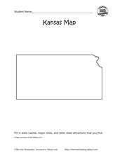
Kansas Map
In this Kansas worksheet, learners fill in a map of Kansas with cities and attractions. Students fill in the map with as many major cities and attractions that they find.
Curated OER
North Dakota Map
In this North Dakota worksheet, students study an outline map of North Dakota with the capital city marked. Students color the map and add other important cities and landmarks.
Curated OER
Ohio Map
In this Ohio learning exercise, 4th graders explore the state of Ohio. Students look at the map of Ohio and fill in the state capital, major cities, and any other important landmark or site on the map.
Curated OER
South Dakota Map
In this South Dakota map worksheet, learners fill in the state capital, major cities and other state attractions in an outline map of South Dakota.
Curated OER
Utah Map
In this Utah worksheet, students analyze an outline map of the state of Utah. The capital city is marked. Students add other important cities, bodies of water or other important features. Students color the map.
Curated OER
Unit III: Worksheet 2 - Motion Maps
Make motion maps, draw graphical representations, and determine displacement. These are the activities included in this physics assignment. This is a great review of velocity, position, acceleration, and displacement concepts.
Curated OER
Report Writing: Creating and Using a Mind Map
Walk your class through the process of creating a mind map. Learners begin with a specific topic and add details. Then, they use their mind maps to write a report. This is a creative approach to teaching writing.
Curated OER
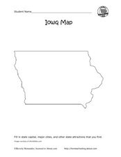
Iowa map
In this Iowa worksheet, learners fill in cities and attractions in a map of Iowa. Students fill in as many cities and attractions they can find.
Curated OER
North Carolina Map
In this state maps worksheet, students identify the state map of North Carolina. Students fill in the state capital, the major cities, and other state attractions.
Curated OER
Maryland Map
In this Maryland worksheet, students analyze an outline map of the state of Maryland. Students fill in the state capital, major cities and other state attractions.
Curated OER
Michigan Map
For this state maps worksheet, students identify the map of Michigan. Students then fill in the capital city, major cities, and other state attractions.
Curated OER
Maine Map
In this state maps worksheet, learners identify the map of Maine. Students fill in the capital city, major cities, and other state attractions.
Curated OER
Montana Map
In this state maps worksheet, students identify the state map of Montana. Students fill in the capital city, the major cities, and other state attractions.
Curated OER
Minnesota Map
In this Minnesota worksheet, students fill in a map of Minnesota with its major cities and attractions. Students fill in as many cities and attractions as they can find.
Curated OER
Massachusetts Map
In this Massachusetts worksheet, students fill in a map of Massachusetts with major cities and attractions. Students fill in as many cities and attractions as they can find.
Curated OER
Oregon Map
In this Oregon worksheet, students fill in a map of Oregon with it's major cities and attractions. Students fill in as many cities and attractions as they can find.
Curated OER
Vermont Map
In this state maps worksheet, students identify the map of Vermont. Students fill in the state capital, the major cities, and other state attractions.
Curated OER
Maps
Students investigate three types of maps. In this history lesson plan, students idenitfy different maps and explore how they relate to the area, while keeping climate and topography in mind. They discuss maps used to navigate...
Ed Helper Clip Art
USA States
Looking for a map of the Unites States of America? Look no further than this printable map designed to accompany your geography instruction and to give map skills a boost.
Curated OER
If You've Seen One Map, Have You Seen Them All?
Students discover why there are many ways to show what Earth looks like on a map. They explain different views of the world and compare a polar map image with other views of the world.
Curated OER
Asia Outline Map
In this Asia outline map learning exercise, students explore the continent as they label the 47 countries. The countries are numbered and lines for the answers are provided on the sheet.
Curated OER
Story Map--Upper Elementary Worksheet
In this retelling of a story worksheet, students choose a story they've already read and fill out the story map. Students follow the sequence of the story map step-by-step.
Polar Trec
Mini-Ocean Bathymetric Mapping Research Cruise
Middle or high schoolers transform into oceanographers in a week-long simulation. To begin, each group follows directions to create a model of the ocean floor with specified features. Next, the groups prepare to set sail on a research...
Other popular searches
- Mapping Skills
- Semantic Mapping
- Concept Maps
- Story Mapping
- Cell Transport Concept Map
- Mapping Skills First Grade
- Mind Mapping
- Concept Mapping
- Gene Mapping
- Land Use Mapping
- Mapping Rivers
- Forestry and Mapping


