Curated OER
Educational Technology Clearinghouse: Maps Etc: Hawaii, 1920
A map from 1920 of the Hawaiian Islands showing the main islands, the capital of Honolulu on the island of Oahu, district boundaries, cities, towns, ports, railroads, principal steamship lines, submarine cable routes, terrain, and...
Curated OER
Educational Technology Clearinghouse: Maps Etc: Hawaii, 1914
A map from 1914 of the Hawaiian Islands showing the main islands, the capital of Honolulu on the island of Oahu, district boundaries, cities, towns, ports, railroads, principal steamship lines, submarine cable routes, terrain, and...
Curated OER
Educational Technology Clearinghouse: Maps Etc: Hawaii, 1920
A map from 1920 of the Hawaiian Islands showing the capital of Honolulu on the island of Oahu, cities, towns, ports, district boundaries, railroads, submarine cable routes, volcanoes, and coastal features. The map is color-coded to show...
Curated OER
Educational Technology Clearinghouse: Maps Etc: Hawaii, 1919
A map from 1919 of the Hawaiian Islands showing the eight main islands of Hawaii, Maui, Kahoolawe, Lanai, Molokai, Oahu, Kauai, and Niihau, the capital of Honolulu on the island of Oahu, cities, towns, ports, railroads, submarine cable...
Curated OER
Educational Technology Clearinghouse: Maps Etc: Hawaii, 1912
A map from 1922 of the Hawaiian Islands showing the eight main islands of Hawaii, Maui, Kahoolawe, Lanai, Molokai, Oahu, and in the inset Kauai and Niihau, the capital of Honolulu on the island of Oahu, cities, towns, ports, railroads,...
Curated OER
Educational Technology Clearinghouse: Maps Etc: Hawaii, 1922
A map from 1922 of the Hawaiian Islands showing the eight main islands of Hawaii, Maui, Kahoolawe, Lanai, Molokai, Oahu, and in the inset Kauai and Niihau, the capital of Honolulu on the island of Oahu, cities, towns, ports, railroads,...
US Geological Survey
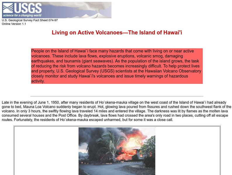
Living on Active Volcanoes on Hawaii
Living on the island of Hawaii brings you the hazard of living near a volcano. Read about actual eruptions and get scientific seismic information and maps.
Curated OER
View of Haleakala Crater, Island of Maui, Hawai`i, Looking Ene
Find information about the Haleakala Crater and the East Maui volcano, including the volcano's eruptive history, maps of the crater, and geologic data sets.
Curated OER
Etc: Territorial Acquisitions of the United States, 1783 1900
A map from 1920 of the United States and its territories between 1783 and 1900 showing the nation's expansion and date of acquisition of each new territory or possession. The map is color-coded to show the progression from the original...
Curated OER
Etc: United States Showing Acquisition of Territory, 1783 1900
A map from 1911 of the United States and its territories between 1783 and 1900 showing the nation's expansion and date of acquisition of each state or territory. The map also shows major cities, waterways, and mountain ranges. Includes...
Curated OER
Etc: United States Showing Acquisition of Territory, 1783 1900
A map from 1912 of the United States and its territories between 1783 and 1900 showing the nation's expansion and date of acquisition of each state or territory. The map also shows major cities, waterways, and mountain ranges. Includes...
Curated OER
Educational Technology Clearinghouse: Clip Art Etc: Captain James Cook
A British explorer who made detailed maps of Newfoundland before he achieved the first European contact with the eastern coastline of Australia and the Hawaiian Islands.


