Curated OER
Finding My Way
Students determine a route from their home to the Stones River National Battlefield. In this map work lesson, students use a detailed city map of Murfreesboro to locate a route to the Stones River National Battlefield. They follow...
Curated OER
Globe Skills Lesson 6 The Louisiana Purchase
Students explore the Louisiana Purchase territory. In this geography skills lesson, students use map skills in order to plot and note latitude and longitude, measure scale distance, and locate landforms that were part of the Louisiana...
Curated OER
Geography Worksheet
In this geography skills worksheet, students respond to 14 short answer questions by using maps and atlases. The maps and atlases are not included.
Curated OER
Natural Features
Learners identify natural features on a map. In this map skill instructional activity, students use a landscape picture map to identify mountains, hills, islands, lakes, and rivers. Learners use post-it notes to demonstrate their location.
Curated OER
Exploring the Hudson in 1609
In this geography worksheet, 5th graders study about the exploration of the Hudson River. Students respond to 7 multiple choice questions about the presented facts.
Curated OER
What is a Watershed?
Young scholars create a classroom size model of a landscape to define the concept of a river watersheds. They spread crumbled newspapers around the floor to simulate different elevations then cover the whole landscape with a sheet. ...
Curated OER
Louisiana Purchase
Students use maps to locate and describe the area purchased by the Louisiana Purchase. In groups, they write a letter to Thomas Jefferson in which they evaluate the topography, climate and geography of the land. They determine the land's...
Curated OER
Reading the World, Then and Now
Students distinguish geographic features using Ptolemy's map of the world.
Curated OER
The Geographic Question
Students are introduced to the characteristics of a river system. In groups, they discover how rivers are formed and how it flows. They discuss the relationship between the river system and people and develop ways to keep the river...
Curated OER
Globe Skills Lesson 7 The Transcontinental Railroad
Students explore the Transcontinental Railroad. In this geography skills activity, students use map skills in order to locate legs of the Transcontinental Railroad on globes.
Curated OER
Globe Skills Lesson 5
For this map skills worksheet, students read a text selection about locations during the American Revolution and then respond to 8 fill in the blank questions.
Curated OER
Natural Features as a Resource
Students investigate how land and water can meet basic needs. In this natural resources lesson, students locate water features on a Landscape Picture Map and describe how water is used to meet their needs.
Curated OER
Problem-Solving Decisions: Reasonable Answers
In this problem solving learning exercise, students answer 6 questions pertaining to a story problem about a tabletop scale model of the Nile River.
Curated OER
Cattle Trails
Students identify and locate cattle trails on a globe. In this map skill lesson, students use a marker to locate Texas and Montana and use the map scale to calculate the distance of the cattle trail.
Curated OER
Leapin' Landmarks: Locating 10 Man-made Landmarks Around the World
Third graders label continents, oceans, and major mountain ranges on maps and use the maps to write an informational report about landmarks. In this landmarks lesson plan, 3rd graders write about 1 major landmark.
Curated OER
A "Sedimental" Journey-Sediment Collection
Middle schoolers are asked how they would gather a sample of sediment from a lake, stream, river, pond, or swamp. They discuss safety concerns involving sample collections. Students are instructed to stay out of the water and to be...
Curated OER
Delightful Directions
First graders identify and demonstrate how symbols and models are used to represent features of the environment. They identify the directions on a map as east, west, north, and south. Finally, 1st graders play a direction game, move to...
Curated OER
Grades 6-8 Lesson Plan - Cities as Transportation Centers
Students examine maps of the 1800's and 1900's. For this geography skills lesson, students collaborate to read core maps and identify transportation centers and travel networks.
Curated OER
Cherstey: What was Cherstey like in the middle ages?
Students examine maps of a medieval village. For this medieval town lesson, students identify major buildings and make inferences about village life. Students could draw a modern day map of medieval Cherstey.
Curated OER
Summertime Travel
Third graders write about a summer event they participated in. In this paragraph writing lesson, the teacher models how to write about a place they have visited. Students then write their own paragraphs. Students will point out on...
Curated OER
FRED the FISH
Students engage in the study of the human impact on environmental systems (specifically rivers). This instructional activity enhances Students' exploration of a variety of themes or topics.
Curated OER
Finding Their New World
First graders place stickers on maps indicating their understanding of the cardinal directions. They locate Jamestown, England, the Atlantic, and Virginia.
Curated OER
Lesson Design Archaeology- World Map
Students practice locating positions on the world map. In this map skills lesson, students explore the world map and items such as the compass rose, Equator, mountains, cities, etc. The students practice locating positions on the world...
Curated OER
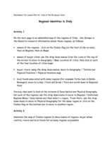
Regional identities in Italy
In this Italy map activity worksheet, students complete 2 map activities that require them to identify major cities and landforms in the country.


