University of Wisconsin
Follow the Drop
Young surveyors look for patterns in water flow around campus. Using a map of the school (that you will need to create), they mark the direction of the path of water. They also perform calculations for the volume that becomes runoff. The...
Curated OER
Water Quality and Watersheds: A GIS Investigation
Requiring more than one class period, this resource takes earth science learners on a journey through a watershed. Using ArcGIS Explorer, an online geographic information system, they view maps of watersheds and surrounding landscapes....
Curated OER
Ancient Greece and Ancient Rome Unit Plan
Students make two T charts, one for Sparta and one for Athens, showing pros and cons for living in either city-state. They use the physical information from the map and the cultural captions given for Athens and Sparts to come to their...
Curated OER
Volcanoes!: Forecasting the Path of Mudflows
Students construct a mockup of a volcano by crumbling up newspapers and piling them into the shape of a volcano. They place a tarp over the newspapers making sure the tarp is large enough to simulate a flat area at the volcano's base....
Curated OER
Fort Jackson and Fort St. Phillip
Review the history of Fort Jackson and Fort St. Phillip during the American Civil War in this informative PowerPoint. Included in this presentation are interesting facts, photos, and maps to increase student understanding of these...
Polk County Public Schools
The French and Indian War
Sharpen those pencils and get to writing with a series of document-based questions about the French and Indian War. High schoolers focus on maps, letters, and other primary documents from the 18th century before answering writing prompts...
NET Foundation for Television
1850-1874 The Kansas-Nebraska Act
How the Kansas-Nebraska Act created Bleeding Kansas is complicated—until scholars research and examine documents from the time. After completing activities that include mapping, photo, document analysis, and discussion, learners...
Curated OER
Animal Farm Chapter 2 Discussion Notes and Mini-Project
Imagine having the opportunity to create your own country. After responding to questions about chapter two, readers of George Orwell's dystopian classic are given a chance to design a utopia for one-million people, complete with...
Curated OER
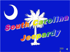
South Carolina Jeopardy
One of the better PowerPoints I've come across is a "Jeopardy"-style game whose focus is South Carolina. Some excellent photographs and maps make the slides especially good. The "Final Jeopardy" clue is especially challenging. An...
Global Oneness Project
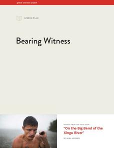
Bearing Witness
A controversial construction project in South America, the Belo Monte dam, is endangering local cultures, ecosystems, and communities. High schoolers create a concept map based on an online article they read before engaging in...
Agriculture in the Classroom
Understanding the Columbian Exchange Through Old World and New World Foods
If you're interested in teaching your class about the impact of the Columbian Exchange on contemporary society, this is worth a look. The plan begins with an introduction to the topic, which stems from a cell phone poll...
Smithsonian Institution
We Have a Story to Tell: Native Peoples of the Chesapeake Region
How did colonial settlement and the establishment of the United States affect Native Americans in the Chesapeake region? Your young historians will analyze contemporary and historical maps, read informational texts, and work in groups to...
Indian Land Tenure Foundation
Respect for Land
Youngsters examine how people show respect and care for the land. Specifically, learners see how the Native Americans truly did care for and respect the land, and still do so to this day! They also explore how they themselves can care...
Curated OER
Salt of the Earth: A Caddo Industry in Arkansas
Middle schoolers explore the history of the Caddo Salt Industry found in Arkansas. Along with learning about how salt deposits formed in Arkansas, learners study the process of salt production and how valuable salt is as a natural...
Curated OER
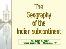
The Geography of the Indian Subcontinent
Gloriously adorned with a glimpse of the Taj Mahal, these slides detail important facts and characteristics of South Asian cultures, such as India, Pakistan, Afghanistan, and several other surrounding countries. Slides cover the...
Montana State University
Everest Extremes: Biodiversity
How many animals can live in a climate as cold as Mount Everest's? Find out with a science lesson all about biodiversity. Activities include research, presentations, group work, coloring maps, and a simulation of a food web.
Curated OER
Backwards Goes It Does
Students create a three-dimensional model of the Chicago river watershed to determine the flow of the river at its mouth. They use prepared clear gelatin and topographic maps to discover that the building of canals actually reversed the...
Curated OER
The Five Finger Exercise
Students understnad the importance of keeping our rivers and streams pollution free by remembering the major rivers of northeast Kansas. The see how the rivers contain particles of every substance that drains into them.
Curated OER
Where's the Barbecue?
Students identify the major landforms, regions and rivers on a map of South Carolina. They compare the locations of the major Native American groups in the state as well. They chart where barbecue restaurants are located and write...
Curated OER
Exploring Our Watershed System
Students examine how watershed systems are made up, and visit the Susquehanna watershed system and map out the system. They evaluate the order of watercourses in their area.
Curated OER
Draw A Coastline
Students identify, locate and draw at least ten different geographical features on a map. Using the map, they must make it to scale and include their own legend and compass rose. They share their map with the class and answer questions.
Curated OER
Come One, Come All
High schoolers analyze information from core map and other sources and construct routes from New York and Boston to Cincinnati as they might have existed in 1835.
Curated OER
A Coin Out of Water
Students examine the Michigan state quarter and identify land and water on the quarter. They locate the Great Lakes and other bodies of water on a map. They compare and contrast streams, rivers, ponds, lakes, and oceans.
Curated OER
Would You Drink This?
Students examine how they affect water quality of those who live downstream after identifying rivers and river basins in Kansas.


