Curated OER
Locating the Salt Front
Students use Hudson River salinity data to create a line
graph that shows the location of the salt front, and use math
skills to explore how this location varies over time. They use the graph to estimate the location of the salt front...
Curated OER
World Geography: Who am I?
High schoolers are able to provide a basic description of one country that has arsenic in its water supply. They are able to locate these countries on a map. Students explore the majors countries that have been affected by arsenic...
Curated OER
Africa
Second graders explore Africa. They label the popular places in Africa on a map. Students label the different cities and monuments that are popular in Africa. They discuss the similarities and differences between cities in Africa and...
Curated OER
Knowing Where You Are
Students work together to research the names of places in their state. They divide up their state so that each group can research a different section and complete a chart of the different names. They create a key for the map to explain...
Curated OER
Tracing Our Own Family Pilgrimages
Students observe a world map and are introduced to vocabulary like: cities, continents, rivers, lakes, and oceans. They discuss the names of the cities they live in and locate them on the map; then using a colored pushpin indicate: the...
Curated OER
Watershed Island
Middle schoolers make a clay model and a geographic map of a watershed. They talk about the differences between the two representations and the potential human threats to watersheds.
Curated OER
The Louisiana Purchase
For this historical map worksheet, students analyze a map of the Louisiana Purchase. Students answer 4 multiple choice questions about the map.
Curated OER
Our Country's Geography
Third graders study geography. In this United States landforms lesson, 3rd graders create a map of the U.S. made out of dough. They use various edible treats to mark the country's capital, the plains, the mountains and the rivers &...
Curated OER
A Geography and Ecology Lesson for Grades 4-7
Pupils explore many of the unusual geographical features of the Amazon River region, and explain the importance of preserving the tropical rainforest.
Curated OER
Geographical Background on the Valley of Virginia
In this social studies worksheet, students learn the geography of the Valley of Virginia (Shenandoah Valley) by reading the information and using the word bank of place names to label a detailed map.
Curated OER
Exploration Watershed
Students discuss what a watershed is, and locate watersheds on a map. In this watershed lesson, students use the information they have been introduced to and create a color coded watershed map of their own.
Curated OER
America Will Be
Learners work together to research and create different types of maps of the United States to be used as part of a geography trivia game.Groups research North American annual rainfall, climate, mountain ranges major rivers and state...
Curated OER
Our Keystone FFA Spring
Students identify where their water sources and explore a watershed on a map. In this watershed lesson students walk a wetland, and identify sources of pollution.
Curated OER
The Grand Canyon
Fourth graders study the Grand Canyon. They research the Grand Canyon and locate the Colorado River on the map of Arizona. They discuss erosion and read how sedimentary rock was formed. They view photographs of the Grand Canyon and...
Curated OER
Geography
Second graders explore the major rivers of Arkansas. They locate the major rivers in Arkansas on a state map. Students discuss how water is used in the region and the state of Arkansas.
Curated OER
Building a Topographic Model
Students explore the features of a topographic map. They make paper models that portray, in three-dimensions, features represented by contour lines on a topographic map. Students demonstrate different elevations shown on a...
Curated OER
Geography of the Harbor
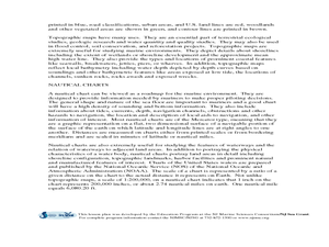
Learners study estuaries and their boundaries. In this investigative instructional activity students locate an estuary on a map and use nautical and topographical maps.
Curated OER
Naming the States of the U.S
Fifth graders study the 50 states on a map. In this social studies lesson plan, 5th graders identify the names of the states and location. Additionally, students work in small groups to name and locate as many states as they can on a...
Curated OER
Texas: U. S. Geography for Children
In this Texas map worksheet, students locate and label key features of Texas on the map and create icons to symbolize the economy and culture of Texas.
Curated OER
Where in the world is...
Students identify locations around the world. In this mapping lesson plan, students place tag board pieces with names of locations on a wall map of the world. Initially, students identify states, then cities, then continents,...
Curated OER
Where in the World Is…
Students identify countries, oceans, states, and more on a globe and on a flat map. In this geography lesson plan, students also locate places around their school.
Curated OER
Oregon Trail Diary
Students pretend they are on the Oregon Trail and keep a diary of their adventures. In this Oregon Trail lesson plan, students write about their decisions to move, crossing rivers, buying supplies, and more.
Curated OER
Where Should We Put a Store?
Young scholars analyze population data. They convert population data into simple density maps to help make decisions about their world. They select the best location for a school store based on population density. They present their...
Curated OER
Nina Bonita: Culture and Beauty
Young scholars read Nina Bonita by Ana Maria Machado. In this reading comprehension/ geography lesson, students recall various parts of the story and create a map of where the rabbit traveled throughout the story. They participate in...


