Curated OER
National Marine Sanctuaries Shipwrecks
Junior oceanographers access the Channel Islands National Marine Sanctuary Shipwreck Database and plot the locations of several shipwrecks. Shipwrecks are always an enthralling subject and this activity allows your learners to act as...
Curated OER
Adventure to Alaska
Learners use their imagination and research skills to create a virtual tour of the "Land of the Midnight Sun." They are told that Alaska is the largest state in the United States. Students gather information about Alaska to help them...
Curated OER
Local Area - What Is a Region?
Students examine the physical characteristics of the Connecticut River Valley. They view and analyze maps, identify common physical characteristics, and color in the Connecticut River on a map of New Hampshire and Vermont.
Curated OER
Local Area - What Is a Region?
Pupils examine the physical characteristics of the Connecticut River Valley. They analyze maps and pictures, identify physical characteristics of the region, and color in the Connecticut River on a map.
Curated OER
Local Area - Is the Land Connected to Us?#144
Students examine how human influences have affected the Connecticut River Valley. They determine what a region is in relation to its human influences. They label the important human features of this region including dams, canals, and...
Curated OER
Give Me a Clue!
Students write clue cards for learning the names and locations of each river basin in Kansas using their knowledge of cardinal and intermediate directions.
Curated OER
The Hunter-Dunbar Expedition of 1804-1805
Students explain the origins of the Hunter-Dunbar Expedition and why it was so important. They map George Hunter and William Dunbar's expedition route on the Ouachita River and examine excerpts of George Hunter's journal.
Curated OER
Track Your Trip
Fourth graders are shown how to read a map and identify key cities, landmarks, rivers, state boundaries, and train routes. They solve basic mathematical problems. Students reivew the componets of a map legend. They are asked to find...
Curated OER
Changing Geography
Young scholars visually examine, identify and analyze the components of various images of the automobile. They discern how to use a road map by planning a route, then use road maps to explain how the state has developed over time.
Curated OER
Natural Features as a Resource
Students research how people use land and water features to meet their basic needs. For this natural features lesson, students review land and water features. Students discuss how the land is used to meet needs using a landscape picture...
Curated OER
Chesapeake and Ohio Canal
Students use maps, readings, drawings, plans and photos to research and the importance of canals in the early industrial economy of America. They consider the development of the Potomac River Canal and research early transportation methods.
Curated OER
Geography: Map Making
Students, working in groups, share notes and maps collected during a study of the Lewis and Clark Expedition. They draw large composite maps of the western United States on butcher paper including land formations, bodies of water, and...
Curated OER
Find the Way
Fourth graders, after discussing different places to visit and being given a map of Indiana, draw the route to his/her destination within Indiana. They tell the directions in their own words and formulate pertinent questions to ask along...
Curated OER
San Francisco Bay Watershed
Students locate important landmarks on a map and explore the watersheds in California. For this watershed lesson students complete a worksheet and discuss what they learned.
Curated OER
Marquette and Joliet Explore the Mississippi in 1673
Students locate and name the St. Lawrence River, the five Great Lakes, and the Mississippi River on a modern map. They find Quebec, Michilimackinac, Wisconsin, and Chicago on that map. They find the same places on a 1681 map.
Curated OER
Understanding Watersheds
Students should learn how their actions on land can affect the water quality of lakes and rivers.
Curated OER
Twain: Steamboat's a-Comin'
Students discover how rivers inspire creative expression. In this Mark Twain instructional activity, students list songs about rivers and discuss common characteristics. They locate the Mississippi River on a map and write a script...
Curated OER
Mining Riches
Learners research and map how various mining ventures have changed local geographies and populations. First they read the article provided--Examining the Environmental and Social Impact of the Mining Industry.
Curated OER
Where Is Japan? How Are We Alike And Different?
First graders use literature, maps, and globes to explain how physical environments in various parts of the world are similar to and different from one's own, and that certain areas have common characteristics and can be called regions.
Curated OER
How To Find a Site
Fourth graders identify the three basic needs of humans. They identify on a map the best places to live and make a list of items that they can find on a map - streams, river, hills, plains, forests, etc.
Curated OER
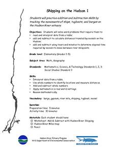
Shipping on the Hudson
Learners track movements of ships, tugboats, and barges on the Hudson River estuary in order to practice addition and subtraction skills. They solve word problems by reading and interpreting data from a table. They calculate distances...
Curated OER
Physical Geography of Africa
Fifth graders investigate the topography of Africa. In this physical geography lesson, 5th graders research the six regions of Africa and complete a physical map. Students locate various landforms in Africa. Students...
Curated OER
Michigan Food: From Farm to You
Students recognize Michigan on a map and understand how its climate is affected by the Great Lakes. In this Michigan food lesson, students play a trivia game to identify the produce of Michigan. Students relate the climate in each part...
Curated OER
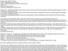
Cadron Settlement and the Trail of Tears
Middle schoolers examine the reason for removal of the Cherokee and other Indian nations. They map the water route of the Trail of Tears from its origination in the east and through the Arkansas River Valley to Indian Territory.


