Curated OER
One Square Meter
Students examine various ecosystems using scientific inquiry. Using the local area, they assess the characteristics and conditions in one square meter. They report their findings in the form of a survey map and data sheet. They...
Curated OER
An Investigation Into Our Community
Students examine maps of Palmer, Massachusetts and practice giving directions. As a class, they discuss how it changed from a farming community to more industrial. To end the lesson, they take pictures of the community to show how it has...
Curated OER
San Francisco Bay Watershed
Students examine relief maps of California and discuss the San Francisco Bay watershed. Discussion continues with the class helping complete a journey of water through seasons in a "finish my sentences" style lecture. They label rain...
Curated OER
The Battle of Horseshoe Bend: Collision of Cultures (54)
Students discover the political and cultural conflicts that led to the Battle of Horseshoe Blend, Alabama, and evaluate historical maps of the Battle of Horseshoe Bend. They research American Indian cultures that were located in their...
Curated OER
History "Rediscovered"
Students, after analyzing an overview of the history of the Jefferson Valley, bridge from the past to the present the realization that while we are today all citizens of the country, inequalities still exist. They examine treaties, legal...
Curated OER
The Lewis and Clark Expedition
Studebts prepare a storyboard showing the main geographical points of the Lewis and Clark expedition. They include a map showing the rivers, Rocky mountains and Pacific ocean. Students think of important events of the trip and include on...
Curated OER
Neotaquit Nature Center: Ecosystems, Science, Technology
Students survey their local forest conducting an inventory of tree species and analyzing data of local ecosystems. They design a nature trail, map the area and make a computer generated trail guide.
Curated OER
Field Exercise: Stream Flow Dynamics & Sedimentation
Students produce a vertical profile of a stream and map and define thalweg, point bar, and cut bank. They measure flow velocity differences across a stream transect and equate flow velocity with size of substrate sediment collected.
Curated OER
Oceans
First graders recognize that nearly three quarters of the Earth is covered by ocean. They locate the Pacific, Atlantic, Indian, Arctic and Antarctic oceans on a map. They describe the difference between ocean water and fresh water.
Curated OER
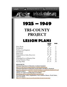
Tri-County Project: Precipitation
Students examine and research the annual rainfall in Nebraska. They create a map of the annual rainfall in Nebraska and use the map to develop explanations of settlement.
Curated OER
"You Shall Do Your Best Endeavor" - Working With Primary Documents
Students read and interpret primary source documents regarding historic Jamestown. In small groups, they read the primary documents, answer questions, and view online maps of Jamestown Island and Virginia.
Curated OER
Finding Your Way: The Underground Railroad
Students describe the difficulties faced when tying to escape using the underground railroad. Participating in an online simulation, students attempt to escape using the underground railroad. They view maps of the routes taken by the...
Curated OER
Water, Water Everywhere, and Nary a Drop to Drink!
Students sing the continent song and locate oceans between the continents on a map. They read "They Earth is Mostly Ocean" and copy notes into their journals. They watch a demonstration of water and saltwater evaporated to see what is...
Curated OER
Stratigraphy -- Layers of Time in the Earth
Students are introduced to the process of stratification. Using the internet, they read about the Richard Beene archeological site near San Antonio. Using a map, they color code the different layers present at this site and answer...
Curated OER
Discovering the Oasis
Students focus on the types of vegetation and animal life living around local water sources. This lesson can be adapted to any local water source, whether it be a lake, a river, stream or ocean. It has a particular focus on the bird...
Curated OER
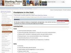
Floodplains in the Field
Students measure a topographic and geologic cross-section across a floodplain using simple surveying and auguring techniques in a field lab. Students also reconstruct the history of a river system.
Curated OER
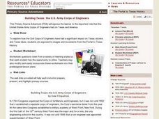
Building Texas: the U.S. Army Corps of Engineers Lesson Plan
Seventh graders study the engineering projects that the US Army Corps of Engineers initiated during the development of Texas. They examine primary source documents that are in digital and print form, and identify US Army Corp of Engineer...
Curated OER
Missouri Time Scale
Students plot events that happened years ago beginning with volcano activity. In this investigative lesson plan students are introduced to the different eras and plot them on a map.
Curated OER
Social Studies: The Lewis and Clark Trail Today
Students locate present-day towns along the Lewis and Clark Trail and compare them to towns in 1800, 1900, and 2,000. Working in groups, they conduct Intenet research to locate the wons along the trail and research their history and...
Curated OER
Dam Identification
Students identify and define Hydroelectric dams that provide us with electricity. Then they identify a variety of methods that have been used to try to help salmon make it past the dams on their journey to the sea. Students also become...
Curated OER
Law of Superposition
Learners identify the law of superposition and it states that beds of rock in a series are laid down with the oldest at the bottom and younger layers on the top. They construct a legen for a block diagram and construct a block diagram...
Curated OER
Social Studies: Cameroon
Young scholars discover the history of Cameroon and compile a list of foreign foods found in their local grocery. After taking notes on a lecture, they brainstorm a list of foods they might find on a trip to the country and compare it to...
Curated OER
Geography and World History
Students build off of their current knowledge of geography and world history, while being introduced to new concepts and ideas.
Curated OER
Lewis and Clark and Native Americans, Part II
Students research the Native Americans living in the regions explored by Lewis and Clark. They identify the modern-day names of sites claimed by the Lakota Indians, and create a poster of the original Native American names.


