Curated OER
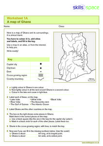
A Map of Ghana
In this Map of Ghana worksheet, students are given a blank map and key. They are told to label major features and color according to directions.
Curated OER
Water Use: Tragedy in the Owens River Valley
Students examine water management issues. In this environmental issues instructional activity, students watch a PBS video to develop an understanding of watershed, aquifers, and ground water. Students evaluate watershed issues in the...
Curated OER
Sense of Place: No River Too Wide-Bridges
Fifth graders discover the history of their hometown Des Moines River. In this U.S. Geography lesson students speak with Iowans that tell stories of the settlers and early villages near the Des Moines River. Students document...
Curated OER
MAKING CONNECTIONS WITH MAPS
Students define choropleth map. They construct a choropleth map. They interpret a choropleth map. They present geographic information.
Curated OER
Mapping Exercise
In this mapping worksheet, students are given data of children exposed to health risks and their geographical location. Students plot each child's home and the risk factors using an (x, y) grid. They answer 2 questions about the...
Curated OER
Maps Can Help Us
First graders explore the geography of Montana by analyzing geographic maps of the area. In this Native American reservation lesson plan, 1st graders discuss the similarities and differences between reservations in the state of Montana....
Facts and Files
The Nile
While it may not be possible to take an entire class to Egypt and explore the ancient wonders, it is possible to engage your young historians in activities that ask them to research these and other antiquities and place them on their...
Curated OER
The Rivers and Lakes of Alberta
Students are introduced to the online Atlas of Canada and they identify the lakes and major rivers of Alberta.
Curated OER
Landscape Picture Map
Students explore pollution of water sources. In this ecology lesson plan, students define and identify natural resources. Students use map skills to locate local rivers and lakes used for recreation. Students brainstorm ways in which to...
Curated OER
Direction of River Flow
Students determine the direction the river flows. They use a US map with rivers listed, colored pencils and a compass or transparency with directions marked. Students use a color key to determine which direction the river is flowing...
Curated OER
Rivers that Flow from the Continental Divide: The Journey of Two Rivers
Students explore river routes. In this social studies lesson, students trace the route of a river from its source and discuss the Continental Divide. Students draw the route the river takes and name the states it flows through. Students...
Curated OER
Science Inquiry Lesson: Mapping Project
Students explore the methods of creating maps. They create a map of Animas River Park using a compass and measuring tape, develop a single map from the team map sections, and devise another map of the Animas River Park using a GPS unit.
Curated OER
Issues About Rivers
Students explore the environmental issues of rivers. In this river instructional activity, students collaborate to create a concept mat pertaining to environmental issues regarding the Tangipahoa River.
Curated OER
Learning to Read a Map
First graders identify the map and globe symbols: Cardinal Directions; Compass Rose; Mountains; Rivers; Lakes; Towns; Roads.
Curated OER
Kid Maps: Reading and Creating Maps with Human Characteristics
Students look at maps. In this map lesson, students listen to the book My Map Book by Sara Fanelli and they see the difference between human characteristics (buildings, etc.) and natural characteristics (rivers, etc.). They...
Curated OER
Climb a Mountain, Raft a River on Your Own Land
Students are introduced to the characteristics of a map. As a class, they discuss the uses of public lands in their community and develop symbols for each feature. They use the symbols to create a map showing the recreational uses of...
Curated OER
Water, Rivers & Topography
Students explore the topography of Idaho and the importance of surface water and drainage. using digital maps, they inspect the courses of major rivers, Yellowstone Hot Spots, and the natural landscaping of Pocatello. Students explore...
Curated OER
Arkansas Geography/History Relief Map
Sixth graders research a number of sources including the Internet to find information about the regions of Arkansas while locating sites of national historic interest. They located sites on maps while working at assigned websites. They...
Curated OER
The Birmingham River System
After a lesson on geography and the features of a river, students view a map of the Birmingham river system, which is in England. They are then asked to label 4 features on the map.
Curated OER
School-Home Link: Maps
In this atlas and parent communication form worksheet, students use an atlas to find several things: the capitol city of Japan, the number of countries in Africa, where to buy a newspaper, the names of Presidents of the United States,...
Curated OER
Map Keys
Third graders examine maps and map keys. In this locating map features instructional activity, 3rd graders use crayons, markers and colored pencils to label maps. Students work in partners to read map keys and locate given places and...
Curated OER
Exploring Earth Through Maps and Technology
In this maps worksheet, students read 3 pages of detailed information about maps, latitude, longitude, topography, satellites and global positioning. Students then answer 10 questions. There is also a research project assignment available.
Curated OER
What You Can Learn From a Map
Students discover how to interpret maps. In this geography skills activity, students explore geographic themes as they complete worksheet activities regarding road maps, shaded relief maps, and topographic maps.
Curated OER
Archaeology- State Map
Students study state maps. In this map skills lesson, students identify the states' location and how to use a legend. Students complete photocopies of the state map.


