Curated OER
Map of Kellyburi
In this map worksheet, 6th graders use a map to label 12 locations, answer 6 directional questions, write the answer for 17 general information questions, select the word for 10 sentences and read 25 English words for Thai animal names.
Curated OER
Sub-Saharan Maps
In this geography skills worksheet, students draw real or imaginary maps that feature escarpment, rift valleys, gorges, diamond mines, plateaus, mountains, lakes, rivers, and gold mines.
Curated OER
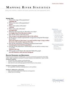
Mapping River Statistics
Students research different statistics to do with the Mississippi River. They answer questions about finding data and collect it by conducting research. The research is used to construct a data table. Then students use the table to...
Curated OER
Mapping Tanzania
In this Tanzania activity, students label countries, cities, landmarks, rivers, and more that make up Tanzania. Students label 10 items.
Curated OER
Mapmaker, Make Me a Map!
Young scholars are introduced to the state quarter program and examine the Colorado state quarter. They locate Colorado on a map and create a map with a key. They discuss the state motto and examine pictures of the state's geographical...
Curated OER
Google Earth Exercise: Rivers
In this Google Earth instructional activity, students search the site and answer short answer questions about different rivers in the world. Students answer 11 questions.
Curated OER
Edible Maps
First graders, in groups, identify major geographical features of Texas. They form a topographical map of Texas using edible dough, candy, etc. They present and then eat their maps.
Curated OER
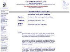
Introduction to the United States Map
Students explore the United States using a map. In this map lesson plan, students discover how to use a United States map and a globe to locate places.
Curated OER
Learning to Read a Regional Map
Learners locate the local community, surrounding communities and major geographic features of the SE Utah and the Four-Corners region on a map, after receiving direct instruction.
Curated OER
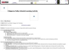
A Map Mystery
First graders solve a mystery by following map clues. In this map clues lesson plan, 1st graders follow a computer program called Neighborhood Map Machine. In this program, it gives students directional and spatial clues in order to...
Curated OER
Tooling Around Arizona: Reading Arizona Maps
Students research Arizona maps. In this map lesson, students discuss map titles, scales, directions, elevation, and symbols. The class will examine topography, landforms, and rivers found on an Arizona map.
Curated OER
Landscape Picture Map- The Earth's Surface
Students discuss different landscapes. In this map lesson, students describe what they see when they travel between home and school. Students use a landscape picture map to locate the places or objects they see.
Curated OER
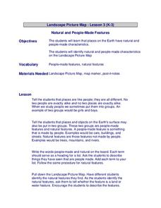
Landscape Picture Map
Students discuss differences between man made and natural features on the Earth's surface. In this natural and man made features lesson, learners brainstorm a list of features and categorize them on the board. Students study a landscape...
Curated OER
Map of Egypt
In this map of Egypt activity, students label the cities, bodies of water, surrounding countries and color the map according to the directions.
Curated OER
Mapping the Civil War
Students identify the locations of pivotal American Civil War battles. In this map skills lesson, students label Fort Sumter, Antietam, Vicksburg, Gettysburg, and the Battle for Atlanta on an outline map. The map is not included.
Curated OER
Mapping the Many Underground Railroads
Students determine the beginning and the end points of the enslaved person's journey to freedom, noting landmarks mentioned along the way such as cities, towns, rivers, mountains, and other geographic features.
Curated OER
Character Mapping
Third graders choose one character from a book they have read recently. Using paper, they create a character map of the character along with a small drawing to show what they look like. To end the lesson, they share their character map...
Curated OER
Map of Italy
In this map of Italy worksheet, students find, color and label cities, surrounding countries, bodies of water and landforms in the country of Italy.
Curated OER
Exploring the Map of Morocco
In this exploring the map of Morocco worksheet, students find and label cities, islands, bodies of water, mountains, deserts and other countries around Morocco.
Curated OER
Boundaries and People
Pupils map watersheds to find their boundaries. For this watershed activity students map and then give their "watershed address." Pupils show the trail from stream, larger stream to oceans. Students describe the...
Curated OER
On the Trail of the Hudson's Migratory Fish
Using data related to the fish in the Hudson River area, learners calculate distance, elapsed time, and growth. They learn about migratory fish, the life cycle of a fish, analyze a map, and answer questions.
Curated OER
The Geography of Africa
Hop a flight to Africa in this presentation, which includes brilliant and appealing photographs of the continent as well as maps and graphs about its geography, topography, and climate. Those who are researching Africa for a project or...
Curated OER
Geography of South America
Student's identify geographic features of a South American map. They use the scale of the map to calculate distances between points. They identify examples of the five geographic themes on the map of South America.
Curated OER
Exploring the Hudson in 1609
While this lesson focuses on a study of the Hudson River, it could be used as a template for a discussion of map skills, converting measurements, and plotting a route. The lesson includes vocabulary and other resources to make it a...


