Curated OER
Character Map
A character map worksheeth as this would be handy for your class to support characterization study for any text. It is completely adaptable: your learners choose a character, write three traits in ovals and identify two instances that...
Curated OER
Maps
Maps, globes, and computer software aid young explorers as they locate state capitols, major cities, geographic features, and attractions for states they are researching. They then use desktop publishing software to create a map to share...
Curated OER
Mapping Electricity
Students complete Internet research and use their map reading skills to learn about how the United States creates and uses electricity in different states. In this energy sources activity, students study the mini map of energy usage...
Curated OER
Tooling Around Arizona: Reading Arizona Maps
Young scholars research Arizona maps. In this map lesson, students discuss map titles, scales, directions, elevation, and symbols. The class will examine topography, landforms, and rivers found on an Arizona map.
Curated OER
Lesson Design Archaeology- USGS Maps
Students research USGS maps and identify the major features. In this map skills instructional activity, students identify low and high elevations on a USGS map and practice finding latitude and longitude.
Curated OER
Globe Skills Lesson 10 Apollo 11
Students develop their globe skills. In this geography skills lesson, students use a globe and a softball to replicate distance between the earth and its moon.
It's About Time
Organizing a Store
When provided with multiple objects, how many ways can the class organize and display them based on predetermined factors? Assist class members with a handy activity—theoretically teaching them concepts to understand periodic...
Novelinks
Where the Red Fern Grows: Graphic Organizer, Story Map
How do you grow a goal from a dream to reality? You make a plan! After reading chapters two and three of Where the Red Fern Grows, learners map how Billy earns his dogs by completing an organizer in pairs and then discussing answers in...
Curated OER
Should the Ming End the Treasure Voyages?
During the first century of Chinese Ming dynasty (1368-1644), the government sent out a total of seven voyages into the Indian Ocean. Young historians will discuss, explain, role play, and compare the decisions made by rulers during the...
Curated OER
The Ancient Civilization of Mali
Students explore the ancient civilization of Mali and examine various historical and cultural aspects of the civilization. In this ancient civilization of Mali instructional activity, students examine trade with respect to geographic...
PBS
Concept Map
Make the thought process visible with a handy concept map organizer. As learners develop their main ideas in research, writing, or creative development, they can add details and like ideas to the worksheet as needed.
Howard Hughes Medical Institute
Mapping Genes to Traits in Dogs Using SNPs
Genetic analysis has gone to the dogs! Learners use real DNA information collected from dog saliva to study the relationship between genotypes and phenotypes. They analyze alleles to determine correlations to coat color, length, and...
Curated OER
Determining Cutting Site Locations
Students explore DNA restriction mapping. They cut pieces of paper into lengths representing those produced when specific enzymes are used to cut a strand of DNA.
Curated OER
Getting it Straight with Latitude and Longitude Skills
Teachers can help students learn latitude and longitude skills using games and other motivating activities.
Curated OER
Our World With MapsQ
Students examine and compare different types of maps. In this map skill instructional activity, students look at neighborhood and national maps on the overhead projector while making comparisons of the symbols and locations. They use a...
Curated OER
Where Am I: How to Read a Map
Third graders develop an understanding of maps. They explore what a map is, who uses maps, and how to use maps. Students investigate the compas rose. They create a compose rose which illustrates the cardinal directions. Students practice...
Curated OER
Map Skills
Students construct a road map using map pieces precut by the teacher. They apply geometric terms such as rotation and turns. Students apply the use of ordinal directions. They apply a variety of map keys.
Curated OER
Map Skills
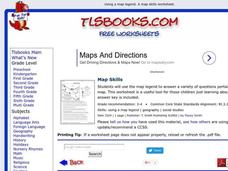
In this history worksheet, students use a map and legend to answer nine comprehension questions. Students check their answers when done.
Curated OER
What You Can Learn From a Map
Students discover how to interpret maps. In this geography skills lesson plan, students explore geographic themes as they complete worksheet activities regarding road maps, shaded relief maps, and topographic maps.
Curated OER
Mapping the Halifax Explosion
Students research the Halifax Explosion using historical maps.
Curated OER
What Do Maps Show?
Students discover the uses for various types of maps. In this geography skills instructional activity, students discuss the type of maps that exist and what their individual features are. Students then practice using different types of...
Curated OER
Organization of a Territory, Map Elements
Third graders compare printed and online maps and use proper geographic terminology to answer questions.
Curated OER
Map Skills: Explorers, Continents, and Oceans
Third graders use a software program to make and label a map of the world. On the map, they locate the seven continents, oceans and the countries of Europe. They also draw the routes of Christopher Columbus, Juan Ponce de Leon and...
Other popular searches
- Mapping Skills First Grade
- Esl Lessons Mapping Skills
- Mapping Skills Activities
- Geography Mapping Skills
- Mapping Skills Test
- Early Mapping Skills
- Geographic Mapping Skills
- Mapping Skills and Halloween
- Mapping Skills of China
- Alberta and Mapping Skills
- Topographic Mapping Skills
- Social Studies Mapping Skills


