Curated OER
Learning to Read a Regional Map
Students locate the local community, surrounding communities and major geographic features of the SE Utah and the Four-Corners region on a map, after receiving direct instruction.
Curated OER
Ancient Egypt: Connecting Literature and Geography
Students brainstorm prior knowledge of Ancient Egypt, locate Egypt on map of Africa and on world map, watch King Tut film, discuss term biography, and map geographical information mentioned in stories and documentaries about Ancient Egypt.
Curated OER
Latitude and Longitude- Online Interactive
In this maps worksheet, learners learn about longitude and latitude by reading a two paragraph text and studying two maps. Students answer 9 fill in the blank questions. This is an online interactive worksheet.
Curated OER
Where in the World Am I: Latitude And Longitude
Students demonstrate their knowledge in using latitude and longitude measurements to find locations on a map, especially places in Hawaii.
Curated OER
Latitude and Longitude
Students find latitude and longitude on a map or atlas. They create maps with a cruise route. They practice plotting locations given latitiude and longitude.
Curated OER
Treasure Hunt
Students find lost "treasure" using a treasure map after being shown a map that you have created where terms and symbols are discussed. The class is divided into small groups where they locate your treasure and then read a section from...
Curated OER
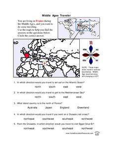
Middle Ages Traveler
In this map worksheet, students are given three maps of France to use to answer multiple choice questions. Students complete an activity from the perspective of a Middle Ages traveler.
Curated OER
World Map and Globe- Introduction to Symbols
Students investigate picture symbols. In this symbols lesson plan, students define symbols and discuss symbols that they see in everyday life. Students identify symbols on maps by using post-it notes.
Curated OER
The Changing Landscape
Students explore how the landscape is constantly changing. In this landscape lesson, students identify a building under construction on the Landscape Picture Map. Students discuss the purpose of the construction and the effect on the...
Curated OER
The Geography of Europe
Students examine maps of Europe. In this geography skills lesson, students interpret several maps to determine the boundaries of the European Union and respond to assessment questions about the maps.
Curated OER
What if the Mormons had not come to Utah?
Fourth graders use critical thinking, evaluation, and geography skills to find alternative locations that Brigham Young could have taken the Mormons to settle.
Curated OER
Mapping Districts
Students become literate in their use of maps. In this 2010 Census lesson plan, students visualize census data on maps, use map keys to read population maps, and explore the concept of population density.
Curated OER
Mapping Districts
Students use maps to learn about the U.S. Census. For this 2010 Census lesson plan, students visualize census data on maps, use map keys to read population maps, and explore the concept of population density.
Curated OER
Globe Lesson 17 - Alaska and Hawaii - Grade 4-5
Students develop their globe skills. In this geography skills lesson, students explore the area added to the United States when the Alaskan territory was purchased from Russia.
Curated OER
Geography Worksheet
In this geography skills worksheet, learners respond to 14 short answer questions by using maps and atlases. The maps and atlases are not included.
Curated OER
Middle East Quiz
In this geography skills quiz worksheet, students take 1 of the 3 provided outline map quizzes on the 23 Middle Eastern countries. Three separate quizzes are offered.
Curated OER
Lesson 2: Mapping Sub-districts
Students learn more about the census. In this mapping sub-districts lesson plan, students visualize census data on a map, use a map key to read a population map, and better understand the concept of population density.
Curated OER
Continents and Oceans
In this geography worksheet, students read a paragraph and learn about the seven continents and five oceans of the world. Students study a map of the world and answer 12 short answer questions. This is an online interactive worksheet.
Curated OER
The United States in 1790
In this geography skills worksheet, students study the provided map of the United States in 1790 and then complete the provided quiz over the 17 states and territories.
Curated OER
Direction March
Students participate in a game that explores map reading skills and intermediate directions. The teacher turns over a direction card for each player or team and announces the move, and they move towards a designated cardinal or...
Curated OER
Lesson Design Archaeology- U.S. Map
Students examine the U.S. map and identify cultural areas. In this archaeology lesson, students locate cultural areas on the U.S. map and fill in the proper locations.
Curated OER
Going, Going, Ghost
Third graders research ghost towns. In this geography lesson, 3rd graders locate ghost towns on a map and choose one location to research. Students construct a research paper and present it to the class.
Curated OER
Mexico Map
For this blank outline map worksheet, students study the political boundaries of the North American country of Mexico. This map may be used in a variety of classroom activities.
Curated OER
Mexico and Central America Map
In this outline map activity, students study the political boundaries of Mexico and the Central American countries. This map is labeled with the country names.
Other popular searches
- Mapping Skills First Grade
- Esl Lessons Mapping Skills
- Mapping Skills Activities
- Geography Mapping Skills
- Mapping Skills Test
- Early Mapping Skills
- Geographic Mapping Skills
- Mapping Skills and Halloween
- Mapping Skills of China
- Alberta and Mapping Skills
- Topographic Mapping Skills
- Social Studies Mapping Skills


