Big History Project
Human Migration Patterns
Humans have been on the move for millennia. Using an article from The Smithsonian, pupils chart human movement before written history on a world map. In addition, they examine the modes of transportation used by different waves of human...
Mathematics Assessment Project
Representing and Combining Transformations
Transform your learners into master geometers with an activity that asks them to first complete an assessment task drawing the result after transformation of a given shape in the coordinate plane. They then use cards to...
DocsTeach
Lewis and Clark's Expedition to the Complex West
Lewis and Clark's famous expedition is a prime example of the United States' westward expansion. Aspiring historians examine maps from Lewis and Clark's journey, as well as discuss their interactions with Native American tribes. The...
NOAA
Why is Hawaii's Ocean Important?
Studying the oceans? Focus on Hawaii's ocean with a resource packed with activity-based worksheets. Everything from products that come from the ocean to the abundance of plants and animals that call the ocean their home, Hawaii's ocean...
Scholastic
Hill of Fire Teaching Plan
Some books are perfect for drawing connections between multiple subjects. The book Hill of Fire becomes the hub for three very different, yet related activity ideas. First the class hones their oral language skills by creating an...
NASA
Tools to Study Tornadoes and Galaxies
Take your class on an intergalactic journey as they explore the galaxy and various meteorological events taking place in our atmosphere each day. Learners investigate electromagnetic waves and the Doppler Effect before gathering radar...
Howard Hughes Medical Institute
Zebrafish and Skin Color
You may not know if that zebrafish in your fish tank is a model citizen—but it is definitely a model organism! What can we learn about ourselves from a tiny zebrafish? Discover more about the polygenic trait of skin color through a...
Curated OER
Call to Arms: A Service Project
Sick of selling candy and washing cars? How about hosting a Digital Day or a Learning Lunch? The suggestions here make fund raising fun and rewarding. Raise money to preserve important maps and other primary source documents.
Curated OER
On the Road with Marco Polo: Marco Polo in China
Learners investigate who the Mongols were and where their empire was located. They research Kublai Khan and the region he ruled. They study the major products of 13th Century China.
Curated OER
Earthquakes: Third Grade Lesson Plans and Activities
Introduce third graders to energy waves with a hands-on geology activity, in which they answer questions and compare seismograms in the San Francisco Bay area. After a demonstration that shows how bigger waves indicate a...
Museum of Tolerance
Family Role Model Activity
What does is take to be a role model? Through grand conversation, and the use of books and a graphic organizer, scholars find out and apply the requirements to identify a role model within their family. They then journey through the...
Curated OER
A Comparison Study of Water Vapor Data to Precipitation over North America
Students use NASA satellite data to compare water vapor over the United States. In this data analysis lesson students use an Excel spreadsheet to map their data.
G. Turrell
Science Activity 2: Light & Sound
Little learners experiment with sunlight and map out how light travels. Using a mirror and slotted card, they find out about items that can reflect or absorb the light. They experiment with a variety of materials to find out how light...
Curated OER
My World
Students study maps. In this social studies lesson, students draw a map of either their room at home or the route they take to school. Students label items on their maps.
Edgate
Great Grids
Learners use grid boxes as a measurement tool and discover how grids are used for mapmaking and scaling down an area. They begin by attempting to draw a model shape drawn by the teacher by using the gridding process. At the conclusion of...
Curated OER
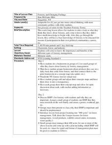
Forestry and Changing Feelings
Students investigate how the forest affects their daily lives by creating a concept map. In this ecological lesson, students create a concept map linking the forest to the many things they use each day. Students take a field...
Curated OER
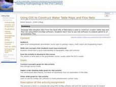
Using GIS to Construct Water Table Maps and Flow Nets
Pupils examine how to use GIS software to analyze patterns of groundwater flow. Seepage lake elevation data from the Sand Hills of Nebraska is used to construct a water table map and flow net using Esri's Arc Map software.
Curated OER
Map Memory
Fifth graders, working in a whole class setting, label a United States map with the names of all the states that they know. They transfer the names of the states to an individual map and color it. Next, they receive directions on how to...
Curated OER
Maps in Kindergarten: Rosie’s Walk
Students are read, Rosie's Walk by Pat Hutchins. In this sequencing lesson, students discover the importance of knowing how to create a map and read it. They listen to the story and complete various map making activities.
Curated OER
Treaties
Students explore Canadian maps. In this map skills and Canadian history lesson plan, students locate reserves that originated from treaties made while establishing the Saskatchewan First Nation reserve communities. Students research...
Curated OER
World Projections
Students identify map projections and examine polar maps. In this map skills lesson plan, students use a flat world map to identify various projections and calculate the distances between locations by using a map scale.
Curated OER
Mapping Your Schoolyard Habitat
Students explore the terrain, structures, plants and signs of habitats around their schoolyard. They draw a sketch map showing the different areas around the schoolyard. Students identify the location of weeds and native plants on their...
Curated OER
Bunyans Lesson Plan
Learners practice their map skills. In this early childhood lesson plan, students use a map of the United States and identify the location of several natural wonders included in the book The Bunyans by Audrey Wood.
Curated OER
Lesson Design Archaeology- World Map
Students practice locating positions on the world map. In this map skills instructional activity, students explore the world map and items such as the compass rose, Equator, mountains, cities, etc. The students practice locating...


