Curated OER
Way to Go! Create a Road Map Game
Students create a travel game of one of the United States. They research a state of their choice and create a travel game using a common road map. They interpret map symbols as they calculate map mileage for their games. They create...
Curated OER
Tortoise and Hare Races
Students listen to the fable, The Tortoise and the Hare, and participate in various map skill activities. They manipulate magnetic tortoises and hares on metal cookie sheets to practice direction, and construct racing tortoises out of...
Curated OER
Finding Captain Hook's Treasure
Students use their map-reading skills to find Captain Hook's treasure. They see how the directions on a map correspond with "real-life" directions, and that symbols on a map represent real things.
Curated OER
Rivers Run Through It
Using a relief map of New York State, learners answer questions about the distance between different cities, identify bodies of water, and more. First, they discuss vocabulary related to the Hudson River area. Then, they complete a...
Curated OER
Sir Francis Drake
Help your learners prep for an exam testing content knowledge related to Florida's State History. Your class can use this printable page to review vocabulary, identify locations on a map, and research both knights and the Sir Francis...
Baylor College
Mapping the Spread of HIV/AIDS
Where is HIV/AIDS most prevalent and what are the current trends regarding HIV? Have groups work together to map the world's HIV/AIDS rates, then create a class map with all the data. Lesson includes cross-disciplinary concepts including...
Curated OER
Map Skills
Students examine the nations, battlefields, troop movement of the Germans through Belgium and the location of both fronts during World War I by creating a map. They visualize the strength of the Germans early in the war.
Radford University
The Roanoke Adventure!
Travel about town. Pupils work in pairs to find the distances between landmarks with a map. The teams determine how far to travel on the streets and the length between the landmarks with the distance formula and compare the two. Learners...
Radford University
Escape from the Zombie Apocalypse - Exploring Quadrilaterals through Google Maps and Google Earth
Prepare for the zombie apocalypse ... by studying quadrilaterals? Given a map of an imaginary town, scholars identify quadrilaterals created by streets. They then use Google Earth and Google Maps to find parallelograms, rectangles,...
Scholastic
Volleyball Road Trip
Review coordinate mapping with your young geographers by matching cities on a volleyball team's road trip itinerary to their appropriate coordinate locations.
NASA
Air Temperatures Around the World: Student Activity
Check out climate anomalies just like NASA climatologists! Investigators use a GISTEMP map from NASA to analyze one month of climate anomalies. Scientists look for data extremes and generate possible explanations for observable...
Curated OER
Mapping Perceptions of China
Students discuss what types of things are included on a map. They compare and contrast maps of China with a map they create and practice using different types of maps. They write analysis of their classmates maps.
Curated OER
Pirate Map
Students write directions explaining how to get from one location to another by using a map of their town and use simple maps to identify and locate places.
Curated OER
Political Legends and Map Symbols
Students identify the legend and map symbols. In this map skills lesson, students use a world map to find various locations using a map key.
Curated OER
Mapping the Family
Students research the locations where their fathers have lived. In this map skills lesson, students identify the locations their fathers have lived in the world as they create charts and maps that note the information.
Curated OER
Maps and Legends by Micheal Chabon
Students read an essay to improve language skills and understanding of American culture for ESL teachers. In this American culture lesson, students read the essay 'Maps and Legends' by Michael Chabon and complete various activities to...
Curated OER
Play Doh Map of Your State
Students create a state map using Playdoh. For this hands-on state geography lesson, students work in groups to form a three-dimensional map of their state using Playdoh made at home following a (given) recipe. Students use four...
Curated OER
Topo Map Mania!
Students read and use topographical maps. They also use a compass to find bearing to an object on a map and in the classroom. Ask your students how they might travel to somewhere they have never been to befo
Curated OER
Fairy Tale Maps
Students study direction as they listen to the stories of Little Red Riding Hood and The Jolly Postman. In this cardinal direction lesson, learners create a map to show the path Little Red Riding Hood took in the story and label the path...
Curated OER
A Map Mystery
Second graders solve a map mystery. In this technology lesson plan, 2nd graders develop an awareness of maps and the symbols associated with maps as they the "Neighborhood Map Machine."
Curated OER
Make a Classroom Map
Students map the items in their classroom to explain the importance of coordinate systems.
National Endowment for the Humanities
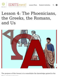
Lesson 4: The Phoenicians, the Greeks, the Romans, and Us
Learners review knowledge gained in the three-part unit on the history of the alphabet. Using maps and images, learners consolidate their understanding of ancient Greece, the Romans and the Phoenicians, and their respective impacts...
Core Knowledge Foundation
Maya, Aztec, and Inca Civilizations
A 10-lesson unit explores the Maya, Aztec, and Inca civilizations. Over the course of two weeks, scholars read nonfiction excerpts, discuss their findings, and complete activities. An assessment equipped with multiple choice and matching...


