Curated OER
Comparing Countries
Students compare facts about different countries. In this comparing lesson, students collect information about the US and another country and compare them. Students locate countries on the map and make a hypothesis about the lives of...
Curated OER
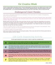
Endangered Giant Pandas
For this giant panda worksheet, students read and complete 5 pages of information and activities pertaining to the giant panda. Students study maps of the area, read fun facts about pandas, cut and paste life cycle sequencing, and read...
Stanford University
Korean War
Learners study the cause of the Korean War. In this World history lesson, Students read excerpts from two different textbooks, one from South Korea, and one from North Korea. They discuss how the cause of the war differs depending on the...
Curated OER
Importance of Rice
Third graders explore the importance of rice in our world. In this rice farming lesson, 3rd graders discover how much rice we use on a daily basis. Students also discover myths from other cultures about rice. Students color code a map of...
Curated OER
Social Studies: Lesson 2
Students explore the beginning of Communism. For this World History lesson, students exhibit their knowledge of Communism and the Marshall Plan through completion of a map activity.
Curated OER
More Than One Grain of Rice
Students explore mathematics, geography and agriculture by studying world rice production. In this production of rice lesson, students read One Grain of Rice and use a worksheet grid to calculate how much rice was received. Students...
Curated OER
Journey to Tibet
Students create "Culturegrams" from the library and travel guides provided during class. They use the library and PC lab during study hall to work on a PowerPoint presentation and show the PowerPoint to the class to describe your trip.
Curated OER
The Three Gorges Dam- Should it be Completed?
Students research and analyze the geographic problem of whether or not the Three Gorges Dam should be completed. Students take a position on the issue, gather information related to their position, present their conclusions, and write a...
Curated OER
Countries w/ Biggest Armies Quiz
In this online interactive military quiz worksheet, students examine the chart that includes details about the number of troops in 20 countries. Students identify the names of the countries in 4 minutes.
Curated OER
Highest Mountain Countries Quiz
In this online interactive geography quiz worksheet, students examine the chart that includes the elevations of 20 world mountains. Students identify the names of the mountains in 4 minutes.
Curated OER
Regions of Countries Quiz
In this online interactive geography quiz worksheet, students examine the chart that includes details about 20 world regions. Students identify the names of the countries where the regions are located in 4 minutes.
Curated OER
Zhuang: China's Largest Minority
Students, in groups, research Chinese ethnic minorities such as the Zhuang population. They identify the characteristics of different ethnic groups and consider the lives of ethnic groups worldwide.
Curated OER
Treasures of the Silk Roads
Students examine and discuss art objects from the Silk Roads. They analyze images of artifacts, create a word map, and develop and write a short story or poem based on the slides viewed.
Curated OER
Incorporating Reading Comprehension Using Cinderella Stories from Different Lands
First graders investigate Cinderella tales from different lands to discover their commonalities in this unit. They perform their favorite Cinderella story.
Curated OER
Time Zones
Third graders have a greater understanding of time zones, explain the basic history and purpose in the creation of time zones, and use time zone maps to calculate the time/day in a certain area.
Curated OER
Discovering the World Virtually
Students experience world adventures through the internet. For this technology lesson, students use a suggested internet site and explore each expedition. Students can virtually travel such lands as China.
Curated OER
Geography Game
Second graders, in groups, selects a letter as a starting point and announces the direction in which he intends to move on a map. The team that closes a square takes possession of the square and marks it with their symbol.
Curated OER
Who Dropped What into the Melting Pot?
Learners show the movement of people to the United States from other countries on maps. They study the geographic cultural roots of foods that contribute to the melting pot of food in America. They research where an ingredient comes from...
Curated OER
Identifying Reasons for World Trade
Students examine the advantages and disadvantages of world trade. They participate in a class discussion of international trade, read a handout about a specific country, and in small groups label a map with agricultural commodity...
Curated OER
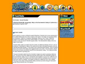
Geography: Why Is the Sacremento Valley a Good Place to Grow Rice?
Third graders locate the Sacramento Valley in California where rice is grown. In this rice growing location lesson, 3rd graders locate the Sacremento Valley, California on a map, and color the mountain ranges and terrain that is around...
Curated OER
The Early Development of Korea
Students examine the early development of the country of Korea. Using maps, they identify how geography of the country has contributed to its isolation. They use the internet to research how China influenced Korea and what achievements...
Curated OER
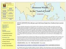
Monsoon Winds to the "Land of Gold"
Students recognize environmental factors that influenced maritime trade routes and the establishment of major trading centers in classical times. They evaluate perceptions of the ancient world through ancient maps and primary source...
Curated OER
The Selling of the Taj Mahal or Osaka Castle
Students practice their marketing skills. In this historical sites lesson, students select and research historical sites in the world that they market and attempt to sell to a businessman.
Curated OER
The History of Rice
Third graders explore the history of rice. In this history of rice lesson students use a timeline to help determine important events in the spread of rice throughout the world. They use a map to locate rice production in the United States.


