Curated OER
Building Bridges for Young Learners--Culture
Young scholars explore the concept of "culture." In this cross curriculum literacy and world history lesson, students listen to a letter written by a child from Namibia, then compare and contrast life in Africa with their own life. Young...
Curated OER
Charles Lindberghs's Flight to Paris
Students practice map skills. In this map skills lesson, students locate the cities of New York and Paris on a map. Students read about the flight made by Charles Lindbergh in May 1927 from New York to Paris. Students answer 8 questions...
Curated OER
Magellan
Students identify the route of Magellan's voyage. In this map skills lesson plan, students use a globe to identify various coordinates where Magellan traveled.
Curated OER
Weather Predictions
Students play the role of weather personalities by making five day forecasts based on data gathered from observations, weather instruments, and weather maps. Each day a small group makes a class forecast for the next day and reviews the...
Curated OER
"Trails, Rails, and Roads" Lesson 2: Road Tripping
Young scholars practice map skills and take a virtual road trip through Maine examining the history of transportation. They create questions from the information they learned and play a game against other groups.
Curated OER
Mapping the Village
Young scholars measure, weigh, and document the amount of trash and garbage generated by the school for one day. They brainstorm solutions for trash in the area and assist with the school-wide recycle program.
California Polytechnic State University
Australian Geography Unit
At the heart of this resource is a beautifully detailed PowerPoint presentation (provided in PDF form) on the overall physical geography of Australia, basic facts about the country, Aboriginal history, and Australia culture and lifestyle.
Curated OER
Instruments From Around the World
How much does the environment affect how and what man creates? Children explore the effect of the environment on primitive man as they research raw materials from a specific location. They use their findings to write a short essay about...
Curated OER
Radiation Comparison Before and After 9-11
Using the NASA website, class members try to determine if changes could be detected in cloud cover, temperature, and/or radiation measurements due to the lack of contrails that resulted from the halt in air traffic after the attacks of...
Peace Corps
Family
Family traditions are the focus of a instructional activity that explores the lives of children in India and those in your classroom. Scholars examine their own family roles and traditions, then respond to an informative text detailing a...
Montana State University
Meet Mount Everest
Learning about one landform might seem boring to some, but using the resource provided practically guarantees scholar interest. The second in a sequential series of eight covering the topic of Mount Everest includes activities such as a...
Curated OER
Locate and Name the bodies of water and the continents
Second graders locate the equator, bodies of water, and different continents on a globe. In this globe lesson plan, 2nd graders recall geographical information on a globe.
Curated OER
Oceans of the World
Second graders demonstrate their ability to find the five oceans on a globe and on a world map and relate their knowledge of mountains and other physical characteristics of land masses to the physical characteristics of the ocean floor.
Curated OER
Learning About the Equator, The Seven Continents and the Four Oceans
Students use a globe or map to locate the equator, oceans and continents. Using the internet, they spend time surfing through predetermined websites on continents and oceans. They write facts on different parts of the globe on index...
Curated OER
Rooster's Night Out
First graders complete interdisciplinary activities associated with a folktale from Cuba. In this Cuban folktale lesson, 1st graders read the Rooster's Night Out, before completing comprehension worksheets, make recipes, and...
Curated OER
What Do We Know About Africa?
First graders explore Africa, its geography and climate. After completing a KWL chart, 1st graders locate Africa on a globe and discuss how its location on the earth affects its climate. Using the Internet and a given fact sheet,...
Curated OER
What is the Population Distribution of Cartoon Characters Living On the Pages of Your Newspaper?
Students read various cartoons in their local newspaper and calculate the population demographics, spatial distribution and grouping of the characters. Using this information, they create a population distribution map and share them with...
Curated OER
Discovering Your Community
Students focus on the origins of the families that make up their community by exploring their family's origins through themselves, parents, and grandparents. Students create a map marked with family origins for the class.
Curated OER
Landforms
Students begin their examination of landforms. Using a map, they locate and identify the major landforms on Earth. They discuss how landforms affect the lifestyle of the community and determine which goods and services the community...
Curated OER
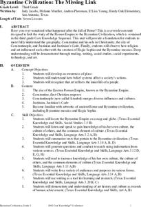
Byzantine Civilization: The Missing Link
Students connect their study of the Roman Empire to their study of the Byzantine Civilization. In this ancient history lesson, students study the time period between the fall of the Roman Empire and the rise of the Byzantine.
Curated OER
America the Beautiful
Students analyze the physical geography of the United States and how we have adapted to or altered the land to create the country we know today. Students complete maps with physical features, states and cities of interest.
Curated OER
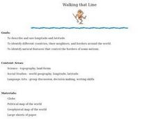
Walking that Line
Students attempt to describe and use longitude and latitude. They will identify different countries, their neighbors, and borders around the world. Included in the lesson the students identify natural features that control the borders of...
Curated OER
Home: the Story of Maine "A Love for the Land": Where Are You? Who Are You?
Students investigate their neighborhood both as it is now and as it was 100 years ago. They take a walk around their neighborhood and fill out a worksheet before completing a worksheet.
Curated OER
Four Main Directions
Students describe directions using a globe for north, east, south and west. In this mapping lesson students identify the north and south pole. Students understand the importance of the equator and the Prime Meridian. Students explain how...


