Curated OER
Making Sense Of A Round World On A Flat Surface
Students engage in a lesson that is concerned with the development of geography skills. They take part in a number of activities that center around finding and traveling to different locations. The lesson has resource links that can be...
Curated OER
Flight Paths of Orbiting Satellites
Learners examine the path a satellite follows as it orbits the earth. In this space science lesson, students use a globe as they illustrate a satellite in its orbital plane, then plot points on the satellite's path on the globe to see...
Curated OER
NASA Satellite 'Sees' Carbon Dioxide
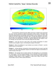
In this atmospheric carbon dioxide activity, students observe a map showing the concentrations of atmospheric carbon dioxide taken by the Atmospheric Infrared Sounder instrument. Students solve 4 problems using the map. They determine...
Curated OER
Exploring the World's Geography
Students discuss the seven continents of Earth and the diverse geography. After discussion, they create their own paper-mache globes which properly display all seven continents, the equator, and the prime meridian. They conduct research...
Curated OER
Donde en el mundo estas?
Students give & follow directions given in Spanish, using oral, written and graphics. They use maps, globes, atlases, and remote sensing, GIS, and GPS to acquire and process information about places.
Curated OER
Louisiana
Third graders study factual information about Louisiana including the state flag, bird, tree, and important geographical points using the Internet and maps. They explain the different groups that settled the state in this mini-unit.
Curated OER
Ocean Planet: Sea Secrets
Students identify ocean features and draw a profile using data points on a map. Through discussion and research, they discover the importance of oceanography and plot a profile of the ocean floor in search for a vessel full of precious...
Curated OER
Foods and Languages of the World
Students explore cultures around the world. In this cross-curriculum geography lesson, students listen to This is the Way We Go to School , a Book about Children around the World , and locate various countries on the globe and a map....
Curated OER
Celebrate Kwanzaa in the United States
Students explore and study the celebration of Kwanzaa in which African-Americans remember their heritage and remind people of the importance of sharing with family and friends. They participate in a chant about the seven continents and...
Curated OER
Establishing Borders: The Expansion of the United States 1846-48
Students investigate how the United States acquired land after the Revolutionary War ended. In this establishing borders instructional activity, students use maps to identify territories acquired by the US and the states that later...
Curated OER
Wolves: Friend or Foe?
High schoolers study wolves and their habitat in Yellowstone. In this environment and behavior activity students create an interactive map of wolves in Yellowstone.
Curated OER
Sense of Place
Young scholars identify the major folk regions of Louisiana and the relationship between folklife, geography, and ecology. They give deeper thought to what makes their own community unique, what their sense of place actually is. ...
Curated OER
Deadly Shadow of Vesuvius
Students view a video clip about volcanoes. They collect data and create maps to see the relationship between volcanoes, earthquakes and plates. They share their maps with the class.
Curated OER
Tactics in the Persian Gulf: From Diplomacy to Force
Students trace the United States' involvement in Iraq from 1991 to today. They interpret a map of Iraq, evaluate possible causes and effects of events. They participate in, collect and analyze a poll regarding the next steps the US...
Curated OER
Our Watershed
Students work with the Tribal Council and Elders to explain the historical importance of the area's watershed. They develop a model of the watershed and map the route of water flow from the watershed to the ocean.
Curated OER
Inuit and Arctic Animals
Students will explore the animals and people living in the Arctic. In this science lesson, students locate Alaska on a globe, discuss its climate and geographical features, and identify common arctic animals. Students complete the first...
Curated OER
WHERE DOES OUR FOOD COME FROM?
Students examine the sources, location and availability of local food, develop mapping skills, interact with Elders to gain pertinent information, and examine subsistence issues of the past and present.
Curated OER
The American Revolution and Its Heroes
Students, through a variety of activities, discover historical aspects of the American Revolution. They make maps and create timelines to track significant events. They create a book about the American Revolution and re-enact Paul...
Curated OER
Weather in Your City
Students observe weather conditions of a particular city. Multiple intelligences are explored within this lesson. They locate their particular city on a United States map. Each student writes about their discoveries in his/her journal...
Curated OER
Star Quest
Students review the concepts of the branch of science known as astronomy. They discuss stars and constellations and then view the night sky using a portable digital planetarium projector. They identify a variety of constellations using a...
Curated OER
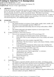
Coming to America: U.S. Immigration
Students study immigration in the late 19th and early 20th century. In this immigration lesson plan, students participate in activities including creating maps, responding to non fiction text, memorizing and analyzing poetry, and...
Curated OER
Oh Canada!!
Fifth graders become familiar with the people, culture, government and geography of Canada. In this Canadian people and places lesson plan, 5th graders research and create a map of Canada reflecting their gathered information. ...
Curated OER
Aboriginal Peoples And The Universals of Culture
Sixth graders research specific features of a province or territory of Canada. In this Canadian history lesson, 6th graders identify aboriginal culture areas on a map, identify cultural features represented in their region, and create...
Curated OER
Where in the World...?
Young scholars use longitude and latitude to locate various cities, regions, landforms, and bodies of water around the globe. They use The New York Times Learning Network's crossword puzzle 'Longitude and Latitude' to sharpen their atlas...
Other popular searches
- Comparing Maps and Globes
- Reading Maps and Globes
- Communities Maps and Globes
- Examining Maps and Globes
- Using Maps and Globes
- Free Maps and Globes
- Maps and Globes Activity
- Maps and Globes Migration
- Globes and Maps
- Maps, Globes and Atlases
- Atlases Maps Globes
- Globes and Maps Continents


