World Globes & Maps
United States Map- Intermediate Directions
Learners identify the four intermediate directions. For this map skills lesson, students use post-it notes to label the four intermediate directions on a map. Learners locate various states using intermediate directions.
Curated OER
Mesopotamia
Young scholars map Mesopotamia. In this Geography lesson, students are introduced to Ancient Mesopotamia. Young scholars use an atlas to label the defining features and areas of Mesopotamia on a map.
Constitutional Rights Foundation
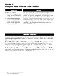
Refugees From Vietnam and Cambodia
The United States may have pulled its troops from the Vietnam War in 1973, but the conflict was far from over for the citizens living in Asia at the time. An informative resource lets learners know about the wave of over 220,000...
Advocates for Human Rights
A Global Perspective on Immigration
To gain a global perspective on immigration, groups investigate and create a map of the migration patterns in Africa, Asia, Europe, Latin America, and the Middle East. Class members then examine the background, immigration history, and...
Curated OER
Out On A Limb In The Pacific Rim?
Students act as cultural attachés to investigate and present briefings on the post-1945 histories and United States diplomatic relationships with East Asian countries. They articulate their foreign policy findings.
Curated OER
Classroom Conservation of East Asian Culture
Learners study East Asian culture. They examine the similarities and differences between East Asian and European history and culture. They produce project presentations to "teach" their classmates about very specific cultural traits...
Luminations Media Group
Geography: Map Reading Basic Skills
Enhance scholars' map skills using this worksheet displaying the land of Kahitsa’an from the series, The Realm, by K.L. Glanville. The activity helps readers visualize the make believe-land, examine its attributes, and answer...
Curated OER
Middle Eastern Lakes, Rivers, Bays, and Seas Map Quiz
In this online interactive geography quiz worksheet, students examine the map that includes 13 bodies of water and rivers in the Middle East. Students match the names of the bodies of water and rivers to the...
Curated OER
Middle Eastern Seas Map Quiz
In this online interactive geography quiz worksheet, students examine the map that includes 8 seas in the Middle East. Students match the names of the seas to the appropriate places on the map.
Curated OER
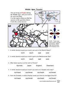
Middle Ages Traveler
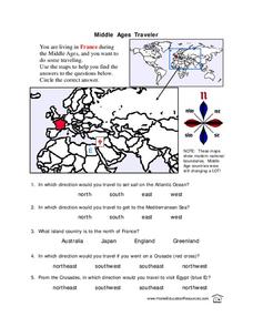
In these Middle Ages worksheets, students use the maps to help them find the answers to the questions that help them understand the directions of north, south, east and west. Students also color another map of France according the...
Curated OER
Somewhere in the Middle
Young scholars investigate the cease-fire between Israel and Lebanon in August of 2006. The geographic region known as the Middle East is examined and maps created with information on border and territory disputes.
National Gallery of Art
Islamic Art and Culture
Provided by the National Gallery of Art in Washington, this resource for teachers examines Islamic art, including calligraphy, arabesques, and geometric designs. A recounting of the spread of the faith and the tumultuous political...
American Museum of Natural History
A Walk Through the Ruins of Petra
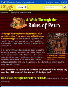
Walking through the ancient Nabataean city of Petra can be a challenge. A tour begins with a 20-minute walk down a rocky slope through the narrow Siq to get to the famous Treasury known to Indiana Jones fans. But that is...
Curated OER
Dead Sea Investigation: Middle East and African Connections
Students demonstrate comprehension of the physical characteristics of the Dead Sea region and its connection to the Red Sea and the African Great Rift Valley. They are given students the opportunity to understand the role of plate...
Curated OER
Middle Eastern Lakes and Rivers Map Quiz
For this online interactive geography quiz worksheet, students respond to 8 identification questions regarding specific lakes and rivers in the Middle East.
Curated OER
Does Conflict Shape Nations? The Middle East
Students locate settlements and observe patterns in the size and distribution of cities using maps, graphics, and other information. They explain the processes that have caused cities to grow.
Curated OER
Understanding "The Stans"
Students explore and locate "The Stans" in Central Asia to create, write and illustrate maps, graphs and charts to organize geographic information. They analyze the historical and physical characteristics of Central Asia via graphic...
Curated OER
Geography and Culture of China
Take out a map, a paper, a ruler, and those coveted colored pencils for a lesson on Chinese culture and geography. This is a multifaceted approach to basic geography skills that incorporate story telling, class discussion, primary source...
Curated OER
Plotting Earthquakes
Students plot earthquakes on a map. In this lesson on earthquakes, students will explore recent earthquake activity in California and Nevada. Students will plot fault lines and earthquake occurrences on a map.
Curated OER
Peace in the Middle East: A Simulation
Tenth graders develop an understanding of the Arab-Israeli conflict. They describe how each side has a valid claim to the Holy Land. They familiarize themselves with the challenges of settling this issue.
Curated OER
World Map Labels
In this geography skills worksheet, students identify the countries and bodies of water labelled on the maps of the world, Africa, Asia, Canada, Europe, the Caribbean, the Middle East, North America, Australia, and South America.
Curated OER
The Early Ottoman Empire: 1281 - 1600s
Once one of the most powerful civilizations in the known world, the Ottoman Empire was all-encompassing and highly influencial in the Middle East. Enjoy maps that detail the Ottomans' rule, as well as pictures of relics and architecture...
Curated OER
Renaissance Trade and Exchange
Sixth graders map out trade routes. In this Renaissance time period lesson, 6th graders complete a Christopher Columbus Map Activity, discuss and identify the parts of a map, and locate Asia, Europe and the Middle East. Students...
Curated OER
Middle Ages Traveler
In this map worksheet, students are given three maps of France to use to answer multiple choice questions. Students complete an activity from the perspective of a Middle Ages traveler.


