Curated OER
Educational Technology Clearinghouse: Maps Etc: The State of Ohio, January 1804
After the French and Indian War, France ceded control of the Northwest region including Ohio to Great Britain. With American independence, Ohio became a part of the Northwest Territory, the first organized land addition to the original...
Curated OER
Educational Technology Clearinghouse: Maps Etc: United States, 1825 1830
A map of the United States during the Presidency of John Quincy Adams (1825&ndash1829) showing the States at the time, the Unorganized Territory of the Louisiana Purchase, and the Oregon Country under joint control with Great Britain.
National Archives (UK)
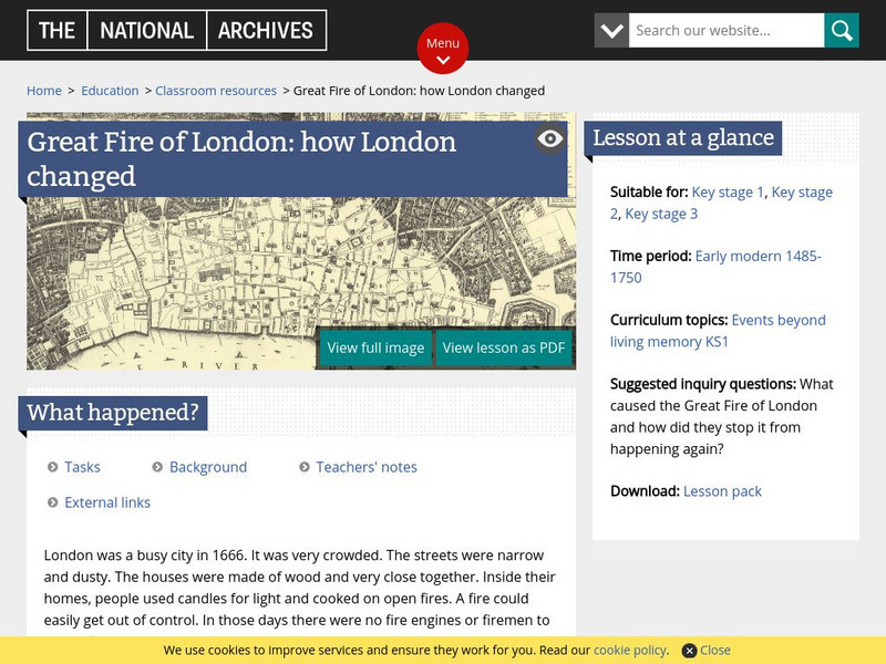
What Happened in the Fire of London?
A great lesson plan on the use of primary documents focusing on the "Great Fire" in London, England which occurred in 1666. There are actual copies of such documents as maps, lists of people living on the street where the fire started...
Nations Online Project
Nations Online: Scotland
Excellent online resource that provides a country profile and travel guide to the European nation of Scotland, background details, and numerous links to key information on the nation's culture, history, geography, economy, environment,...
Other
Hri Online: John Strype: Survey of the Cities of London and Westminster [1720]
Transcription and scanned images and maps from a landmark survey of Britain's capital city published in 1720, at the time when Britain was poised to become a great industrial power.
Curated OER
Educational Technology Clearinghouse: Maps Etc: Roman Britain, 55 Bc to Ad 449
A map of England (Britannia) under the Roman Empire, from the time of the first invasion by Julius Caesar (55 BC) extending to the invasion of the Saxons (AD 449). The Roman Period of control of Britannia is generally considered AD 43 to...
Curated OER
Map of the United Kingdom/great Britian
This is an online resource for information on the United Kingdom of Great Britain, which consists of England, Wales, Scotland and Northern Ireland. The site includes a map and flag, government, industries, natural resources, economic...
Library of Congress
Loc: Today in History: October 19: Surrender at Yorktown
View a contemporary map and read how British General Charles Cornwallis surrendered at Yorktown on October 19, 1781, thus effectively ending Great Britain's attempt to put down the American Revolution.
Made From Media
Made From History: Europe in 1914 First World War Alliances Explained
See actual illustrated maps form the time of World War I. On one side, see the dual alliance between Germany and Austria-Hungary, and on the other, the Triple Entente between France, Russia, and Great Britain.
Curated OER
Etc: French Expansion and British Conquests in North America , 1700 1763
A map of eastern North America showing the British and French territorial expansion in the region between 1700 and the end of the French and Indian War in 1763. The map shows the principal stages in the acquisition of Eastern North...
Curated OER
Etc: The Territory of the United States, 1846 1848
A map showing the territory of the United States after the annexation of Texas in 1845, and the acquisition of the Oregon Country by treaty with Great Britain in 1846. The map is color-coded to show the possessions of the United States,...
Curated OER
Etc: Comparative Projections of Asia, 1800 1899
A map using comparative map projections of Asia, as part of a hemisphere and on a Mercator's projection, to illustrate European misconceptions of land claims during territorial colonialism. In the 19th century, European powers were...
Curated OER
Etc: The Louisiana Purchase, 1803 1809
A map of the United States and the Louisiana Territory showing boundary disputes and boundary claims between 1763 and 1809. The map shows the natural boundaries and extent of the original Louisiana Territory claimed by the French, the...
Curated OER
Etc: The Revolution in Southern States, 1774 1783
A map of America's southern states during the time of the American Revolution, including North Carolina, South Carolina, and Georgia. The map shows major cities, towns, forts, battle sites, mountain systems, rivers, and coastal features...
Curated OER
Etc: The Growth of the United States, 1776 1867
A map of the United States showing the growth of the nation from 1776-1867. The map is color-coded to show the thirteen original states, the territory acquired by conquest during the revolution and the Treaty of 1783, the Louisiana...
Curated OER
Etc: The Territory of the United States, 1845 1886
A map from 1886 of the United States showing the territories ceded by Mexico and the acquisition of Alaska. The map is color-coded to show the possessions of the United States, Great Britain, and Mexico at the time, and the Mexican...
Curated OER
Etc: Territorial Development of the United States, 1783 1867
A map of the United States showing the growth of the nation from 1783-1867. The map is color-coded to show the thirteen original states, the territory acquired by conquest during the revolution and the Treaty of 1783, the Louisiana...
Curated OER
Etc: Ireland During the Stuart and Brunswick Period, 1605 1714
A map of Ireland during the Stuart Period (from the ascension of King James I in1603 to the death of Queen Anne in 1714) and the Brunswick (House of Hanover) Period (from the ascension of George I as King of Great Britain and Ireland in...
Curated OER
Etc: Maine Boundary Controversy, 1763 1842
A map of Maine showing the boundary disputes with Quebec and New Brunswick between 1763-1842. The map shows the areas claimed by Quebec under the Proclamation of 1763, by the Americans to St. Croix River till 1798, by Great Britain from...
Curated OER
Etc: West Florida Under the English, 1763 1780
A map of West Florida as a British possession between 1763 and 1780. In 1763, the King of Great Britain by royal proclamation limited West Florida on the west by the Mississippi River, on the north by the 31st parallel, on the east by...
Lizard Point Quizzes
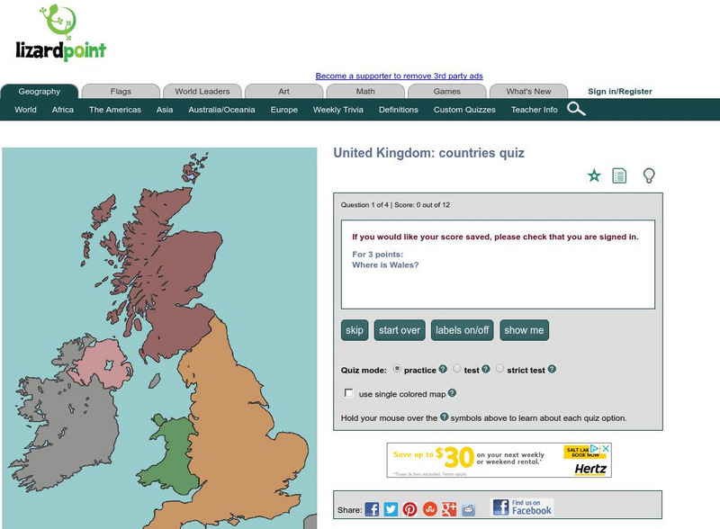
Lizard Point: United Kingdom: Countries Quiz
Try this interactive geography quiz which tests your knowledge about the countries of the United Kingdom.
Lizard Point Quizzes
Lizard Point: Wales: Provinces Quiz
Test your geography knowledge by taking this interactive quiz over the provinces in the country of Wales in the United Kingdom.
Curated OER
Etc: Development of the Northwest Territory in Us, 1790 1810
A map of the American Northwest Territory showing the boundary developments in 1790, 1800, and 1810. The upper left map shows the territory acquired by the United States from Britain after the Revolutionary War as established by the...
Curated OER
Flag of United Kingdom
This is an online resource for information on the United Kingdom of Great Britain, which consists of England, Wales, Scotland and Northern Ireland. The site includes a map and flag, government, industries, natural resources, economic...


![Hri Online: John Strype: Survey of the Cities of London and Westminster [1720] Primary Hri Online: John Strype: Survey of the Cities of London and Westminster [1720] Primary](https://content.lessonplanet.com/knovation/original/781472-b49d1ce6ffb1fb557935add18371eb14.jpg?1661491511)


