Curated OER
Introducing the Concept: Proportions
Students measure distances. In this proportions lesson, students use a map to find how far it is between different cities. Students use their knowledge of measurement, multiplication and fractions to find the distances.
Curated OER
Virtual Field Trip
Are we there yet? Young trip planners learn about their state and plan a trip. They will select sites to see in three cities in their state, and record associated costs in a spreadsheet. While this was originally designed as a...
Curated OER
Lesson Two: Writing Letters in Code
Combine your friendly letter lesson, grammar lesson, and technology lesson with this fun activity! Young writers compose letters to friends, and then convert the text to Webdings font. Their friends then decode the letter based on a key....
Curated OER
Through the Forest and Home Again: Maps Help Us Find Our Ways
Students read Little Red Riding Hood, focusing on her path home to Grandma's house. In this language arts and geography instructional activity, students perform a reader's theater, re-creating the walk home and possible routes that could...
NASA
Biology Training Conclusion
Gravity is just one consideration when determining human habitability on a new planet. The lesson connects four different units and starts with connecting the various systems: planetary systems, human body systems, etc. After scholars...
Curated OER
Map your Schoolyard
Students practice their mapping skills by creating an accurate map of their schoolyard using an aerial photo from the National Map web site. Students include legends, a scale, and a north arrow on their maps.
Curated OER
Kid Maps: Reading and Creating Maps with Human Characteristics
Learners look at maps. In this map instructional activity, students listen to the book My Map Book by Sara Fanelli and they see the difference between human characteristics (buildings, etc.) and natural characteristics (rivers, etc.)....
Curated OER
Mapping Counties
Students practice reading a map. In this mapping lesson, students illustrate a map and compare and contrast the counties based on their population. Students also explore what a census is and read census data on a map. A student...
Curated OER
Lesson Ten: Direction
Students explore the concept of relative location. In this map lesson, students read I Hate English by Ellen Levine and consider how maps and globes help people to familiarize themselves with an area.
Curated OER
Learning About Maps
Students investigate the many uses and features of maps and globes and locate where they live on both. In this map lesson, student play a travel game and create their own maps to explore states, continents, countries, and islands.
Curated OER
Exploring Earth Through Maps and Technology
In this maps worksheet, students read 3 pages of detailed information about maps, latitude, longitude, topography, satellites and global positioning. Students then answer 10 questions. There is also a research project assignment available.
Curated OER
The Global Grapefruit - Maps vs Globes
Students tell how maps differ from globes, state some characteristics of 3 different types of map projections, and realize that distortions are inherent in various systems of map projections.
Curated OER
Read a Map ... It's a Snap!
Students are introduced to map and globe skills. They use grids and are able to construct their own simple maps of familiar places. Students are able to define a map, globe, and symbol and use the direction words north, south, east,...
NOAA
Tracking a Drifter
Be shore to use this drifter resource. The third installment of a five-part series has learners using the NOAA's Adopt-a-Drifter website to track to movement of a drifter (buoy) in the ocean. Graphing the collected data on a map allows...
Curated OER
US City Quality of Life Analysis and Comparison
Students analyze US census data and criteria to compare and measure the quality of life in the country's fifty largest cities. After accessing the 2005 quality of life world report online, students conduct their study to compare three...
Curated OER
Understanding "The Stans"
Students explore and locate "The Stans" in Central Asia to create, write and illustrate maps, graphs and charts to organize geographic information. They analyze the historical and physical characteristics of Central Asia via graphic...
Laboratory for Atmospheric and Space Physics
Charting the Progress of New Horizons
In 2006, New Horizons began its mission to fly to Pluto. As it continues its journey, scholars track its progress with the help of an informative website, all the while reinforcing measurement concepts with the construction of a scaled...
Mathematics Vision Project
Module 7: Connecting Algebra and Geometry
The coordinate plane links key geometry and algebra concepts in this approachable but rigorous unit. The class starts by developing the distance formula from the Pythagorean Theorem, then moves to applications of slope. Activities...
ReadWriteThink
Heroes Are Made of This: Studying the Character of Heroes
What makes heroes and villains? A six-part unit plan asks young scholars to explore the concept of heroism and the characteristics they consider heroic and unheroic. Groups create character maps that focus on how characters are shaped by...
New York Historical Society
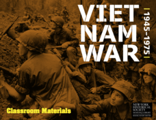
The Vietnam War: 1945-1975
Do pupils know that the Vietnam War spanned a period of 30 years? A war that long is bound to leave devastating effects. Help young historians develop a comprehensive understanding of the war through multiple units on the subject that...
Curated OER
Introducing Literacy Elements in Nonfiction
Explore nonfiction writing with your class. They will identify elements in nonfiction by reviewing elements of fiction. Then they use biographies, memoirs, menus, Time for Kids, and text books to identify elements of nonfiction. They...
Curated OER
Absolute Location
Fifth graders examine the geographic concept of absolute location. Using a variety of resources, they create a life-size classroom grid and locate the coordinates of a point, identify latitude and longitude of different locations, and...
Curated OER
Mapping Colonial New England: Looking at the Landscape of New England
High schoolers understand the similarities and differences between English and Native American conceptions of the land and town settlement. They understand how the colony of Massachusetts developed and expanded. Students understand the...
Curated OER
French and Indian War: Make A Map
Fifth graders create a map of the battles that occurred during The French and Indian War. In this history lesson plan, 5th graders read about the war in their text books, then divide into groups to create a detailed map of a famous...


