Curated OER
Yo Ho, Yo Ho, A Pirate's Map for Me: An Original Story
Pupils read Blackbeard and brainstorm their knowledge of maps. In this language arts and geography lesson, students use landmarks on their playground to review north, south, east and west and discuss the compass rose. Pupils read This is...
Curated OER
Mapping Roxaboxen
Fourth graders read Roxaboxen and draw a map of the Roxaboxen community. In this language arts and geography instructional activity, 4th graders use specifications given, adding features to the map as described in the book and creating a...
Curated OER
"Potato Mountain": Reading/Understanding Topographic Maps
Students investigate how to read topographic maps. In this map reading lesson students complete a topographic map activity.
Curated OER
Mapping the Human Genome
Students study DNA and how it was discovered. In this biology lesson students see the effects of mapping the human genome would have.
Southern Nevada Regional Professional Development Program
Using Maps to Inspire Personal Narratives
A solid description of one way to teach narrative writing, this resource outlines the writing process from concept to completion. Class members create concept maps of moments in their lives and follow the writing process to publish their...
Edgate
Great Grids
Learners use grid boxes as a measurement tool and discover how grids are used for mapmaking and scaling down an area. They begin by attempting to draw a model shape drawn by the teacher by using the gridding process. At the conclusion of...
Curated OER
Stellaluna Lesson: Increase Oral Language Development and Story Comprehension
To be used with the BRAIDY system, this lesson works to increase oral language and reading comprehension. Special needs pupils review parts of a story, sequence of events, and create a Venn diagram showing the differences between birds...
Channel Islands Film
Cache: Lesson Plan 2 - Grades 4-6
Class members will dig this activity that has them trying their hand at recovering artifacts. Groups are assigned a section of a sandbox, carefully uncover the artifacts in their section, and then develop theories about who might have...
National Wildlife Federation
Bats: Maligned or Malicious?
Most people couldn't name the positive qualities of bats. Learners discover how bats benefit the environment and then create a concept map to summarize the information. After their reading, they identify misconceptions people have about...
Anti-Defamation League
Viewing History from Multiple Perspectives
Celebration or protest song? The full text of Woody Guthrie's "This Land is Your Land" opens a study of the Lewis and Clark Expedition, the Louisiana Purchase, and Western Expansion from various perspectives. Middle schoolers examine...
Alabama Wildlife Federation
Water Words
Water is an interesting substance that all living things need to survive. Learners focus on the characteristics of water as they create a list of words related to water and then incorporate them into descriptive paragraphs. They then use...
American Institute of Physics
Women and the Manhattan Project
The Manhattan Project was a massive undertaking involving multiple sites and thousands of scientists and technicians. To gain an understanding of the women who participated in the project, groups select an oral history of a woman...
Curated OER
Application of Graph Theory
Students investigate different online tutorials as they study graphing. In this graphing lesson, students apply the concept of graphs cross curricular and use it to make predictions. They define the purpose and theories behind graphs.
Curated OER
Relative Location
First graders use landmarks to describe relative locations of a place. In this geography and mapping lesson plan, 1st graders draw picture maps of their bedrooms to show an object's location in relation to other objects. As an...
Curated OER
Maps In Our Everyday Lives
Students break into groups and complete a chart about information on maps of their hometown.
Curated OER
Introduction to Symbols
Students study the concept of picture symbols as a way to express ideas without using words. In this picture symbol lesson, students place symbols on a U.S. map according to meaning. Students then review various symbols representing...
Curated OER
PA Watersheds, Many Ways to the Sea
Learners examine the water cycle and the factors that interact with watersheds. In this watersheds activity students describe the purification process, trace the flow of infiltrate water through aquifers, and research the Internet to...
Curated OER
Relief Maps
Learners study geographical maps and their functions. In this geography instructional activity students work in groups to build a map to scale.
Curated OER
Latitude on World Maps - World Map Activity 2
Students explore the concept of latitude. In this geography lesson, students discover the global grid system and complete a map activity which require them to record the latitude of various cities in the world.
Curated OER
Ancient Rome: Map Work
Seventh graders explore the Roman Empire. In this ancient Rome lesson, 7th graders use digital and print maps to examine the geography of the Roman empires. Students are assigned regions of the empire to analyze and present their...
Curated OER
Adventures With Maps And Globes
First graders examine the differences between a map and a globe. They discuss and identify the symbols on maps and globes, then in small groups complete a worksheet. Students then complete a Venn Diagram comparing maps and globes.
Curated OER
Slope and Topographic Maps
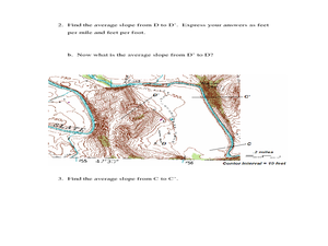
Students investigate slopes as they study topographic maps. In this algebra lesson, students discuss and apply the concept of slopes to graphing and analyzing data.
Curated OER
Stellar Navigation
Middle schoolers are introduced to the concept of stellar navigation. Inside a portable digital planetarium they identify various stars that were used as a navigational tool. They go through several activities in which they attempt to...
Curated OER
Lesson on Ethnic Discrimination
Students study ethnic discrimination. For this discrimination lesson, students define ethnicity and ethnic discrimination in the global community as well as steps against it. Students examine their own ethnic backgrounds and examine the...


