Curated OER
Where's the Sand?
Students identify the characteristics of deserts. In this geography lesson plan, students discuss the characteristics of a desert and label a map with the names of deserts.
Curated OER
Force of Habitat
Students examine the Nevada state quarter and discuss the Great Basin and the desert habitat. They draw a desert animal and write a sentence about its attributes and how they help the animal to survive in its habitat.
Curated OER
Hands On Biome-Building
Students create a desert biome to understand the abiotic and biotic factors of that biome. In this desert biome lesson plan, students include elevation, precipitation, temperature, plants, and more.
Curated OER
The Power of Maps & Native American Cultures
Sixth graders discover where and how five Native American cultures lived in North America in what is currently the United States. They examine their way of life and the regions they inhabited. Additionally, 6th graders will understand...
Curated OER
Tooling Around Arizona: Reading Arizona Maps
Students study geography. In this Arizona maps lesson, students develop their map reading skills. They have class discussions and work independently with various copies of Arizona maps to practice those skills. This lesson mentions...
Curated OER
Desertification
Learners investigate the process of desertification in the Sahel region of Africa. They discuss photos from a National Geographic magazine, analyze the physical/political map of the Sahara, identify the causes and effects of...
Curated OER
Kalahari Explorations
Students explore world geography by completing graphic organizers and researching the Internet. In this Kalahari desert instructional activity, students identify the geographic location, weather and creation of the Kalahari desert....
Curated OER
Capitals, Oceans, And Border States
Students investigate geography by completing games with classmates. In this United States of America lesson, students examine a map of North America and identify the borders of Mexico and Canada as well as the Pacific and Atlantic....
Curated OER
Geography Booklet
Sixth graders explore geography terms. Students use resources to find real examples of landforms in the world. They create a map showing the landform. students label the surrounding features, countries and states. Students use each...
Curated OER
Geography and World History
Students build off of their current knowledge of geography and world history, while being introduced to new concepts and ideas.
Curated OER
Desert Views - First Impressions: Travelers on the Gila Trail
Students draw animals and plants that are described to them as they read passages of people who traveled across the Gila Trail in the Southwest. In this Gila Trail lesson plan, students also write a letter describing a plant or animal in...
Curated OER
I Can Find that Where? - A Study of Landforms
First graders make landform maps of the United States. In this landform lessons, 1st graders participate in a discussion of local landforms and make a landform map of the United States. They follow the teacher's directions to add plains,...
Curated OER
You Can Die Here
Students examine Death Valley including the amount of precipitation and winds that it gets. In this climate based lesson students explain the reasons for the amount of precipitation and windward patterns in Death Valley.
Curated OER
Pre-Columbian Cultures in the Americas
Native American studies is fun, educational, and highly motivating. Fifth graders will gain a deeper understanding of the six major pre-Columbian culture areas on the North American continent. They will choose one group and conduct...
Curated OER
Trekking to Timbuktu: The Geography of Mali -Teacher Version
Learners investigate the geography of Mali. They locate Mali on a satellite map, explore various websites, describe the landscape and climate, label a map, and write an essay about the Niger Riger.
Curated OER
Comparing the Effects of El Nino and La Nina
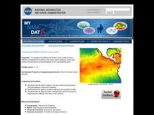
Students examine the differences between an El Nino and La Nina year. For this investigative lesson students create maps and graphs of the data they obtained.
Curated OER
Biomes- Culminating Slideshow
Third graders investigate the concept of differentiation of biomes. They select one biome and conduct research to obtain information. In particular, 3rd graders demonstrate how to find a biome on a map. The information is used to create...
Curated OER
Namib From Space
Students view photos of the Namib Desert from space as they appear on the World Wide Web. They study the photos and identify landmarks from space as they examine how to collect information from the Internet for a class presentation.
Curated OER
Nina Bonita: Culture and Beauty
Students read Nina Bonita by Ana Maria Machado. In this reading comprehension/ geography lesson, students recall various parts of the story and create a map of where the rabbit traveled throughout the story. They participate in group...
Curated OER
The Frozen Desert: Graphing and Comparing Climates
Students explore the concept of climate. They use temperature and precipitation data from their area and other regions to construct climate graphs. These graphs are used to help identify factors that influence climate.
Curated OER
Sand, Sand, Everywhere Sand
Students study the physical characteristics of four types of desert regions. In this desert regions lesson, students watch a video about deserts and discuss the deserts. Students compare the deserts and research the ways humans have...
Curated OER
Ecosystems Lesson Plan
Students research ecosystems (rainforest, desert, grassland, woodland, and arctic tundra). Students compare the seven continents and the importance of proximaty to the equator.
Curated OER
The Rigors of Learning a New Language
Young scholars examine the experiences of a Peace Corps volunteer learning to speak Chinese. They read and discuss an essay written by the Peace Corps volunteer, analyze a map of China, and discuss the author's difficulties in learning...
Curated OER
Are You a Super Sign Speler or Speller?
Why is spelling important? Develop your class' spelling skills. They examine examples of homonyms, heteronyms, and creative spelling. They also photograph misspellings in the real world in order to discover the importance of spelling...


