Curated OER
The Geography of the Indian Subcontinent
Gloriously adorned with a glimpse of the Taj Mahal, these slides detail important facts and characteristics of South Asian cultures, such as India, Pakistan, Afghanistan, and several other surrounding countries. Slides cover the...
Curated OER
Comparing the Effects of El Nino and La Nina
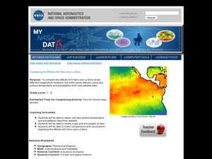
Students examine the differences between an El Nino and La Nina year. For this investigative lesson students create maps and graphs of the data they obtained.
It's About Time
Present-Day Climate in Your Community
So what exactly is climate? This first installment of a six-part series introduces the concept of climate using real-world data tables and topographic maps. The timely lesson includes a comprehensive overview of climate, as well as...
American Museum of Natural History
A Walk Through the Ruins of Petra
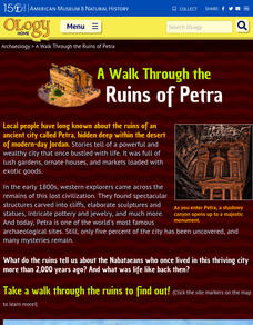
Walking through the ancient Nabataean city of Petra can be a challenge. A tour begins with a 20-minute walk down a rocky slope through the narrow Siq to get to the famous Treasury known to Indiana Jones fans. But that is just the...
California Historical Society
Understanding California
Here is a beautiful handout through which learners can explore the history of California, from the earliest Europeans to visit the Golden State up through its experiences during the Great Depression and position in the modern world.
Curated OER
Biomes- Culminating Slideshow
Third graders investigate the concept of differentiation of biomes. They select one biome and conduct research to obtain information. In particular, 3rd graders demonstrate how to find a biome on a map. The information is used to create...
Curated OER
Namib From Space
Students view photos of the Namib Desert from space as they appear on the World Wide Web. They study the photos and identify landmarks from space as they examine how to collect information from the Internet for a class presentation.
Curated OER
Nina Bonita: Culture and Beauty
Students read Nina Bonita by Ana Maria Machado. In this reading comprehension/ geography lesson, students recall various parts of the story and create a map of where the rabbit traveled throughout the story. They participate in group...
Curated OER
The Frozen Desert: Graphing and Comparing Climates
Students explore the concept of climate. They use temperature and precipitation data from their area and other regions to construct climate graphs. These graphs are used to help identify factors that influence climate.
Curated OER
Sand, Sand, Everywhere Sand
Students study the physical characteristics of four types of desert regions. In this desert regions lesson, students watch a video about deserts and discuss the deserts. Students compare the deserts and research the ways humans have...
Curated OER
Ecosystems Lesson Plan
Students research ecosystems (rainforest, desert, grassland, woodland, and arctic tundra). Students compare the seven continents and the importance of proximaty to the equator.
Curated OER
The Rigors of Learning a New Language
Young scholars examine the experiences of a Peace Corps volunteer learning to speak Chinese. They read and discuss an essay written by the Peace Corps volunteer, analyze a map of China, and discuss the author's difficulties in learning...
Curated OER
Are You a Super Sign Speler or Speller?
Why is spelling important? Develop your class' spelling skills. They examine examples of homonyms, heteronyms, and creative spelling. They also photograph misspellings in the real world in order to discover the importance of spelling...
Curated OER
Message in a Bottle
Sixth graders write a short story about being stranded on a deserted island. After a brief geography review of locations at various latitudes and longitudes, 6th graders draft their story about being stranded. They use sensory and...
Curated OER
Weather and Climate Around the World
Students explain the difference between climate and weather. They gain concepts of currents and discuss how the currents have an affect on climate and weather. Students gain knowledge of the instruments that meteorologists use to predict...
Annenberg Foundation
Teaching Geography: Workshop 4—North Africa/Southwest Asia
Can Jerusalem be equitably organized? Can Israel and Palestine be successfully partitioned? Part one of a two-part workshop looks at the geo-political history of Jerusalem while Part two investigates Egypt's dependence of the Nile River...
Curated OER
Discovering the Past Using the Future: Remote Sensing and the Lost City of Ubar
Learners identify and locate specific locations on the Arabian Peninsula, the Rub al Khali Desert, and present day Oman. They identify other names for the lost city of Arabia as Ubar, the Atlantis of the Sands, Iran, and the city of towers.
Curated OER
Gallery Scavenger Hunt for U.S. History
In this U. S. historical facts worksheet, students participate in identifying the various leaders being described, identify places described in detail and fill out a map by following the directions given.
Curated OER
Michigan Food: From Farm to You
Students recognize Michigan on a map and understand how its climate is affected by the Great Lakes. In this Michigan food lesson, students play a trivia game to identify the produce of Michigan. Students relate the climate in each part...
Curated OER
Where Is Japan? How Are We Alike And Different?
First graders use literature, maps, and globes to explain how physical environments in various parts of the world are similar to and different from one's own, and that certain areas have common characteristics and can be called regions.
Curated OER
Predator Or Prey?
Students study the concept of predator/prey by researching specific examples of birds. They participate in a concept map/webbing activity to determine different characteristics of birds. They engage in a class discussion about...
Curated OER
Renaissance Trade and Exchange
Sixth graders map out trade routes. In this Renaissance time period lesson, 6th graders complete a Christopher Columbus Map Activity, discuss and identify the parts of a map, and locate Asia, Europe and the Middle East. Students...
Curated OER
Off to the Future
Students read a handout and predict the position of the San Andreas Fault far in the future. In this future world lesson, students use a map worksheet to demonstrate the path of the Pacific Plate millions of years from now.
Curated OER
Building Bridges for Young Learners- School
Young scholars examine the purpose of education. In this schooling lesson, students read a letter from a child in Uzbekistan. Young scholars compare and contrast their schooling to children around the world.


