Curated OER
New Food Saves Lives, Could End Hunger
Students locate the country of Niger, then read a news article about a new type of food that is being used to fight childhood hunger in Africa. In this current events lesson, the teacher introduces the article with map and vocabulary...
Curated OER
Harvest the Wind
Wind is a natural resource available around the world. Help your pupils appreciate the power and importance of wind by researching wind farms, making pinwheels, and designing windmills.
Curated OER
Early Explorers
Fifth graders study early explorers. For this World history lesson, 5th graders draw an outline of a map labeling each part, build geographical features out of dough, and paint each of the land and water features.
Curated OER
Arabia: Educator's Resource and Activity Guide
MacGillivray Freeman's film Arabia presents viewers with remarkable images and insights into this ancient and mysterious land. An educator's guide is designed to provided teachers with the materials they need to support a showing of the...
Devine Educational Consultancy Services
Geography Student Workbook, Australia
Your youngsters will be experts on the geography of Australia after working with these activities and worksheets, which review the continent's weather, major landforms, dimensions, history, and climate.
Curated OER
Biomes
Students explore the worlds biomes and see how organisms adapt to these ecological communities. In this world's biomes lesson students research and write a paper about one of the world's biomes.
Curated OER
Trouble for the United States in the Middle East: The Reagan-Bush Years
Learners examine U.S. foreign affairs with the Middle East during the Reagan and Bush presidencies. In this Middle East lesson, students watch video segments, examine maps, and listen to music regarding the relationship between the U.S....
Curated OER
Richard Misrach
Learners analyze the Great Salt Lake as a resource for artistic work and other studies. In this art analysis lesson, students view maps that show the location of the Great Salt Lake including a satellite image. Learners can also study...
Curated OER
Choral Music II
In this music learning exercise, students look at a map of the world and find the places where the Santa Fe, New Mexico Desert Chorale has traveled. There is little information about music on this page.
Curated OER
Traveling the Silk Road
Pupils take a virtual trip down the Silk Road. Using a map, they trace the location of the trade route and others that were developed later. They use different spices and goods to trace how they came to the Americas. They answer...
Curated OER
Mountain Magic: Identifying the Basic Physical Characteristics of Mountains
Students read about and identify on maps the physical characteristics of mountains. In this mountains lesson plan, students also write about the characteristics using personification.
Curated OER
Watercolor Ways
Students investigate the concept of being part of a global community. For this global community lesson, students learning the definition of stewardship as it relates to taking care of the Earth. They listen to the lyrics of the song,...
Curated OER
Canada...a Visual Journey
Students, in groups, research Canada's six natural regions (ecozones). They create a visual representation of each region on a large wall map of Canada and present it to the rest of the class.
Curated OER
Canada...A Visual Journey
Students work together to analyze the six natural regions of Canada. Using this information, they create a visual representation of each region on a large wall map and present it to the class. They must identify five key points of each...
Curated OER
Westward Ho: The Difficulties of Emigrants Moving West
Learners research the journey west of 19th century emigrants. In this pioneer lesson, students read the letters and diaries of a fictitious family traveling on the Oregon Trail. They mark their route on a US map, create a chart showing...
Curated OER
Exploring Landforms
Second graders discuss the different types of landforms throughout the world. They pick one and research and present it to the class.
Curated OER
Geography: Why Is the Sacremento Valley a Good Place to Grow Rice?
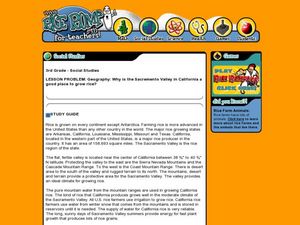
Third graders locate the Sacramento Valley in California where rice is grown. In this rice growing location lesson, 3rd graders locate the Sacremento Valley, California on a map, and color the mountain ranges and terrain that is around...
Curated OER
California Biodiversity
Students examine several maps of California exhibiting features such as precipitation, topography, and vegetation. They look for patterns that might be the source of or influence biodiversity in different regions. They pay particular...
Curated OER
The Mountain Community: Why Flagstaff?
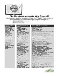
Students identify geographical features that hindered or promoted settlement in the city of Flagstaff, Arizona. In this settlement lesson plan, students write a summary of what they learned and identify geographical features on a map.
Curated OER
Through Time: Change in Sedona
Learners locate events on a timeline of Sedona, Arizona and describe human and physical characteristics of the city. In this Sedona lesson plan, students locate the city on a map and listen to stories about Sedona.
Curated OER
From Sea to Shining Sea
Students study the geography of the United States of America. Students write letters, create travel brochures, make maps, graph population numbers, read fiction and nonfiction selections, complete KWL charts, and watch films.
Curated OER
Choral Music 1
In this music worksheet, students listen to choral music from different countries around the world. Students also answer three questions about the music.
Curated OER
Jewish Diversity: Travels of Jewish Foods and Jewish Families
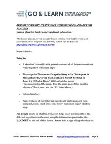
Pupils are introduced to Jewish history thorugh food and various ingredients. As a class, they read a passage from the Bible about the exodus from Egypt and answer discussion questions. They make traditional Jewish meals with their...
Curated OER
Landforms All Around
Students create a "Landform Dictionary". They develop an overlay map and participate in hands-on activities to identify the key characteristics of landforms. They discuss the plant and animal life of these areas. Handouts for the lessons...


