Curated OER
Educational Technology Clearinghouse: Maps Etc: Boston, With Its Environs, 1776
A map of Boston and vicinity in 1776, showing the relative positions of hostile forces at the opening of the American Revolutionary War, and the various works thrown up during the summer and autumn of 1775, and at the beginning of 1776.
Curated OER
Etc: Maps Etc: British Fort on Bunker Hill, 1775
A plan of the British fort on Bunker Hill. The map is keyed to show: (a) two temporary magazines; (b) barracks; (c) guard-houses; (d) magazine; (e) advanced ditch; and (h) bastions. "This was a well-built redoubt. The parapet was from...
Curated OER
Etc: Maps Etc: Boston and Dorchester Heights, 1776
A map of Boston and the surrounding area during early March, 1776, showing Bunker Hill, Breed's Hill, Charlestown, Cambridge, Washington's headquarters, Beacon Hill, Roxbury, and Dorchester Heights.
Curated OER
Etc: Maps Etc: Pilgrim Arrival at Cape Cod Harbor, 1620
A map showing the Pilgrim activity upon arrival at Cape Cod Harbor on the ship Mayflower (November 15-17, 1620). "There were three expeditions from the ship. The women were set ashore to wash at (a), and while the carpenter was repairing...
Curated OER
Educational Technology Clearinghouse: Maps Etc: New Hampshire and Vermont, 1898
A map from 1898 of New Hampshire and Vermont. "New Hampshire, one of the thirteen original States. Settled by English Puritans at Dover and Portsmouth 1623. Named for Hampshire County, England, called the 'Granite State.’ Ratified United...
Curated OER
Educational Technology Clearinghouse: Maps Etc: United States, 1789
A map of the United States in 1789, showing the State territorial claims, territories, and areas of territorial dispute. The map is color-coded to show States, territories, British possessions, and Spanish possessions, and shows the...
Curated OER
Etc: Maps Etc: Route Through Baltimore, April 19, 1860
Route of the Sixth Massachusetts Troops through Baltimore.
Other
Stcc: Shays' Rebellion and the Making of a Nation
An extensive site that tells the story of Shay's Rebellion which took place after the Revolution in Massachusetts. Includes historic scenes, artifacts, documents, people, themes and essays, maps, songs and music, a timeline, and videos,...
Syracuse University
Syracuse University: Map of New England, 17th Century
A map that shows the seventeenth-century migration routes of the Puritans from England to New England. Early population centers are designated as well as some interregional migrations.
A&E Television
History.com: The States
Learn unique facts about each American state. You can also read a more in-depth history of each state, watch videos and play a game about all the states.
Kidport
Kidport: United States of America Geography
This site contains a fun way to learn about the states within the United States. Click on the state that you want to learn more about and it provides facts, geographic landmarks, points of interest, major industries, a quiz and more.
Columbia University
The Pequot War
Site includes brief essay on the Pequot War, timeline, maps of the battles and 17th century settlements, as well as link to Pequot Museum and Research Center.
Curated OER
Etc: Maps Etc: Boston, Charlestown, and Cambridge, 1919
A city plan of Boston, Cambridge, and Charlestown from the Official Automobile Blue Book (1919), showing the Charles River and wharfs, major roads, bridges, railroads and stations, parks, hotels and garages, and major landmarks.
Curated OER
Educational Technology Clearinghouse: Maps Etc: Boston, 1919
A city plan of central Boston from the Official Automobile Blue Book (1919), showing the Charles River and wharfs, neighboring cities, major roads, bridges, railroads and stations, parks, and major landmarks.
Curated OER
Educational Technology Clearinghouse: Maps Etc: Siege of Boston, 1775
A plan of the siege of Boston showing the American fortifications and positions around the harbor, and the British batteries and positions.
Curated OER
Educational Technology Clearinghouse: Maps Etc: Boston and Its Environs, 1775
Boston and its environs.
Curated OER
Etc: Maps Etc: Plan of the Siege of Boston, 1775
A plan of the siege of Boston showing the American fortifications around the harbor and British positions in Charlestown.
Curated OER
Etc: Maps Etc: Scene of the Battle of Bunker Hill, June 17, 1775
A plan of the Battle of Bunker Hill (June 17, 1775) showing the Charles and Mystic rivers, the city of Charlestown, Breed's Hill, Bunker Hill, Morton's Hill, Charlestown Neck, the landing point of the British, the rail fence, and the...
Other
The Descendants of Henry Doude: Perspectives: The Pequot War
A brief description of the Pequot War, a conflict between the Pequots and the English colonists from the Massachusetts Bay colony. There are two maps showing the location of Indian tribes in 1636 and again in 1639.
Curated OER
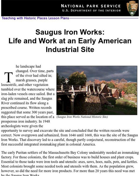
National Park Service: Saugus Iron Works: Life & Work at an Early American Site
Use this site to learn about life and work at an early American industrial site. Understand the need for iron ore for the early Puritans through excellent history info, an inquiry question, maps, images, readings, activities and more....
University of Illinois
University of Illinois: Modern American Poetry: Edna St. Vincent Millay
This outstanding resource offers literary criticism, biographical information, full text of poems, and historical context for Edna St. Vincent Millay's (1892-1950 CE) work.
Cayuse Canyon
The Us50
This clickable map of the United States gives students access to research information from history and tourism to attractions and famous historic figures.
Curated OER
Etc: Atlantic Coast Development, 1650 1695
A series of maps showing the development and colonial claims of the northern Atlantic Coast between 1650 and 1695. The maps are color-coded to show charter colonies, proprietary colonies, and the royal colonies. The map from 1650 shows...


