Illustrative Mathematics
Similar Triangles
Proving triangles are similar is often an exercise in applying one of the many theorems young geometers memorize, like the AA similarity criteria. But proving that the criteria themselves are valid from basic principles is a great...
Curated OER
Locating Points Using Cartesian Coordinates
Students discover coordinates as they explore Chicago. In this math lesson plan, students give the coordinates of a point, plot a point, and use the coordinate system in locating places on a map.
Curated OER
Coordinate Grid: Mapping Archeological Sites
Fourth graders discover how to apply the Cartesian coordinate system by figuring out the length and width of their school playground. They determine that pacing is an important tool for the initial mapping of a site. Students conduct a...
Curated OER
Coordinate Plane Treasure Hunt
Students create a treasure map by plotting points on a coordinate plane using a computer drawing program. Students name and identify different landmasses and structures on their map. They create instructions to find the treasure that...
Curated OER
Coordinates
Students identify and label the coordinate planes by the four different quadrants. In this geometry lesson, students plot an ordered pair correctly. They identify and differentiate between rational and irrational numbers.
Curated OER
INTERPRETING MAGNETIC FIELD MAPS
Students interpret magnetic field maps, rotate the coordinates to obtain different views, change the coordinate representation, and produce alternate graphical representations.
Curated OER
Grid it, Map it
Young scholars participate in designing a city layout using grids and coordinates. They work on a city space and create a grid on a life size layout on the gym floor.
Curated OER
Coordinate Graphs
Students use coordinate graphs in order to identify objects and their locations. They are shown how to plot the x and y coordinates and then are given values to be plotted during guided and independent practice. Students are assessed on...
Curated OER
Mapping with a Compass: A Simulated Survey
Students use compasses and grids to map the locations of artifacts found in a simulated dig site. In groups, they role-play as future archeologists excavating a school site. Groups begin at their assigned datum and site the artifacts...
Curated OER
Locating IIT Using Ordered Pairs
Students investigate ordered pairs. In this math lesson, students plot and locate ordered pairs in a coordinate plane and are exposed to how to read and create a map.
Curated OER
Integer: Tic-Tac-Toe Four In a Row!
Students explore the concept of the coordinate plane. In this coordinate plane lesson, students discuss integers and their place on the number line. Students discuss locating points on the coordinate plane. Students play tic-tac-toe by...
Curated OER
What's Your Temperature?
Learners take a look at the local newspaper and focus on the weather section. They get into small groups, and each one looks at the same map, but of a different part of the country. They must prepare a presentation that shows how...
Mathematics Assessment Project
Representing Inequalities Graphically
A new, improved version of the game Battleship? Learners graph linear inequalities on the coordinate plane, then participate in a game where they have to guess coordinate points based on the solution to a system of linear...
Mathematics Assessment Project
Classifying Equations of Parallel and Perpendicular Lines
Parallel parking might be difficult, but finding parallel lines is fairly simple. In this instructional activity, learners first complete an assessment task involving parallel and perpendicular lines in the coordinate plane. Individuals...
Mathed Up!
Translations
Introduce translations as transformations that move figures in horizontal and vertical distances with a video that shows how to translate the figures. A second video covers how to determine the translation that has occurred. Pupils...
Mathematics Assessment Project
Representing and Combining Transformations
Transform your learners into master geometers with an activity that asks them to first complete an assessment task drawing the result after transformation of a given shape in the coordinate plane. They then use cards to...
CK-12 Foundation
Position and Displacement Simulation
How can we use vectors to determine a person's position when traveling? The simulation offers guided practice at determining the coordinates and the distance between coordinates on a map grid. It reinforces the importance of positive...
Curated OER
Where Are We?
Learners use Cartesian coordinates or degrees of latitude and longitude to locate important locations within their specific countries. They Use a grid to apply the concept of latitude and longitude, or positive and negative Cartesian...
Mathematics Assessment Project
Aaron's Designs
Learners first create designs for greeting cards by applying transformations of shapes on a coordinate plane, and then determine a sequence of transformations that produces a given design.
Curated OER
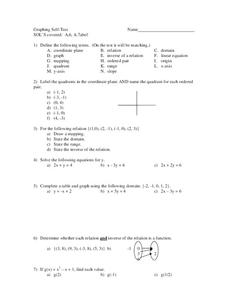
Graphing
In this graphing instructional activity, 9th graders solve and graph 8 different problems that include defining various terms related to graphing. First, they label the quadrants in a coordinate plane and name the quadrant for each...
Curated OER
Mapping Natural Disasters
Pupils use Cartesian coordinates to plot current natural disasters. They relate location of natural disasters to their specific major project countries. Students tie in geometry within this lesson as connected to spatial relationships...
Curated OER
The Treasure Map
Third graders problem solve using drawings and map interpretations. They preview graphs and Cartesian geometry. They follow directions on a map using a grid and compass references while simulating they are reading a pirate map.
CPM
Rigid Transformations
In this rigid transformation worksheet, students follow directions to translate, reflect or rotate a figure in a coordinate plane. Examples and explanations are provided at the beginning of the document. This two-page worksheet contains...
Curated OER
NIGHT AND DAY: DAILY CYCLES IN SOLAR RADIATION
Students examine how Earth's rotation causes daily cycles in solar energy using a microset of satellite data to investigate the Earth's daily radiation budget and locating map locations using latitude and longitude coordinates.


