Geophysical Institute
Latitude and Longitude with Google Earth
Travel the world from the comfort of your classroom with a lesson that features Google Earth. High schoolers follow a series of steps to locate places all over the earth with sets of coordinates. Additionally, they measure the distance...
Curated OER
Separate Vacations
Students plot the migration paths of birds using latitude and longitude data from a table.
Curated OER
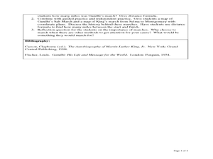
The Distance Formula and Marching Nonviolently for Social Change
Students explore the distance formula using real world data from nonviolent marches for social change. In this secondary mathematics lesson, students investigate the marches of Gandhi and King using maps overlaid with a coordinate...
101 Questions
Transforming Houses
Moving a house is hard work. Given a diagram of a row of houses, scholars determine a set of transformations that would map one house to the next. A second diagram with a coordinate plane helps with the task.
Curated OER
Slides, Flips. Turns......It's All On A Memory Book Page
Fourth graders use tangram sets to investigate the congruence of shapes. They use congruent shapes to demonstrate the properties of slides, flips, and turns. They complete a math journal entry that describes and illustrates each concept.
Curated OER
Robot Cartography
Students identify points plotted on the coordinate plane. In this geometry lesson, students learn to read a map using concepts of a coordinate plane grid. They find the path given a map to tell them where to go.
Curated OER
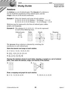
Relations
In this relations activity, 10th graders solve and complete 7 different problems that include defining various relations of number sets. First, they state the domain and range of each relation. Then, students express the relations shown...
Curated OER
Mathematics of Cartography
Students practice their math skills as they explore maps. In this cartography instructional activity, students calculate distance, scale, coordinate systems, and projection as they work independently reading online maps.
Curated OER
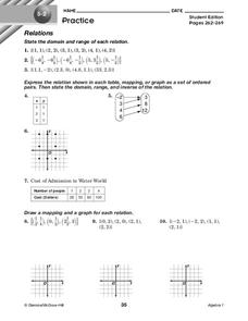
Relations
In this relations worksheet, 10th graders solve and complete 10 different problems that include defining various forms of relations. First, they state the domain and range of each relation. Then, students express the relation shown in...
Curated OER
You Can Find It!
Students, in groups, use longitude and latitude to locate various places on a map.
EngageNY
The Geometric Effect of Some Complex Arithmetic 1
Translating complex numbers is as simple as adding 1, 2, 3. In the ninth instructional activity in a 32-part series, the class takes a deeper look at the geometric effect of adding and subtracting complex numbers. The resource leads...
Illustrative Mathematics
Why Does SSS Work?
While it may seem incredibly obvious to the geometry student that congruent sides make congruent triangles, the proving of this by definition actually takes a bit of work. This exercise steps the class through this kind of proof by...
Curated OER
Latitude and Longitude: Geography and Geometry!
Second graders use latitude and longitude coordinates to pinpoint an exact location on the map. In this geography lesson, 2nd graders utilize handouts from the Maritime Museum in order to gain practice in finding locations throughout the...
Curated OER
You Can Find It!
Students locate different places including U.S. cities using longitude and latitude coordinates. In this longitude and latitude lesson plan, students locate 10 different locations.
Curated OER
Plotting Grids Using Battleship
Young scholars coordinate grid points on X and Y axises to plot a physical location. The game of "Battleship is used to present first hand knowledge of this skill.
Curated OER
Plotting Points
In this coordinate pairs worksheet, students learn to plot points on a graph. Students study the examples and then complete 20 questions. This is intended as an online activity, but may be completed with pencil and paper.
Curated OER
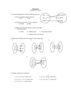
Trigonometry: Worksheet for Test #4
In this trigonometry learning exercise, students determine whether given mappings are functions. They evaluate 5 functions for a given x value. Students graph 2 functions. They determine which ordered pairs are solutions to given...
Curated OER
TE Activity: Nidy-Gridy
Students make a grid and coordinate system map of their classroom as they investigate why it is important to have a common map making system. They look at how landmarks are used for navigating an area.
Mathematics Assessment Project
Sorting Equations of Circles 2
How much can you tell about a circle from its equation? This detailed lesson plan focuses on connecting equations and graphs of circles. Learners use equations to identify x- and y-intercepts, centers, and radii of circles. They also...
Curated OER
Identify and Graph Linear Equations
Students investigate linear functions. In this mathematics lesson, students plot points onto a graph by solving the equations y=x and y=mx+b by being given numbers for x and solving for y.
Curated OER
Make Your Own "Weather" Map
Learners create their own "weather" map using data from x-ray sources. They analyze and discuss why it is important to organize data in a fashion in which is easy to read. They compare and contrast different x-ray sources using a stellar...
Curated OER
Creating a Thematic Map Using S'COOL Data
Students observe weather patterns, collect data, and make a weather predictions for various locations on a map.
Curated OER
Where is it?
Students use a coordinate grid. They investigate and discuss what caused certain objects to be in specific places. They choose a room in their home to map and place objects in specific locations.
Curated OER
Distance Formula
Students watch teacher demonstration of distance formula, view non-collinear cities on maps, plot points on coordinate plane, evaluate square roots, compute distance between two points, and use Heron's formula to find area of triangles.


