Curated OER
Osprey Journey
Students investigate the migration route of one bird, Osprey B4, using information gathered from satellites to track birds over a two-year period. They coimpare their graphs with maps of B4's migrations that have been plotted by...
Curated OER
Relations and Functions
Students differentiate between a relation and a function. In this algebra lesson, students identify a pair of coordinates as being a relation or a function. They analyze graphs for function as they solve word problems.
Curated OER
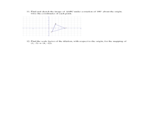
Geometry Standardized Test Practice
In this figures and graphs review worksheet, 10th graders solve and complete 23 various types of problems that include identifying various figures and graphs. First, they name the transformation that maps the unshaded figure or preimage...
Curated OER
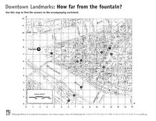
How Far From the Fountain?
In this estimation worksheet, students estimate and measure ten landmarks from the fountain in inches. Students also answer two word problems involving coordinates.
Curated OER
Geometric Transformations
Learners examine images and preimages of a mapping and identify isometry. They view images by M.C. Escher, observe teacher demonstrations, and create a translation image, a rotation image, and a dilation.
Curated OER
The Grand Excursion GPS Map
Eighth graders investigate the uses of a global positioning system. They create waypoints and have to find them using the system. Students must review the geographical concepts of latitude and longitude. The media requirements of the...
Curated OER
Make Your Own "Weather" Map
Students develop and apply a variety of strategies to solve problems, with an emphasis on multi-step and non-routine problems. They acquire confidence in using mathematics meaningfully.
Curated OER
Data Analysis and Measurement: Ahead, Above the Clouds
Young scholars explore and discuss hurricanes, and examine how meteorologists, weather officers, and NASA researchers use measurement and data analysis to predict severe weather. They plot points on coordinate map, classify hurricanes...
Curated OER
Algebra/Geometry Institute Summer 2007: Graphing Activity
Seventh graders practice identifying coordinates by examining a city map. In this graphing lesson, 7th graders create coordinate directions on an index card and practice locating these locations on a grid. Students read and...
Curated OER
Transformations Homework
In this geometry worksheet, students transform a coordinate based on a reflection, translation, or dilation in order to obtain the image. There are 12 questions.
Curated OER
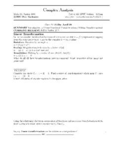
Complex Analysis: Linear Fractional Transformations
In this transformation worksheet, students explore linear transformations and mappings. They map equations on a coordinate plane. This two-page worksheet contains approximately three problems.
Curated OER
Problem Solving: Graphing Functions
In this graphing functions worksheet, students solve 6 word problems, finding ordered pairs, missing coordinates and numbers, slopes of lines and functions.
Curated OER
Complex Analysis: The Complex Derivative
For this complex derivative worksheet, students determine the circle of a radius under the mapping principle. They identify analytic functions, and explore the relationship between real and imaginary parts of complex functions. This...
Space Awareness
How To Travel On Earth Without Getting Lost
Have you ever wanted to travel the world? Take a virtual trip with a geography lesson that uses longitude and latitude, the position of the sun, an astronomy app, and a classroom globe.
EngageNY
Sequences of Rigid Motions
Examine the various rigid transformations and recognize sequences of these transformations. The instructional activity asks learners to perform sequences of rotations, reflections, and translations. Individuals also describe a sequence...
Noyce Foundation
Photographs
Scaling needs to be picture perfect. Pupils use proportional reasoning to find the missing dimension of a photo. Class members determine the sizes of paper needed for two configurations of pictures in the short assessment task.
Curated OER
A Real Life Example of the Distance Formula
Young scholars answer the following question: "Using the lines of latitude and longitude, what is the distance (in degrees) if you were to travel from NASA Dryden to NASA Ames?" They use the distance formula to find the distance...
Curated OER
Where in the World? :Understanding Latitude and Longitude
Students play a grid-based game and devise clues to help classmates locate spots on the globe in order to recognize the value of using longitude and latitude for identifying locations.
Curated OER
Understanding Growth of the Phoenix Area
Students study the growth of the Phoenix area using geographic images, maps, tables, and graphs. They study the idea of community.
Curated OER
What a Site!
Fourth graders are introduced to how to properly create a grid site. In groups, they use Cartesian coordinates to establish the boundaries for the grid and photograph the location of artifacts. They exchange their photos with another...
Curated OER
A Message in a Bottle
Students investigate the motion of water currents by mapping the possible movement of messages cast into the ocean in bottles.They accurately plot the appearance of bottles on a world map and illustrate the flow of an ocean current...
Curated OER
The Next Dimension
Young scholars explore the three dimensional Cartesian coordinate system and discuss how it is important for structural engineers in order to be able to describe locations in space to fellow engineers. They participate in a hands-on...
Curated OER
What A Tombstone Can Tell Us
In this coordinates worksheet, students determine the coordinates to visit a cemetery. Students determine 18 coordinates on this worksheet.
Curated OER
Lagoon Lake
Students develop skill in using co-ordinates. Up to eight cardinal points of the compass are used making this a useful activity in simple map and grid work. They utilize educational software to gain practice.


