Curated OER
X Marks the Spot
Fourth graders use games and puzzles to explore co-ordinate systems and their uses. Students are given the opportunity to invent their own systems by locating counters on a sheet of paper and by finding the dead center of a set of objects.
Curated OER
Number lines and graphs
In this number lines and graphs worksheet, learners identify points on a number line and in a graph. Students complete 10 multiple choice questions.
Curated OER
High and Low Tides
Students collect real world data from the Web regarding high and low tides at various locations in the United States. They find a function which models this data and make predictions on tide levels based on the information found.
Curated OER
Deer Tracks
Students use satellite images to track to movement patterns of deer and examine deer behavior. They write stories about a day in the life of a field scientist.
Curated OER
Radiation Comparison Before and After 9-11
Using the NASA website, class members try to determine if changes could be detected in cloud cover, temperature, and/or radiation measurements due to the lack of contrails that resulted from the halt in air traffic after the attacks...
Curated OER
El Nino
Students explain what El Nino is, where it is located and how it is created. They describe the weather changes caused by El Nino. They draw the patterns of El Nino on a world map. They predict economic effects El Nino has on the areas it...
Curated OER
Deep Blue: Exploring the Deep Ocean
Students examine landforms. In this social studies lesson, students bounce a beach ball around in order to discover that seventy percent of the Earth is covered in water. Students
PBS
Pbs Learning Media: Using a Coordinate Grid
In this Cyberchase video segment, the CyberSquad must locate each other using a map's grid to construct a coordinate system using letters and numbers.
E-learning for Kids
E Learning for Kids: Math: World of Fish: Position on a Map
Students will play an interactive game to interpret simple maps by describing position, plotting points with coordinates, and drawing and following a path.
E-learning for Kids
E Learning for Kids: Math: Bus Station: Position on a Map
Help Jamal read maps, describe directions, and identify coordinates in this series of interactive exercises.
Alabama Learning Exchange
Alex: Coordinate Geometry
Students will participate in several activities that will build their knowledge of coordinates graphing. Students will use ordered pairs to locate points on a grid. Students will also relate coordinate graphing to the real world through...
E-learning for Kids
E Learning for Kids: Math: Tea Store: Position on a Map
Help Gina locate items in the tea store using coordinates, a compass, and a ruler in this series of leveled exercises.
Khan Academy
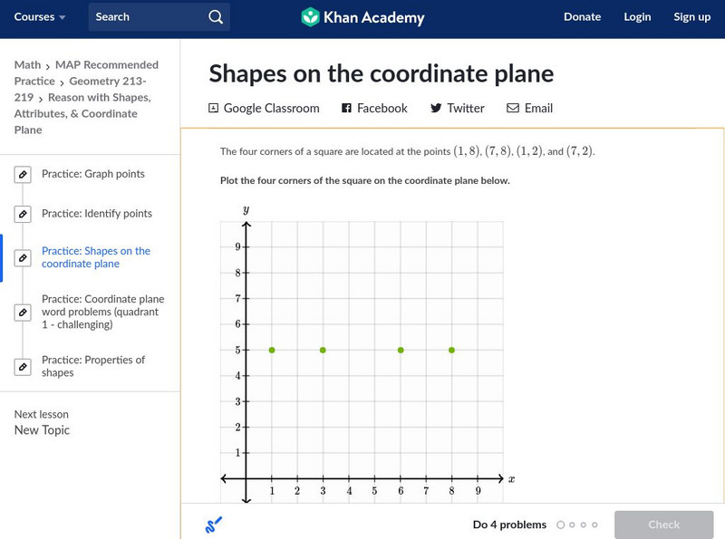
Khan Academy: Shapes on the Coordinate Plane
In this exercise, students practice identifying shapes on the coordinate plane. Students receive immediate feedback and have the opportunity to get hints and try questions repeatedly.
E-learning for Kids
E Learning for Kids: Math: Group of Pyramids: Capacity and Position
On this interactive website students practice various math skills using a real life scenario at the pyramids. Those skills include comparing capacity of three or more containers, using compass directions to describe locations, and using...
E-learning for Kids
E Learning for Kids: Math: Riksjas, Toek Toek: Position
Students will play an interactive game to explore maps, routes, and locations of objects.
E-learning for Kids
E Learning for Kids: Math: World of Fish: Position and Directions
Meet Calypso the fish and go to the underwater world to learn more about position on maps.
Wolfram Research
Wolfram Math World: Map
A brief description of a map. There are also many links about related map topics, included on this MathWorld site.
E-learning for Kids
E Learning for Kids: Math: Dinosaurs: Angles and Position on a Map
Students will play learning games to practice moving on a coodinate plane.
Texas A&M University
Wtamu Virtual Math Lab: Intermediate Algebra
This site is a tutorial for students in algebra 2 or for those who need a refresher. The site has explanations, definitions, examples, practice problems and practice tests are found covering topics such as linear equations, graphing,...
Khan Academy
Khan Academy: Determine Rotations
Given a figure on the coordinate plane and a center of a rotation, find the angle for the rotation that maps one figure to the other. Students receive immediate feedback and have the opportunity to try questions repeatedly, watch a...
Khan Academy
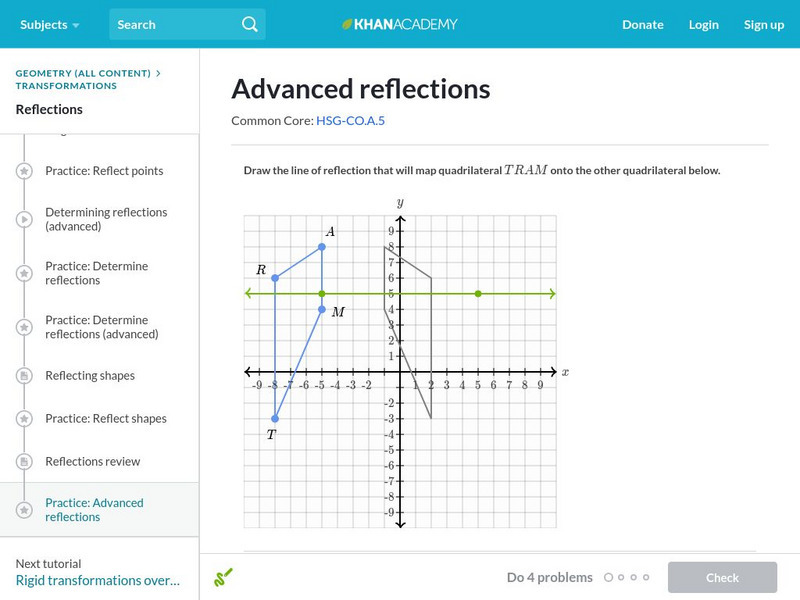
Khan Academy: Advanced Reflections
Find the reflection that maps a given figure to another and draw the image of a reflection. The lines of reflection in this exercise have a wide range of slopes. Students receive immediate feedback and have the opportunity to try...
Rice University
Rice University: Cynthia Lanius: Mathematics of Cartography: Coordinate System
A coordinate system such as latitude/longitude is an example of absolute location. Links to Greenwich/Prime Meridian.


