Curated OER
Rivers, Maps, and Math
Students use maps to locate and label the major rivers of North and South America. Using the internet, they identify forests, grasslands, mountain ranges and other landforms on the continents as well. They compare and contrast the...
Curated OER
Exploring the Hudson in 1609
While this lesson focuses on a study of the Hudson River, it could be used as a template for a discussion of map skills, converting measurements, and plotting a route. The lesson includes vocabulary and other resources to make it a...
Curated OER
Mapping the Bone Field: An Area and Scale Exercise
Here is an excellent cross-curricular lesson. Learners relate multiplication to area by making a grid on graph paper, and then creating the same grid in real space outside in the school yard.
Curated OER
Ratios And Scale
students investigate the concept of using a ratio in the work of construction and solve problems using real life applications. They read descriptions of how various types of construction professionals use ratios on the job. The lesson...
Curated OER
Math: Checking Scale Drawings for Accuracy
Students critique their own drawings for accuracy and make constructive suggestions prior to reworking them. They discover how scale in maps and drawing relate to relative size and distance. In addition, students comprehend the...
Curated OER
Solve for Scale Factors Using Proportions
Eighth graders solve problems using proportions with scaled drawings. They work with maps and blue-prints discussing scales and plans and examine different polygons and figure out the scale factors or proportions they have been changed by.
Curated OER
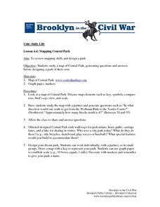
Mapping Central Park
Students use the mapping skills to explore New York's Central Park. They examine a map of Central Park to discover its features. After discussing the characteristics of the park, students design their own dream park and draw it to scale.
Curated OER
A Map of the Big Race
Students read a novel and practice putting the events into the correct sequence. Using the text, they create a map showing the events of the race in order and a legend. They must use vocabulary from previous chapters and make their map...
Curated OER
Draw To Scale The E-Z Way
Fourth graders draw a rough floor plan of a house to scale without using a ruler to determine measurements. They see how architects use scale to draw blueprints, and solve math problems using scale.
Curated OER
Essential Elements of Habitat
First graders compare their local area with the Belize landscape. They construct maps of the school area, adding descriptive information. They write haiku poems about their favorite outside places.
Edgate
Great Grids
Learners use grid boxes as a measurement tool and discover how grids are used for mapmaking and scaling down an area. They begin by attempting to draw a model shape drawn by the teacher by using the gridding process. At the conclusion of...
Curated OER
The Crash Scene
Fifth graders explore geography by participating in a mapping activity. In this engineering lesson, 5th graders identify the differences between latitude and longitude and practice locating precise points on a globe or map. Students...
Discovery Education
Architects in Action
Hands-on and real-world applications are great ways to teach mathematical concepts. Creative thinkers examine how ratios are used to create scale models of buildings and structures. They practice working with ratios by looking at a map...
Curated OER
You Are Here
Students map local places and learn to use scale and distance. In this mapping lesson, students map their school and a favorite place. Students recreate their maps showing distance and scale sizes. Students locate their location on a...
Curated OER
Colonial Vacation Planner
Looking for a good lesson on the Colonial Period for your upper-elementary class? Then, this lesson is for you! They use website designs, U.S. travel publications, and maps to plan a family vacation to states which were part of the...
Curated OER
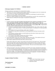
CORNER CABINET
Ninth and tenth graders calculate the length, width, height, perimeter, area, volume, surface area, angle measures or sums of angle measures of common geometric figures. They solve problems involving scale drawings, models, maps or...
Curated OER
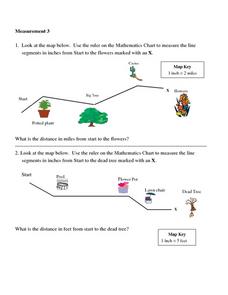
Measurement 3: Rulers
In this measurement worksheet, students measure the linear distance, in inches, between stated objects. Next, they determine the actual distance, in miles.
Curated OER
Johnny Appleseed Walkabout
Second graders calculate mileage for a journey. In this place value and measurement lesson, 2nd graders read Johnny Appleseed, work in groups to locate his birthplace on a map, locate the other states he stopped in, and measure the...
Curated OER
Map Scale and the Pioneer Journey
Fourth graders use a map, ruler and calculato to determine the distance the pioneers traveled from Nauvoo, Ill. to the Salt Lake Valley.
Curated OER
Math with Maps and Globes
Students round out their math skills with these ‘round the world' ideas. In this math and geography lesson, students try out time zone sticks, a polar race, and tic-tac-globe to engage them in learning more about globes and the...
Curated OER
Map Maker Map Maker
Students create their own maps. In this map making lesson, students go to Microsoft Word and create a chart. They label directions, buildings, streets, and distance.
Curated OER
Scale Basketball
Students understand that a spreadsheet can be used to find the best scale to use in a model. They place the distances of the planets of the solar system to the Sun in one column of the spreadsheet. Students try different scales so that...
Curated OER
TOPSY TURVY MAPS
Eighth graders use the data analyzer and motion detector to collect data and measure distances. They create topographic maps drawn to scale of a given setup and relate the concepts to the creation of historical ocean maps.
Curated OER
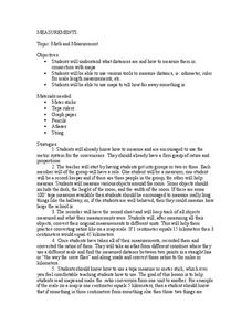
Math and Measurement
Students use the correct tool to measure distances. In this geometry lesson, students use an odometer and ruler correctly as they study maps. They describe how far way something is.


