Curated OER
The Pilgrims
Students use distance measuring tools to follow directions and chart the path the pilgrims made from Plymouth, England to Boston, Massachusetts. In this Pilgrim voyage lesson, students use a map to chart the distance traveled by the...
Curated OER
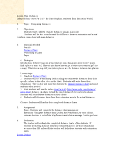
Comparing Distances
Students practice estimating distances by analyzing a map. In this length measurement lesson, students view a map with a distance key and use their measurement skills to estimate the distance between two cities. Students utilize an...
Curated OER
Grid it, Map it
Students participate in designing a city layout using grids and coordinates. They work on a city space and create a grid on a life size layout on the gym floor.
Curated OER
The Grand Excursion GPS Map
Eighth graders investigate the uses of a global positioning system. They create waypoints and have to find them using the system. Students must review the geographical concepts of latitude and longitude. The media requirements of the...
Curated OER
Coordinate Grid: Mapping an Archaeological Site
Students examine how archaeologists preserve context of sites through use of rectangular grid or Cartesian coordinate system, and develop sense of distance by pacing off and estimating distances.
Curated OER
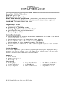
CEENBoT Takes a Dive
Students create a map to scale using technology. For this algebra lesson, students navigate through a shipwreck to perform rescues. They use he CEENBoT program to perform the different tasks.
Curated OER
Painting the Hallway with Pixels
Students create science design to be painted on the wall in the hallway of the science area of the school building. They measure space available, make a scale model of the design, and paint different pixels.
EngageNY
Informal Proofs of Properties of Dilations
Challenge the class to prove that the dilation properties always hold. The lesson develops an informal proof of the properties of dilations through a discussion. Two of the proofs are verified with each class member performing the...
Curated OER
Chernobyl 1 - Radiation Released
Young scholars investigate the Chernobyl nuclear disaster by mapping out the winds carrying radiation and viewing a short video about the aftermath and subsequent health problems. They then calculate the amount of radiation that people...
Mathematics Assessment Project
Comparing Strategies for Proportion Problems
Having problems with proportions? Then solve these proportion problems with an exercise that asks learners to first individually solve a set of problems involving ratios and proportional reasoning. Groups then discuss provided sample...
Mathematics Assessment Project
Calculating Arcs and Areas of Sectors of Circles
Going around in circles trying to find a resource on sectors of circles? Here is an activity where pupils first complete an assessment task to determine the areas and perimeters of sectors of circles. They then participate in an activity...
Mathematics Assessment Project
Evaluating Statements About Enlargements
Double, toil ,and double linear dimensions. Learners first complete an assessment investigating how doubling linear dimensions affects the area of pizzas and the volume of popcorn containers. They then complete an activity investigating...
Curated OER
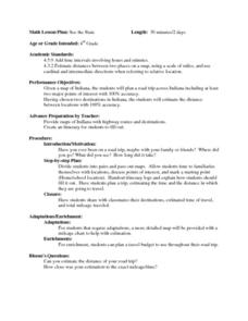
See the State
Fourth graders are given a map of Indiana and have to plan a road trip including at least two major points of interest with 100% accuracy. The students estimate the distance between their two chosen locations with 100% accuracy.
Curated OER
Measurement
In this measurement worksheet, students measure distance with a provided ruler. Using the provided map scale, students determine the actual distance between objects. They may set up proportions to evaluate each situation.
Curated OER
TE Activity: The Trouble with Topos
Students study the uses of topographical maps including the many forms that they take. They discover that the map features show its intended use such as city maps, wilderness maps, and state maps. They complete a worksheet in which they...
Curated OER
Living in the Desert
Conduct an investigation on the plants used by the Hohokam tribe. To survive in the harsh desert environment the Hohokam used many natural resources. Learners read, research, map, and graph multiple aspects of Hohokam plant use as a...
Curated OER
Basic Math - Plan a Cruise
Students measure distances and report them in fractions. They convert fractions to decimals and multiply decimals.
Curated OER
The Mathematics of Space and Place
Students investigate the measurements and geometry of the school grounds. They conduct inquiry while measuring the campus and some of the city blocks. Then students draw a map to scale and categorize property types using a pie graph.
Curated OER
Home on the Range
Students use maps and mathematics to determine the appropriate panther population in a given area. In this Florida ecology lesson, students research the area requirements of male and female panther and use a map to help calculate how...
Curated OER
Math: A Geometric Neighborhood
Young scholars, as a final project, draw a picture of their ideal neighborhood on a sunny day. In addition to the sun, their drawings include homes, trees, streets, and selected objects. Each object in their drawing has a written...
Curated OER
Mission: Possible
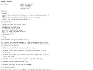
Students explore the concept of scale. In this scale lesson, students are given directions scaled in inches and students must convert them to feet. Students take a section of a map and create a bigger scaled model of the section.
Curated OER
From the Heights to the Depths
Students create a relief map of Asia and Australia. They work in small groups on sections of the map to make one complete map of the continents.
Curated OER
Estimating Distances
Middle schoolers investigate distance measurement. In this middle school mathematics lesson, students find the average length of their pace and use their pace to measure various unknown distances in feet and miles. Middle schoolers...
Curated OER
GPS Art
Learners design their own logo or picture and use a handheld GPS receiver to map it out. They write out a word or graphic on a field or playground, walk the path, and log GPS data. The results display their "art" on their GPS receiver...


