Curated OER
Touring Delmarva
Young scholars plan a trip. For this trip planning lesson, students use a map to find where they would like to visit with a pretend family of 4. They get a specific amount of money and time and need to decide where they will stay and...
Curated OER
Mental Tests
In this ratio worksheet students use mental math to find the ratios in problems about people, distance, length, and products.
Curated OER
Mush! Tracking Travelers on the Trail
Students get to know Alaska and the Iditarod route that is run by dogs as they track the mushers' progress on a map that they create specifically for the race. They learn about latitude, longitude, plotting on a map, checkpoints, and...
Curated OER
Is There Ice on Mercury?
In this ice on Mercury learning exercise, students read about the data collected from the NASA Messenger and the Arecibo Radio Telescope indicating the possibility of ice on Mercury. Students solve 6 problems including finding the scale...
Curated OER
The Good, The Bad, The Ugly
Sixth graders examine the causes of the stock market crash of 1929. In this integrated math/history unit on the stock market, 6th graders study, research, and read stocks, visit a local bank, and create a PowerPoint to show the finished...
Curated OER
Geography Journey
Fourth graders examine the geographic features that define places and regions and answer questions about the state of California. They discuss the components of a map legend and answer worksheet questions using a map of California as a...
Curated OER
Having a Hot Time on Mars!
For this cosmic radiation on Mars worksheet, learners study a radiation map of Mars taken by the MARIE instrument on the Odyssey spacecraft. Students answer 4 questions using the radiation map and they answer questions about the exposure...
Curated OER
The Pilgrims
Students use distance measuring tools to follow directions and chart the path the pilgrims made from Plymouth, England to Boston, Massachusetts. In this Pilgrim voyage lesson, students use a map to chart the distance traveled by the...
Curated OER
A Star Sheds a Comet Tail!
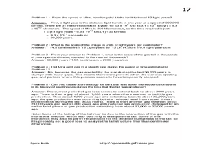
In this comet tails and stars learning exercise, students read about the star Mira and the vast clouds of gases it emits. They use a photograph from the Galaxy Evolution Explorer satellite to solve 5 problems about the scale of the...
Curated OER
Comparing Distances
Students practice estimating distances by analyzing a map. In this length measurement lesson, students view a map with a distance key and use their measurement skills to estimate the distance between two cities. Students utilize an...
Curated OER
Grid it, Map it
Students participate in designing a city layout using grids and coordinates. They work on a city space and create a grid on a life size layout on the gym floor.
Curated OER
The Grand Excursion GPS Map
Eighth graders investigate the uses of a global positioning system. They create waypoints and have to find them using the system. Students must review the geographical concepts of latitude and longitude. The media requirements of the...
Curated OER
Coordinate Grid: Mapping an Archaeological Site
Students examine how archaeologists preserve context of sites through use of rectangular grid or Cartesian coordinate system, and develop sense of distance by pacing off and estimating distances.
Curated OER
Angles, Bearings and Maps
In this secondary mathematics worksheet, students determine how many independent angles are in a diagram, bearings, and flight paths. The four page worksheet contains seven problems. Answers are provided.
Curated OER
CEENBoT Takes a Dive
Students create a map to scale using technology. For this algebra lesson, students navigate through a shipwreck to perform rescues. They use he CEENBoT program to perform the different tasks.
Curated OER
Painting the Hallway with Pixels
Students create science design to be painted on the wall in the hallway of the science area of the school building. They measure space available, make a scale model of the design, and paint different pixels.
EngageNY
Informal Proofs of Properties of Dilations
Challenge the class to prove that the dilation properties always hold. The lesson develops an informal proof of the properties of dilations through a discussion. Two of the proofs are verified with each class member performing the...
Curated OER
Chernobyl 1 - Radiation Released
Young scholars investigate the Chernobyl nuclear disaster by mapping out the winds carrying radiation and viewing a short video about the aftermath and subsequent health problems. They then calculate the amount of radiation that people...
Inside Mathematics
Swimming Pool
Swimming is more fun with quantities. The short assessment task encompasses finding the volume of a trapezoidal prism using an understanding of quantities. Individuals make a connection to the rate of which the pool is filled with a...
Mathematics Assessment Project
Comparing Strategies for Proportion Problems
Having problems with proportions? Then solve these proportion problems with an exercise that asks learners to first individually solve a set of problems involving ratios and proportional reasoning. Groups then discuss provided sample...
Mathematics Assessment Project
Calculating Arcs and Areas of Sectors of Circles
Going around in circles trying to find a resource on sectors of circles? Here is an activity where pupils first complete an assessment task to determine the areas and perimeters of sectors of circles. They then participate in an activity...
Mathematics Assessment Project
Evaluating Statements About Enlargements
Double, toil ,and double linear dimensions. Learners first complete an assessment investigating how doubling linear dimensions affects the area of pizzas and the volume of popcorn containers. They then complete an activity investigating...
Mathematics Assessment Project
Fruit Boxes
Perfect for visual and hands-on learners, an engaging lesson prompts pupils to consider the different-sized boxes they can create from a piece of cardboard. They develop a model to determine the size of the box with the greatest volume.
Curated OER
See the State
Fourth graders are given a map of Indiana and have to plan a road trip including at least two major points of interest with 100% accuracy. The students estimate the distance between their two chosen locations with 100% accuracy.


