Curated OER
Map Your House
Students are introduced to the concepts of maps as scale models of the whole. After a brief lecture on creating and using an accurate scale when drawing and reading a map. They create a scale drawing of the floorplan of their homes.
Curated OER
Map Activities
In this geography worksheet, learners follow the directions and shade 3 different regions of a UK political map, shade European Union countries on a political map of Europe, match 4 physical feature of Africa to their descriptions, and...
Curated OER
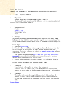
Comparing Distances
Students practice estimating distances by analyzing a map. In this length measurement lesson plan, students view a map with a distance key and use their measurement skills to estimate the distance between two cities. Students utilize an...
Curated OER
Maps/ Scales and Conversions
In this math worksheet, students look for the actual values for the measurements of distance. The answers are found on page three.
Curated OER
Map Scale and the Pioneer Journey
Fourth graders, using a map, ruler and calculator, determine the distance the pioneers traveled from Nauvoo, Ill. to the Salt Lake Valley.
Curated OER
Exploring the Hudson in 1609
While this lesson plan focuses on a study of the Hudson River, it could be used as a template for a discussion of map skills, converting measurements, and plotting a route. The lesson plan includes vocabulary and other resources to make...
Curated OER
Welina's World
Students living in Hawaii draw a picture of themselves in their neighborhood. They draw their neighborhood in relation to their district and then in relation to the island they are from. They compare their pictures to their classmates'...
Curated OER
Rivers Run Through It
Using a relief map of New York State, learners answer questions about the distance between different cities, identify bodies of water, and more. First, they discuss vocabulary related to the Hudson River area. Then, they complete a...
Curated OER
River Run Through It
With vocabulary lists, worksheets, and more, this lesson sets learners on an exploration of the Hudson River area. They read an essay about the area, analyze a relief map of New York State, and complete a worksheet.
Bowland
Alien Invasion
Win the war of the worlds! Scholars solve a variety of problems related to an alien invasion. They determine where spaceships have landed on a coordinate map, devise a plan to avoid the aliens, observe the aliens, and break a code to...
Science Matters
Finding the Epicenter
The epicenter is the point on the ground above the initial point of rupture. The 10th lesson in a series of 20 encourages scholars to learn to triangulate the epicenter of an earthquake based on the arrival times of p waves and s...
Curated OER
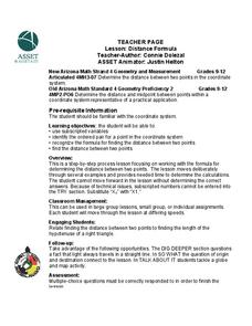
Distance Formula
Students calculate the distance formula. For this geometry lesson, students find the distance between two points on a coordinate plane. They identify the four different quadrants.
Curated OER
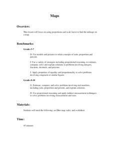
Maps
Students figure out the mileage from one state to another using a map. In this map lesson plan, students look at the scale factor and turn it into a fraction. They measure the distance between two cities and use the proportion to find...
Curated OER
Mountain Man Measurement Activity
Fourth graders discover the history of the Utah Mountain Men and utilize their math skills simultaneously. In this cross-curricular history and measurement lesson plan, 4th graders read about the Utah Mountain Men and the challenges they...
Curated OER
Proportions and Scale Factor for Measurement
Students explore the concept of proportion. In this proportion lesson, students use google maps to find the distance the their school is from home. Students discuss what a scale factor is through teacher led discussion. Students...
Curated OER
Around the Town
In the world of GPS, make sure your kids can still read maps and determine distances between locations. You will need neighborhood street maps, ideally of your class' home turf. Ask kids questions about different locations in relation to...
Curated OER
You Are Here
Learners map local places and learn to use scale and distance. In this mapping lesson, students map their school and a favorite place. Learners recreate their maps showing distance and scale sizes. Students locate their...
Curated OER
Estimating Distances
Fifth graders explore the concept of estimating distances between two places on a map. In this estimating distances lesson, 5th graders interpret maps according to measuring distance. Students choose a place on a map and find the...
Curated OER
Mission: Possible
Young scholars explore the concept of scale. In this scale lesson, students are given directions scaled in inches and young scholars must convert them to feet. Students take a section of a map and create a bigger scaled model of the...
Curated OER
Measurement
In this measurement worksheet, students measure distance with a provided ruler. Using the provided map scale, students determine the actual distance between objects. They may set up proportions to evaluate each situation.
Laboratory for Atmospheric and Space Physics
Charting the Progress of New Horizons
In 2006, New Horizons began its mission to fly to Pluto. As it continues its journey, scholars track its progress with the help of an informative website, all the while reinforcing measurement concepts with the construction of a scaled...
Mathematics Assessment Project
Middle School Mathematics Test 4
Raise expectations in your classroom and assess learners through the provided performance tasks. Class members must apply concepts learned throughout the year, providing a good measurement of how well they understand the...
Curated OER
Mapping and Topgraphy- 8th Grade
Eighth graders practice interpreting a contour map as well as reading latitude and longitude in a team activity. Following a discussion on mapping terms, teams are given maps and estimate the distance between two points. Students...
Curated OER
TOPSY TURVY MAPS
Eighth graders use the data analyzer and motion detector to collect data and measure distances. They create topographic maps drawn to scale of a given setup and relate the concepts to the creation of historical ocean maps.


