Curated OER
School-Home Link: Maps
In this atlas and parent communication form worksheet, students use an atlas to find several things: the capitol city of Japan, the number of countries in Africa, where to buy a newspaper, the names of Presidents of the United States,...
Curated OER
Where in the world is...
Learners identify locations around the world. In this mapping lesson, students place tag board pieces with names of locations on a wall map of the world. Initially, learners identify states, then cities, then continents, eventually...
Curated OER
Qu¿¿ tiempo hace?
Learners use the internet to gather information on Spanish cities and its weather. After completing a worksheet, they compare and contrast the weather conditions for the cities they researched. They share their information with the class.
Curated OER
The Science of Weather: Hurricanes
Students use this USA today activity to learn about hurricane season. In this hurricane lesson, students study the map of the earth and hurricane science. Students complete discuss questions. Students draw a map of the United States and...
Curated OER
Getting to Know My World
Students participate in hands-on activities using maps and globes to identify geographical features. Students use map legends to identify direction. Students locate oceans, continents, countries, states and cities. Handouts and...
Curated OER
Integrated Algebra Practice: Exponential Growth
In this exponential growth worksheet, students solve 4 short answer and multiple choice problems. Students determine the population of a city after a given amount of time.
Curated OER
America the Beautiful
Students analyze the physical geography of the United States and how we have adapted to or altered the land to create the country we know today. Students complete maps with physical features, states and cities of interest.
Curated OER
Countdown to Disaster
Learners discover the potential dangers of weather in their hometown. In this environmental lesson, students research Hurricane Hugo and the devastation it caused South Carolina in 1989. Learners record weather data from their city and...
Curated OER
History of the Americas – Mexican Revolution
For this Mexican history worksheet, students respond to 10 short answer questions about the Tragic Ten Days of the Mexican Revolution.
Curated OER
Geography: US States and Capitals Picture/Word #7
For this US states and capitals worksheet, learners trace the sentences that list the capital cities of the following states: New Mexico, New York, North Carolina, North Dakota, and Ohio.
Curated OER
Where We Put Ourselves
Learners examine the form and function of furniture in New Spain, explore the origins of marquetry, and discover the influences of other countries on marquetry in Puebla, Mexico.
Curated OER
Crossing the Border: Practicalities
Students plan a trip for a citizen of Mexico to travel within various regions of the US. Another group plans a trip for a citizen of the US to travel to a non-tourist area of Mexico.
Curated OER
Dream Machines
Students explore the modern applications of robots and create one of the five parts of a robot that could solve a hypothetical public works problem. They study about the use of robots for laying fiber-optics cable in New Mexico by...
Curated OER
Texas Weather Report
Learners use provided links to observe selected weather sites and collect temperature and precipitation data for listed cities. They enter the information onto their spreadsheet. Students study maps of the Texas natural reagions,...
Curated OER
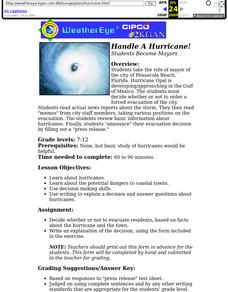
Handle A Hurricane! Students Become Mayors
Students take the role of mayor of the city of Pensacola Beach, Florida
Curated OER
Biological and Cultural Diversity of a Latin American Country
Students conduct an 8 hour Annual Summit Meeting on the Cultural and Biological Diversity of a Latin American Country. They construct a Rainforest, coffee and banana plantations, and a street scene of a typical large city.
Curated OER
The Mexican Revolution
In this Mexican history worksheet, students read the noted pages in their textbook about the Mexican Revolution and then take notes on the 4 listed subtopics.
Curated OER
Colonial North America
Showcase the religion, conflicts, daily life, and politics of Colonial North America. A very well-done presentation highlights all the major colonial groups, social norms, demographics, and political struggles of the time. Perfect for an...
Scholastic
Step-by-Step Strategies for Teaching Expository Writing
A carefully crafted, logically organized, 128-page packet is an excellent addition to your unit on expository writing.
Scholastic
Comprehension During Independent Reading
Ideal for a language arts class, literary unit, or independent reading assignment, a set of reading worksheets address a wide array of skills. From poetic elements to nonfiction text features, you can surely find a valuable resource in...
Scholastic
Teaching with Aesop's Fables
Bring the applicable morals of Aesop's Fables to your classroom with a series of reading comprehension activities. With 12 different fables with activities and exercises, the packet focuses on the ways learners can apply the fables and...
Curated OER
Bank On It! Worksheet Cinco de Mayo
In this Cinco de May worksheet, students read a passage about the celebration of Cinco de Mayo in the United States. Students fill in ten missing words to make the text understandable. The words will be of the student's own choice; there...
Curated OER
Celebrating Cinco de Mayo Without Stereotypes
Put more meaning into your Cinco de Mayo party with geography lessons, literature, and more!
CFR Washington
Urbanization and Wildlife
Urbanization and how it affects wildlife is the focus of a presentation that uses statistics to make a case for concern and change.
Other popular searches
- Mexico City and Countryside
- Mexico City Map
- Population Mexico City
- Pollution in Mexico City
- Mexico City Class Projects
- Mexico City Earthquake
- Mexico City Bus Tour
- Environment Mexico City
- Mexico City and Pollution
- Mexico City Air Pollution
- Mexico City Air Polution


