Constitutional Rights Foundation
Refugees From Vietnam and Cambodia
The United States may have pulled its troops from the Vietnam War in 1973, but the conflict was far from over for the citizens living in Asia at the time. An informative resource lets learners know about the wave of over 220,000...
Curated OER
Out On A Limb In The Pacific Rim?
Students act as cultural attachés to investigate and present briefings on the post-1945 histories and United States diplomatic relationships with East Asian countries. They articulate their foreign policy findings.
Curated OER
Middle Ages Traveler
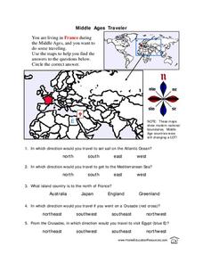
In these Middle Ages worksheets, students use the maps to help them find the answers to the questions that help them understand the directions of north, south, east and west. Students also color another map of France according the...
Curated OER
Somewhere in the Middle
Young scholars investigate the cease-fire between Israel and Lebanon in August of 2006. The geographic region known as the Middle East is examined and maps created with information on border and territory disputes.
Curated OER
EU and Turkey
Should Turkey be admitted to the European Union? Before debating this question, class members research the background and stated purpose of the EU, read articles of Turkey's bid to become a member of the EU, and the concerns other...
Curated OER
World Map Labels
In this geography skills worksheet, students identify the countries and bodies of water labelled on the maps of the world, Africa, Asia, Canada, Europe, the Caribbean, the Middle East, North America, Australia, and South America.
Curated OER
Middle Ages Traveler
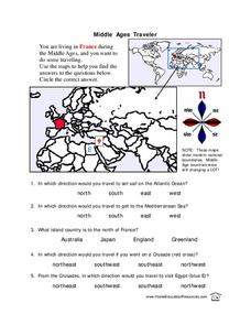
In this map worksheet, students are given three maps of France to use to answer multiple choice questions. Students complete an activity from the perspective of a Middle Ages traveler.
AGSSS
World Regions
Help your learners to visualize where historical events have taken place around the globe with a map that details the major regions of the seven continents.
Curated OER
Mapping Population Changes In The United States
Students create a choropleth map to illustrate the population growth rate of the United States. They explore how to construct a choropleth map, and discuss the impact of population changes for the future.
Curated OER
Africa Capitals Map Quiz
In this online interactive geography quiz learning exercise, students examine the map that includes 53 African countries. Students match the names of the countries to the appropriate locations.
Curated OER
North American Biomes
For this Science worksheet, students color a biome map of North America. Students color the map by solving the clues listed on a separate sheet of paper.
Delegation of the European Union to the United States
The Geography of Europe
What is the European Union? Where is it? Why is it? To begin a study of the EU, class members examine the physical geography of Europe and the size and population density of 28-member countries in comparison to non-member countries...
Curated OER
Lesson Plan on Map Skills for South Asia
Seventh graders observe and discuss an overhead transparency map of South Asia. In small groups, they label a blank map of South Asia, and listen to a lecture on the realm.
Curated OER
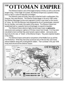
The Ottoman Empire
In this Ottoman Empire worksheet, students read a 1-page selection about the empire and examine a map. Students then respond to 5 short answer questions about the reading selection and the map.
Curated OER
Introduction to Canada
Ninth graders investigate the country of Canada by examining their media in this geography lesson. They use the Internet to research Canadian newspapers and analyze a topic covered by both US and Canadian media sources. After comparing...
Curated OER
Biome Map
In this biomes instructional activity, learners color the map of North America according to the biome clues. Students then answer questions about the North American biomes.
Curated OER
Ooooh, The Oud
Students listen to a performance of the instrument, oud. After watching a video, they discover how many parts of the world it is used in and locate the countries on a map. They compare and contrast the oud with other instruments from the...
Curated OER
Iraq, Where's That?
Students identify the Middle Eastern countries on the map and the oil-producing countries of OPEC in the region. They examine whether the presence of important producing oil fields qualifies as a characteristic of this region.
Curated OER
Roman Empire: Physical Framework - Location, Borders, Dimensions
Students relate the classical world to the modern world. In this map skills lesson, students turn a blank map into a colorful complete map by following step-by-step directions. This lesson allows students to connect our current geography...
Curated OER
Graphin' And Glyphin' Utah Weather
Fourth graders investigate the concepts of looking at sets of data. The focus of the study is upon the local weather of Utah. They study the weather found in the city and in the country and make comparisons based upon geographical location.
Curated OER
Sub-Saharan Africa: Physical Geography
In this geography skills worksheet, students respond to 22 short answer and map skills questions about the location and geographic features of sub-Saharan Africa.
Curated OER
International Formum on Iran's Nuclear Program
Young scholars are explained that they are going to participate in an international forum to develop a policy addressing Iran's nuclear program. They are divided into six groups of the six countries represented. Pupils develop their...
Curated OER
How 9/11 Shaped U.S. Foreign Policy
Students discuss the U.S. foreign policy and the components they consider important. They read and discuss President George W. Bush's speech of November 10, 2001. Students locate and mark countries President Bush identified in his speech...
Curated OER
Changing Circumstances, Changing U.S. Foreign Policy
Students examine how relationships between countries change overtime. They identify the factors that play a role in altering the relationships and contribute to U.S. foreign policy toward their country of research. Groups conduct their...


