Curated OER
River to the Sea
Students investigate the function of wathersheds and weather while they follow Lewis and Clark on their jouney west. They also create a map using acurate measurements and build a model watershed.
Curated OER
Shedding Light on Watersheds
Learners discuss what a watershed is, complete online activities showing them how to take care of a watershed, and create a model of a watershed that they experiment with to see what happens when it is disrupted by civilization.
Curated OER
Science: Draining the Land - the Mississippi River
Young scholars use topographic maps to identify parts of rivers. In addition, they discover gradient and predict changes in the channels caused by variations in water flow. Other activities include sketching a river model with a new...
Curated OER
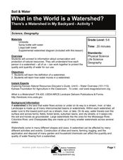
What in the World Is a Watershed?
Students discover the role of a watershed. In this geography lesson, students are shown a diagram of a watershed and discuss the definition of a watershed. Students demonstrate the role of a watershed by using an umbrella and spraying it...
Curated OER
Be a Watershed - Create a Living River
Learners investigate water ways by conducting an experiment with classmates. In this natural resources instructional activity, students define a watershed and identify where large ones are located within the United States. Learners...
Curated OER
Exploration Watershed
Students discuss what a watershed is, and locate watersheds on a map. For this watershed lesson, students use the information they have been introduced to and create a color coded watershed map of their own.
Curated OER
Rivers, Maps, and Math
Students use maps to locate and label the major rivers of North and South America. Using the internet, they identify forests, grasslands, mountain ranges and other landforms on the continents as well. They compare and contrast the...
Curated OER
River Study
Students explore a stream in their area and show the class the topographic map of the stream. They locate the topographic map and name the streams, lakes and ponds in their watershed. They write a paragraph about their stream and...
Curated OER
Boundaries and People
Students map watersheds to find their boundaries. In this watershed activity students map and then give their "watershed address." Students show the trail from stream, larger stream to oceans. Students describe the boundaries of the...
Curated OER
Surface Water Model
Students examine, through demonstration and experimentation, how water moves through watershed, identify pollutants that can enter water system from different land use activities, and discuss ways people can help prevent water pollution.
Curated OER
Rivers... for Kids
Students investigate U.S. geography by exploring it's bodies of water. In this river formation lesson, students identify the reasons rivers are needed in our country by reading assigned text. Students examine a diagram which explains how...
Curated OER
Cane River Civil Rights: A Native American Perspective
Students interpret historical evidence presented in primary resources. In this civil rights lesson, students examine the civil rights struggle from a Native American perspective. Students analyze documents and write journal entries that...
Curated OER
Beyond the Tap
Students explain the basic properties of a watershed including how water flows from higher to lower elevations and how watersheds are interconnected. They comprehend how the placement of buildings, roads, and parking lots can be...
Curated OER
Katrina Case Study
Students explore the impact natural events have on the environment, specifically the wetlands. They view a video about the impact of Hurricane Katrina on the Mississippi Delta and answer discussion questions.
Curated OER
Hypoxia and the Dead Zone in the Gulf of Mexico
Students investigate the causes of hypoxia, the characteristics of a watershed, and how the actions and management practices of people can both negatively and positively affect aquatic ecosystems.
Curated OER
River Study
Students study physical features of a local stream. They study how to identify water features on topographic maps.
Curated OER
Native Species Restoration and its Impact on Local Populations
Learners watch video clips of ecosystems and answer questions relating to them.
Curated OER
What's a Swamp Good For?
Students identify the function and value of wetlands. In this lesson on appreciating wetlands, students explain how different household items can represent different aspects of the wetlands.
PBS
Pbs Learning Media: Taming the Mississippi
At 2,300 miles long, the Mississippi River is the second longest river in North America. People have tried to control the flow of the river to prevent floods and keep it flowing towards port cities. This can lead to loss of land in the...
Missouri Botanical Garden
Missouri Botanical Garden: Rivers and Streams
The Evergreen Project profiles the natural history of rivers and streams. Topics include watersheds, how a stream becomes a river, erosion, water pollution, and the like.
Curated OER
Etc: Native American Delimitations, 1763 1770
A map of the American colonies and territories west to the Mississippi River between the end of the French and Indian War of 1763 and the beginnings of westward expansion of the trans-Appalachian colony proposed in the Vandalia Project...


