Montana State University
Meet Mount Everest
Learning about one landform might seem boring to some, but using the resource provided practically guarantees scholar interest. The second in a sequential series of eight covering the topic of Mount Everest includes activities such as a...
Montana State University
What's the Weather?
How many jackets do you need to stay warm and climb Mount Everest? An informatie resource covers the topic of Mount Everest, the resource helps young scientists discover the difference between climate and weather. Activities include...
Montana State University
Everest Extremes: Biodiversity
How many animals can live in a climate as cold as Mount Everest's? Find out with a science lesson all about biodiversity. Activities include research, presentations, group work, coloring maps, and a simulation of a food web.
Curated OER
Mount Everest History Lesson
Students explore Mount Everest. In this exploration instructional activity, students read "The Top of the World: Climbing Mount Everest," by Steve Jenkins. Students then respond to discussion questions and participate in a map skills...
National Geographic
Mapping the Shape of Everest
With Mount Everest as the motivator, your earth science class learns about topographic maps. Begin by showing a film clip from The Wildest Dream: Conquest of Everest, featuring fearsome virtual imagery of a path up world's tallest...
Curated OER
Documenting a Historic Climb of Mount Everest
Students create front pages of newspapers that document the historic attempt of a group of Sherpa women to summit Mount Everest.
Smarter Balanced
Exploring the World
To prepare for the Exploring the World Performance Task, class groups generate a list of places they would like to explore, examine images of seven natural wonders of the world, and consider why these sites are wondrous. A map and images...
Montana State University
Who’s on Top?
What's it like to climb Mount Everest? An educational resource encourages an in-depth knowledge of Mount Everest's scientific missions through a variety of activities, including an analysis of maps, a KWL chart, videos, a simulation, and...
Curated OER
Three Mapping Activities
Students label three maps of China after being introduced to background information about the country. For this geography lesson, students color two maps and label various points of interest in China. Finally, students draw...
National Geographic
The Monsoon
Few things are as fascinating as the challenge of climbing Mount Everest. This lesson plan investigates how monsoon weather impacts climbers. To begin, you are instructed to show various video clips. The only one directly provided,...
Curated OER
The Physical Geography of South Asia
Young scholars describe the physical forces that formed and shaped the Himalaya, then discuss the physical geography of Mount Everest and how it influences the routes climbers take to the summit.
National Geographic
Measuring Elevation Past and Present
After viewing a short video about a climb up Mount Everest, high schoolers read about triangulation for measuring distant elevations. Have your class work in groups to construct an inclinometer and then use it to measure the height of...
National Geographic
Altitude: What's in the Air?
Introuduce your scientists to the differences in air at varying altitudes with a colorful explanatory graph. After some discussion, they view unbelievable footage of mountain-climbing Leo Houlding and a narrative about how he might do...
Curated OER
Mountains
An informative and well-designed presentation on mountains awaits your geographers. Excellent photographs from mountain ranges around the world are includedin this terrific PowerPoint. The last slide effectively sums up what pupils have...
Curated OER
China: Dim Sum: 3 Mapping Lessons
Fourth graders, after studying maps, draw a very large outline map of Asia and then a large map of China on it in the appropriate place. They label the appropriate information.
Curated OER
The Rigors of Learning a New Language
Students examine the experiences of a Peace Corps volunteer learning to speak Chinese. They read and discuss an essay written by the Peace Corps volunteer, analyze a map of China, and discuss the author's difficulties in learning the...
Curated OER
Definite Article or Zero Article-Geography
Here is a grammar and geography worksheet! Learners choose the correct sentence or answer for sixteen questions dealing with articles in connection with geography.
August House
The Archer and the Sun
Reinforce reading comprehension with a instructional activity about The Archer and the Sun, a Chinese folktale. Kids learn some background information about Chinese culture before reading the story, and answer literacy...
Curated OER
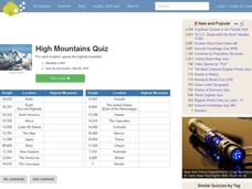
High Mountains Quiz
In this online interactive geography quiz worksheet, students respond to 18 identification questions about the highest mountain ranges in the world. Students have 4 minutes to complete the quiz.
Other
The Royal Geographic Society: Imaging Everest
The online version of an exhibition created to commemorate the 50th anniversary of the first successful ascent of Mt. Everest in 1953. The photographs, maps, and artifacts in the exhibition trace Everest from its early exploration in the...
National Geographic
National Geographic: Measuring Elevation Past and Present
One of a series of lessons created to accompany the film The Wildest Dream: Conquest of Everest, which explores the attempt by George Mallory in 1924 to reach the top of Mount Everest. His body was discovered 75 years later. In this...
National Geographic Kids
National Geographic Kids: Nepal
Nepal lies between China and India in South Asia. The country is slightly larger than the state of Arkansas. Nepal has the greatest altitude change of any location on Earth. The lowlands are at sea level and the mountains of the...


