Curated OER
Glaciers on the Move
Students study how glaciers form, move, and change the Earth's landscape. They research information about the effects of global warming on glaciers and sculpt a detailed replica of mountains with glaciers calving into the ocean.
Curated OER
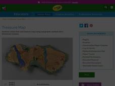
Treasure Map
Students study and recognize topographical symbols on maps. They create their own topographical Treasure Maps using symbols they learned or invent new ones. They create a bird's-eye view and include landscape details such as mountains...
Curated OER
Blowing and Flowing
Fifth graders compare and evaluate the rate of erosion from water and wind on three type of landscape: bare land, land with sparse vegetation, and land covered by dense vegetation.
Curated OER
Make an "I'm Thankful For..." Placemat
Learners compare and contrast what they are thankful for and what the pilgrims were thankful for, and create a Thanksgiving placemat. They read and recite the poem "I'm Thankful For," and create a laminated landscape placemat that...
Curated OER
Poetry In the World Around Us
Students engage in a lesson plan which is designed as a literacy connection to science lessons on the effects of water on plants. This lesson plan uses an excellent Reading Rainbow episode on the effect of drought, and then rainfall,...
Curated OER
Identifying Watersheds with Topographic Maps
Learners model a watershed and delineate one using topographic maps. In this hydrology lesson plan, students use aluminum foil to model a landscape and observe how water moves on it. They also observe the features of a topographic map...
Curated OER
Topography of Africa
Students study Africa's diverse landscape and investigate how these features impact the available water supply, food sources, and population distribution of the continent. They compare topographical features and
their affect on each...
Curated OER
Salad Tray 3D Topographic Model
Students explore the characteristics of topographical maps. They examine the relationship of contour lines and vertical elevation. Students create a three-dimensional model of a landscape represented by a topographic contour map.
Curated OER
Common Themes
Tenth graders test usefulness of a model Earth by comparing its predictions to observations in the real world. In this landforms lesson students construct an island from a contour map using model clay then analyze the landscape...
Cornell University
Constructing and Visualizing Topographic Profiles
Militaries throughout history have used topography information to plan strategies, yet many pupils today don't understand it. Scholars use Legos and a contour gauge to understand how to construct and visualize topographic profiles. This...
Curated OER
Book: Spain
Learners, after reading Chapter One in the book, "Spain," design and re-create the political boundaries as well as the physical features of nation of Spain. They utilize play-doh or salt dough to illustrate and create their three...
Curated OER
Rivers Run Through It
In this mapping practice activity, 5th graders read an informational paragraph and answer 7 questions about the parts of a map along with places shown on a given map.
Curated OER
Geography: I Spy Environments
Fourth graders examine nature paintings from a Utah museum for their physical characteristics. In small groups, they observe museum postcards and discuss the season, precipitation, temperature, and geometric shapes pictured. Focusing...
Curated OER
A Look at the Geological History
In this geological history worksheet, students draw a cartoon strip to sequence how the North American continent grew. Students use information about continental drift to sequence events of how the different continents were formed.
Curated OER
Buddhist Art - Lost In The Landscape
Students explore new objectives for art and examine how Chinese painting reflects Buddhist principles. This lesson plan includes a vocabulary list and possible lesson plan extensions for various student levels.
Curated OER
Converging Earthquake!
Students identify the fault lines and tectonic plates on the map. In this earth science lesson, students simulate landscape formation using robots. They take a quiz at the end of the lesson to demonstrate mastery.
Curated OER
Google Earth on the Range
Eighth graders use Google Earth to study the landscape of Utah. In this Utah landscape lesson, 8th graders view landscape photos and work in partners to analyze the pictures. Students write a paragraph that describes the landscape and...
Curated OER
Persistent Paths: Trails, Tracks and Turnpikes Across the Alleghenies
High schoolers study maps to determine barriers associated with the Pennsylvania mountains and the Native Americans. In this investigative lesson students study the routes used by Native Americans, explain physical features of the...
Curated OER
What is a Watershed?
Learners create a classroom size model of a landscape to define the concept of a river watersheds. They spread crumbled newspapers around the floor to simulate different elevations then cover the whole landscape with a sheet. They pour...
Curated OER
Traveling to Texas
First graders read "Where the River Begins" by Thomas Locker and discuss the Texan landscape. They use construction paper to make suitcases and then fill them with types of Texan landforms and scenery they might see on a trip to Texas.
Curated OER
Topographic Map Unit Plan
High schoolers examine topographic maps and discover how to decipher contour intervals, use contour lines and apply information to complete a topographic map lab. Working in groups, they identify the scale of the map, latitude and...
Curated OER
The Great American Desert
In this American deserts worksheet, students study the images and read the passages to learn about the 6 divisions in the American landscape: the Eastern lowlands, the Flood Plain, the Great Plains, the Rocky Mountains, and the Pacific...
Curated OER
Lesson Nine: Size and Scale
Young scholars investigate scale as it is related to maps. In this map instructional activity, students read Jack and the Beanstalk by Carol North. Young scholars then compare the setting in the story to a landscape picture map to help...
Curated OER
Exploring 'Wild' Places With GIS
Students explore "wild" places. In this technology lesson students use ArcGIS Explorer to investigate wild places near them in their neighborhood. Students view the landscape from both above and the ground.


