Curated OER
Building a Topographic Model
Learners explore the features of a topographic map. They make paper models that portray, in three-dimensions, features represented by contour lines on a topographic map. Students demonstrate different elevations shown on a...
Curated OER
Regions of Virginia
In this geography worksheet, 5th graders identify the regions of the state of Virginia and sort them according to location. Then 10 questions focus upon the specifics of different regions.
Curated OER
African Pride- Reading Comprehension
In this reading comprehension worksheet, students read a speech which the President of South Africa delivered. Students answer questions, and write an essay.
Curated OER
Poetry Gifts
What kind of shoe is this person? What time of day is this person? Aspiring poets’ responses to a list of questions provide descriptive words and phrases that can be crafted into a blank verse poem. A link to sample poems is provided.
Curated OER
The Ocean Floor
Practice reading comprehension by approaching oceanography through 2 pages of informational text. The text compares the ocean floor to the Grand Canyon to gives students perspective, and gives a brief coverage of the earth's crust and...
Curated OER
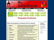
Geography Vocabulary
In this identifying geographic terms and their definitions online interactive worksheet, students match the vocabulary words with their definitions. Students match 24 answers.
Arizona Geographic Alliance
Geography of Ancient Greece
In this geography skills worksheet, students read a selection about the geography of ancient Greece and then respond to 6 essay, short answer, and graphic organizer questions based on the selection.
Curated OER
State of Alabama
In this reading passages about the state of Alabama worksheet, students read about the state's geography, history, exploration, industry, and people and use the information to answer multiple choice and true and false questions. Students...
Curated OER
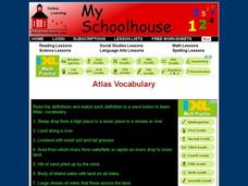
Atlas Vocabulary
In this atlas terms and definitions online interactive worksheet, learners read the definitions and match them with Atlas vocabulary words. Students match 49 answers.
Curated OER
Blowing and Flowing
Fifth graders compare and evaluate the rate of erosion from water and wind on three type of landscape: bare land, land with sparse vegetation, and land covered by dense vegetation.
Curated OER
Being There: Exploring China And Japan
Students discover the culture, society, geography, and history of Asia through games, food, art, and literature in this multi-day instructional activity about China and Japan. An exciting instructional activity for upper-elementary or...
Curated OER
Stressed to a Fault!
Eighth graders describe how stress builds up in the Earth's crust by the movement of tectonic plates. In groups, they relate the three types of stresses to the types of plate movements and explain how the stress causes faults to form. ...
Curated OER
Regional Landforms and Native People
Third graders study the Native American tribes of Maidu and Miwok by studying Internet artifacts, culture, language, music, storytelling, architecture, food, clothing, crafts and geology.
Curated OER
California: Land and People
Fourth graders research information about some of California indigenous tribes to find out as much as possible about the first people found in the four regions of California. They research the history of a selected tribe and their...
Curated OER
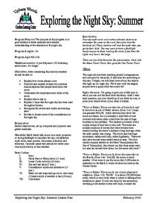
Exploring the Night Sky: Summer
Students explain how moon phases occur. They describe and explain at least two common misconceptions that people have about the moon. Students explain what a star is. They explain 3 ways that the night sky has been used throughout history.
Curated OER
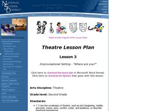
Improvisational Setting - "Where are You?"
Second graders explore setting through improvisations. In this theatre lesson, 2nd graders perform a variety of improvisations in different settings and chart how they established the setting in the different environments.
Curated OER
India and Its Climate
The climate found in different regions of India is the focus of this brief presentation. Learners discover that India has three main seasons; winter, summer, and monsoon. There isn't a lot for pupils to do with this PowerPoint, but it...
Curated OER
Salad Tray 3D Topographic Model
Learners explore the characteristics of topographical maps. They examine the relationship of contour lines and vertical elevation. Students create a three-dimensional model of a landscape represented by a topographic contour map.
Curated OER
Problems Encountered by Surveyors of Arkansas
Fifth graders examine the six geographic regions of Arkansas by examining the problems encountered by surveyors in Arkansas after the Louisiana Purchase. They conduct Internet research, create a chart, and write an essay comparing two...
Curated OER
Water Around and Around Again
Learners form a hypothesis for a water cycle experiment. In this water cycle lesson, students create their own environment with water and earth to study the water cycle. Learners complete a handout to make a hypothesis and prediction of...
Curated OER
Landforms - Landform Examples in the Philippines (Matching)
In this landforms worksheet, students match the landforms to their definitions. Students complete 10 matches on this worksheet and answer true and false and multiple choice questions about landforms in the Philippines.
Curated OER
Landforms By Hand: Geography, Map Skills
Students experiment with landform vocabulary by using their own hands and a bar of soap as media.
Curated OER
Geography Terms
Pupils identify different landforms and fill out a worksheet where they explain what each landform is. In this geography lesson plan, students fill in a landform map and then use landform words as they describe the landforms.
Curated OER
Bison or Buffalo?
Students discover the difference between the terms of Bison and Buffalo and the history of the animal in the early years of the country. They uncover the difference in species depending on the area of the country where the Bison were...


