Curated OER
Educational Technology Clearinghouse: Maps Etc: South America, 1902
A map from 1902 of South America showing the national boundaries at the time. The map shows capitals, major cities, ports, railroads, canals, rivers, and coastal features. Railroads appear as red lines, with important trunk lines shown...
Curated OER
Wikipedia: Natl Historic Landmarks in Mn: Charles A. Lindbergh House and Park
The Charles A. Lindbergh House and Park was once the farm of Congressman Charles August Lindbergh and his son Charles Lindbergh, the famous aviator. Their restored 1906 house and two other farm buildings are within the park boundaries....
Curated OER
University of Texas: Jamaica: Political Map
This site has a map of Jamaica. It's a clear, large map showing parish boundaries, roads and railroads.
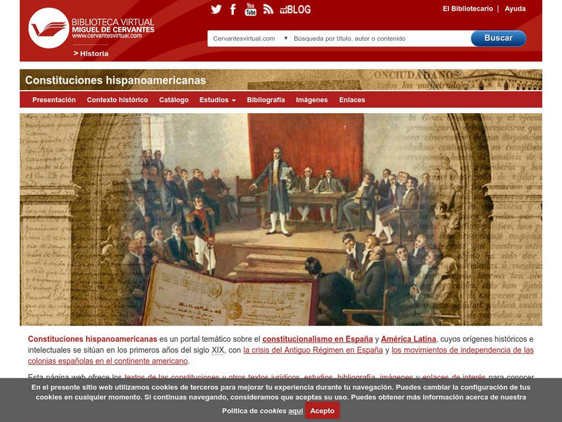
Biblioteca Virtual Miguel de Cervantes
Biblioteca Virtual Miguel De Cervantes: Paraguay
This resource site in Spanish for the country of Paraguay. The flag and a general map of the country are included. Of particular interest is the statistical data available on land size, climate, population, life expectancy, infant...
Biblioteca Virtual Miguel de Cervantes
Biblioteca Virtual Miguel De Cervantes: El Salvador
This resource site in Spanish for the country of El Salvador. The flag and a general map of the country are included. Of particular interest is the statistical data available on land size, climate, population, life expectancy, infant...
Biblioteca Virtual Miguel de Cervantes
Biblioteca Virtual Miguel De Cervantes: Costa Rica
This resource site in Spanish for the country of Costa Rica. The flag and a general map of the country are included. Of particular interest is the statistical data available on land size, climate, population, life expectancy, infant...
Biblioteca Virtual Miguel de Cervantes
Biblioteca Virtual Miguel De Cervantes: Colombia
This resource is on the country of Colombia. The flag and a general map of the country are included. Of particular interest is the statistical data available on land size, climate, population, life expectancy, infant mortality rate, and...
Biblioteca Virtual Miguel de Cervantes
Biblioteca Virtual Miguel De Cervantes: Espana
This resource site in Spanish for the country of Spain. The flag and a general map of the country are included. Of particular interest is the statistical data available on land size, climate, population, life expectancy, infant mortality...
Other
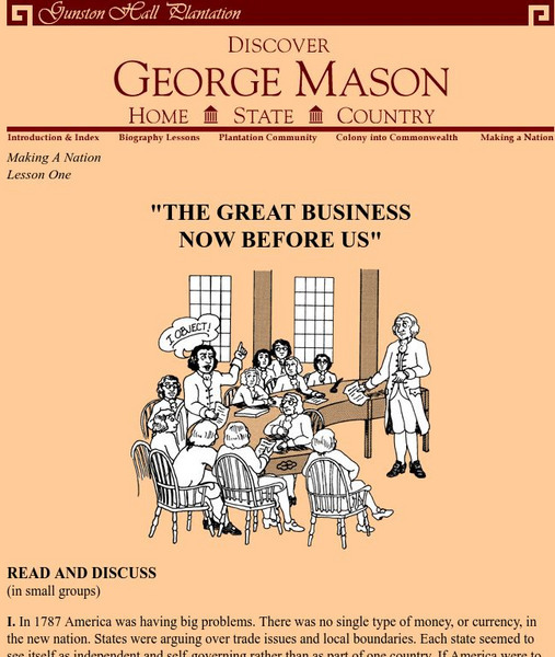
Gunston Hall Plantation: "The Great Business Now Before Us"
In 1787, America was having big problems. There was no single type of money, or currency, in the new nation. States were arguing over trade issues and local boundaries. Each state seemed to see itself as independent and self-governing...
Biblioteca Virtual Miguel de Cervantes
Biblioteca Virtual Miguel De Cervantes: Peru
This resource site in Spanish from the Biblioteca Virtual Miguel de Cervantes for the country of Peru. The flag and a general map of the country are included. Of particular interest is the statistical data available on land size,...
Biblioteca Virtual Miguel de Cervantes
Biblioteca Virtual Miguel De Cervantes: Uruguay
This resource site from the Biblioteca Virtual Miguel de Cervantes in Spanish for the country of Uruguay. The flag and a general map of the country are included. Of particular interest is the statistical data available on land size,...
Biblioteca Virtual Miguel de Cervantes
Biblioteca Virtual Miguel De Cervantes: Ecuador
This resource site from Biblioteca Virtual Miguel de Cervantes in Spanish for the country of Ecuador. The flag and a general map of the country are included. Of particular interest is the statistical data available on land size, climate,...
Biblioteca Virtual Miguel de Cervantes
Biblioteca Virtual Miguel De Cervantes: Puerto Rico
Bibliotica Virtual Miguel de Cervantes is an excellent resource site in Spanish for Puerto Rico. The flag and a general map of Puerto Rico are included. Of particular interest is the statistical data available on land size, climate,...
Biblioteca Virtual Miguel de Cervantes
Biblioteca Virtual Miguel De Cervantes: Panama
Excellent resource site from the Bibliotica Virtual Miguel de Cervantes in Spanish for the country of Panama. The flag and a general map of the country are included. Of particular interest is the statistical data available on land size,...
Biblioteca Virtual Miguel de Cervantes
Biblioteca Virtual Miguel De Cervantes: Nicaragua
This resource site from Biblioteca Virtual Miguel de Cervantes in Spanish is for the country of Nicaragua. The flag and a general map of the country are included. Of particular interest is the statistical data available on land size,...
Biblioteca Virtual Miguel de Cervantes
Biblioteca Virtual Miguel De Cervantes: Venezuela
This resource site from Biblioteca Virtual Miguel de Cervantes in Spanish for the country of Venezuela. The flag and a general map of the country are included. Of particular interest is the statistical data available on land size,...
Biblioteca Virtual Miguel de Cervantes
Biblioteca Virtual Miguel De Cervantes: Guatemala
This resource site from Biblioteca Virtual Miguel de Cervantes in Spanish is for the country of Guatemala. The flag and a general map of the country are included. Of particular interest is the statistical data available on land size,...
Biblioteca Virtual Miguel de Cervantes
Biblioteca Virtual Miguel De Cervantes: Argentina
This resource site from Bibliotica Virtual Miguel de Cervantes in Spanish for the country of Argentina. The flag and a general map of the country are included. Of particular interest is the statistical data available on land size,...
Biblioteca Virtual Miguel de Cervantes
Biblioteca Virtual Miguel De Cervantes: Honduras
This resource site from Biblioteca Virtual Miguel de Cervantes in Spanish for the country of Honduras. The flag and a general map of the country are included. Of particular interest is the statistical data available on land size,...
Biblioteca Virtual Miguel de Cervantes
Biblioteca Virtual Miguel De Cervantes: Chile
This resource site from Bibliotica Virtual Miguel de Cervantes in Spanish for the country of Chile. The flag and a general map of the country are included. Of particular interest is the statistical data available on land size, climate,...
Curated OER
Educational Technology Clearinghouse: Maps Etc: Southern California, 1920
A map of Southern California from 1920 showing the major cities and towns, railroads, National Park boundaries, National Forest boundaries, Indian reservation boundaries, mountain systems, lakes, rivers, and coastal features.
Curated OER
Educational Technology Clearinghouse: Maps Etc: Southern California, 1911
A map of Southern California from 1911 showing the major cities and towns, railroads, National Park boundaries, National Forest boundaries, Indian reservation boundaries, mountain systems, lakes, rivers, and coastal features. A grid...
Curated OER
Educational Technology Clearinghouse: Maps Etc: California (Southern), 1920
A map of Southern California from 1920 showing the counties and county seats, major cities and towns, railroads, National Park boundaries, National Forest boundaries, Indian reservation boundaries, mountain systems, lakes, rivers, and...


