Curated OER
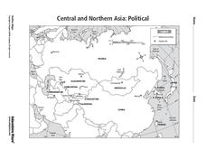
Central and Northern Asia: Political
In this Central and Northern Asia map worksheet, students examine national political boundaries and national capitals in this region of the world. The map is labeled.
Curated OER
Central and Northern Asia: Political
In this Central and Northern Asia outline map, learners examine the political boundaries of the nations in this region and note the location of their capital cities. This unlabeled map may be used in a variety of classroom activities.
Curated OER
Surveying the Land
Students explore the different kinds of maps and the purpose of each. In this Geography lesson, students work in small groups to create a map which includes the use of a map key.
Curated OER
A Model of Three Faults
Students investigate faults. In this science lesson, students explore the many stresses and strains in the earth's layers and research the types of faults in their state.
Curated OER
How would an oil spill affect a Marine Sanctuary?
Students explore the concept of environmental stewardship. In this science activity, students discover how scientists assess damages to the environment following oil spills. Students conduct a simulation of a public meeting in order to...
Curated OER
Afghanistan in ruins
Students think about and internalize how they would help to rebuild a country. They study the meaning of global interdependence and why rich countries help poor countries. They also explore different types of international aid and...
Curated OER
Earthquake Depth
Students research and locate earthquake epicenters on a map using latitude and longitude. They determine if the depth of an earthquake has any relationship to the distance from a plate boundary.
Curated OER
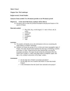
The Landscape of Poland
Students recognize and re-create the political boundaries and physical features of the nation of Poland. They create three dimensional topographic maps of Poland. In addition, they compose two journal entries written in two different...
Curated OER
The Landscape
Students recognize and recreate the political boundaries and physical features of the nation of Slovakia. They create topographic maps of Slovakia. The maps should include labeled line drawings of bordering countries. Slovakia should be...
Curated OER
Canada's Geographic Position
Ninth graders investigate the characteristics of the geographic position of Quebec and Canada in the World. They study Canada's land and water boundaries, surface area and time zones.
Curated OER
The Geologic TimeString
Students create a simple tool to visualize geologic time. They create knots to represent the K/T, P/T and Precambrian boundaries in a 4.6 meter string with each millimeter representing one million years. They then refer back to this...
Curated OER
Map Skills
Students examine the nations, battlefields, troop movement of the Germans through Belgium and the location of both fronts during World War I by creating a map. They visualize the strength of the Germans early in the war.
Curated OER
Why Does Delaware Have Such A StrangeShape?
Middle schoolers examine the events and history surrounding the boundaries of Delaware. They participate in a class discussion and analyze a map, then create a floor map using masking tape. Students also participate in a play about the...
Curated OER
United States of America: 1860
In this United States historical map worksheet, students examine the boundaries of the labeled states and territories of the nation in 1860.
Curated OER
United States of America: 1860
In this United States historical map worksheet, learners examine the boundaries of the states and territories of the nation in 1860. This map is unlabeled.
Curated OER
Microsoft Publisher Country Brochure
Young scholars explore geographic information. In this geography and technology lesson, students choose a county and answer related questions on a Webquest. Young scholars create a word web and design a country brochure.
Curated OER
Our Compromise, Our Constitution
Sixth graders explore, analyze and study our constitutional government and become aware of the purpose of our government. They assess the basic rights that are protected by the United States Constitution through graphic organizers and...
Curated OER
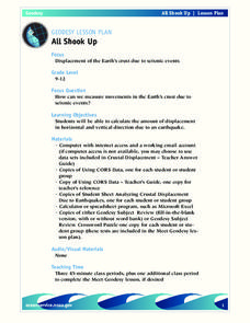
All Shook Up
Students measure movements in the Earth's crust due to seismic activity. Students calculate the amount of displacement in horizontal and vertical direction due to an earthquake.
Curated OER
United States Map
In this United States political map worksheet, students examine national and state boundaries. The map also highlights the location of each of the state capitals and the national capital.
Curated OER
World Political Map
In this blank outline map worksheet, students note the political boundaries of the nations of the world on a Mercator projection map.
Curated OER
United States 1860
For this United States historical map worksheet, students examine the state and territorial boundaries as well as the large cities of the nation in 1860.
Curated OER
Europe: Political Map
In this Europe political map worksheet, students examine each country's boundaries. The map also highlights each of the nation's capitals with a star.
Curated OER
South east Asia and the South Pacific: Political: Labeled Map
In this Asia and the South Pacific map worksheet, students examine the boundaries of the nations in this region of the world. Students also note the location of capital cities as they are denoted by stars. This map is labeled.
Curated OER
United States of America Map
In this United States of America map worksheet, students examine boundaries of each of the 50 states in the nation. This map not is labeled.


