Curated OER
Regents High School Examination: Physical Setting Earth Science 2006
Test your class on earth science with this extensive resource. This test, created by The University of the State of New York Regents, is made up of 50 multiple choice questions and 32 short answer questions that cover the branches of...
New York State Education Department
Global History and Geography Examination: June 2012
Want to find out how much class members really know about history? A copy of a New York state test assesses scholars' knowledge of world geography and history in a multi-format test that includes multiple choice and essay items. The...
Curated OER
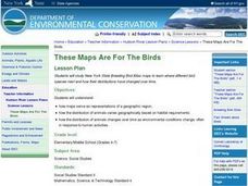
These Maps are for the Birds
Students identify and study New York State Breeding Bird Atlas maps to learn where different bird species nest and how their distributions have changed over time. They also identify how maps serve as representations of a geographic...
Syracuse University
Erie Canal
While canals are not the way to travel today, in the first half of the nineteenth century, they were sometimes the best way to move goods and people. Scholars examine primary sources, including maps and pictures, to investigate the role...
Curated OER
Mapping Where Animals Live
In this animal mapping worksheet, students read a short passage about amphibians and reptiles in New York State, then use a set of maps to answer related questions.
Curated OER
States Research Project
Eighth graders create an in-depth research report on a state. They conduct Internet research, write a comparison essay about New York State and their assigned state, create a 3-dimensional map, and develop a Powerpoint presentation.
Curated OER
The Gold Rush
Young scholars identify the routes involved in the Gold Rush on a map. In this map skills instructional activity, students use a United States map to locate the routes used to travel to California during the Gold Rush. Young scholars...
Curated OER
Using Social Studies in Five Shared Reading Lessons: Geography
After several short 15-minute mini-lessons, your learners will gain an understanding of the characteristics of a non-fiction text. Using the book Map It by Elspeth Leacock, your class will become acquainted with non-fiction terms such as...
Curated OER
Run/Walk Across America
Walk, jog, or run across America. Maps of individual states, visual progress, competition, and rewards, seem to be great motivational ideas. Make sure that the distances that each class has to walk or run are the same, because getting...
Teach Engineering
Where Are the Plastics Near Me? (Mapping the Data)
The last activity in a nine-part series has teams create a Google Earth map using the data they collected during a field trip. Using the map, groups analyze the results and make adjustments to the map to reflect their analysis. A short...
Curated OER
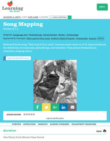
Our Land Lesson 2: Song Mapping
Students study the meaning of philanthropy as giving of time. talent, and treasures. They sing This Land Is Your Land while locating five of the places on a map of the United States showing that relief office are everywhere. They decide...
Curated OER
Grand Celebration! Broadside
Learners research the construction and history of the Erie Canal. They answer discussion questions in small groups, draw and label the Erie Canal on a map of New York State, read and discuss a handout, and complete a worksheet.
Curated OER
Mapmaker, Mapmaker, Make Me a Map!
Learners evaluate the different types of historical and geographical information that one can gather through close study of historical maps from the 16th through the 19th centuries. They create their own maps.
National Endowment for the Humanities
African-American Communities in the North Before the Civil War
Middle schoolers may be surprised to learn that before the American Civil War there were more slaves living in New York than there were in Kentucky! Young historians examine maps and census data to gather statistics about...
Curated OER
Song Mapping
Learners explore locations on the United States map. In this map skills activity, students recite the song This Land Is Your Land and locate various places listed in the song on the map.
Curated OER
New York State Testing Program: English/Language Arts Book 1, Grade 4
In this 4th grade English/Language Arts standardized test practice worksheet, students read 2 fictional selections and respond to multiple choice and open-ended questions regarding the pieces. Students also read 2...
NYC Department of Records
Citizenship and Elections: The Importance of a Ballot
Approximately 58 prcent of those eligible voted in the 2016 US Presidential election. In an attempt to impress upon learners the importance of voting and voting rights, class members examine primary source documents related to the...
Curated OER
Working With Electronic Topography Maps
Junior geologists examine topographic maps online and learn how to read them. they answer seven associated follow-up questions. This lesson plan is only a general outline and does not provide the details or the websites that you would...
Curated OER
U.S. Political Map
In this political map activity, students use the map of the United States and the 7 cities to measure the straight-line distance between the cities. Students add the total number of miles traveled and write their answers in the spaces.
New York State Education Department
US History and Government Examination: June 2018
Ready to test your learners about anything and everything related to United States history and government? The resource uses multiple-choice and essay questions to assess knowledge.
Curated OER
How Do Cartographers Find Points on a Map?
Ninth graders describe latitude and longitude and how they may be useful to find things on a map. In this cartography lesson students divide into groups and devise a coordinate system that can be used to communicate a position.
Curated OER
The United States in 1790
In this geography skills worksheet, students study the provided map of the United States in 1790 and then complete the provided quiz over the 17 states and territories.
Curated OER
Map Studies - Estimate And Measure Distance
First graders explore estimating and measuring distances. They analyze and discuss a map of New York State, make estimations, measure distances using yarn, and calculate total distances between cities on the map.
Curated OER
The Rigors of Learning a New Language
Young scholars examine the experiences of a Peace Corps volunteer learning to speak Chinese. They read and discuss an essay written by the Peace Corps volunteer, analyze a map of China, and discuss the author's difficulties in learning...


