Curated OER
Rockin' Round New York State
Students discuss their favorite rock groups and bands. They create rock groups that will be touring New York State. Students research cities in New York, determine dates of concerts, create touring itineraries, and develop Inspiration...
Curated OER
Mapping Where Animals Live
What type of reptiles live in New York State? This lesson gets the class thinking about what factors determine where particular animals live. They analyze the Hudson Valley environment, identify specific reptile and amphibian...
Curated OER
Welcome to New York State
Students choose one region of New York state, and create a travel brochure that includes information such as geographical features, tourist attractions, accesibility, economic features, and historical events that occured in that region.
Curated OER
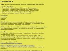
Our community and New York City
Fourth graders research websites to gather information about New York City and the Ridgewood community. In this New York City and Community lesson, 4th graders make a semantic map. Students write short postcards to send to students...
Curated OER
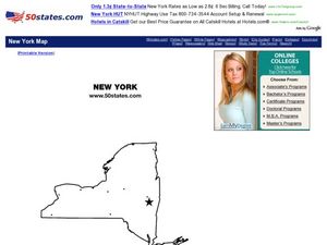
New York Map
In this state map instructional activity, students identify the state map of New York. Students fill in the state capital, major cities, and other state attractions.
Curated OER
The Mystery of Exploration
Young scholars comprehend the history of European exploration of North America. They are introduced to basic reasearch techniques. Students focus on four explorers who visited New York State: Verrazano, Cartier, Champlian, and Hudson. ...
Curated OER
Five Days in New York City
In this New York City worksheet, students look at websites given and answer short answer questions about New York City. Students complete 15 questions.
Curated OER
U.S. geography for Children: New York
In this geography worksheet, 5th graders study the state of New York. Students follow the given directions to complete 5 tasks on the state map that is given.
Curated OER
Sightseeing in New York City
Students practice locating tourist attractions in New York City, and ask for location and directions in their own hometown.
Curated OER
Study of New York City
Fourth graders read A Cricket in Times Square and examine the essence of living in New York City. They examine subway maps and other resources concerning NYC and then complete several writing activities about the city. They also create...
Curated OER
The Geography of the United States
Full of bright maps and interesting information, this presentation details U.S. Geography. Slides include basic facts about size, regions, topography, and demographics, as well as fascinating trivia about the United States, including...
Curated OER
Rivers Run Through It
Using a relief map of New York State, learners answer questions about the distance between different cities, identify bodies of water, and more. First, they discuss vocabulary related to the Hudson River area. Then, they complete a...
Curated OER
Document Based Question: Erie Canal
Fourth graders read the provided documents about the Erie Canal to discover the impact that this transportation systems had on the New York community. In this history lesson plan, 4th graders first analyze the documents and answer the...
Curated OER
Map Memory
Fifth graders, working in a whole class setting, label a United States map with the names of all the states that they know. They transfer the names of the states to an individual map and color it. Next, they receive directions on how to...
Curated OER
New York Earns Title: Empire State
Seventh graders study the Erie Canal and New York state. They design a three-day vacation itinerary using tourism sites, which highlight historical facts and include the modern remains of the New York Canal system.
Curated OER
State to State Scavenger Hunt
In this states worksheet, students utilize the Internet to access one specific website to locate the answers to five fill in the blank statements about the states found on a United States map.
Curated OER
Map of New York State
In this map worksheet, students view a blank map of New York. Worksheet does not come with any associated activities, but does have "dots" designating cities on the map.
Curated OER
Do You Know Your 50 States?
Learners use the names and abbreviations of the 50 states to label a blank map of the United States.
New York State Education Department
Global History and Geography Examination: June 2012
Want to find out how much class members really know about history? A copy of a New York state test assesses scholars' knowledge of world geography and history in a multi-format test that includes multiple choice and essay items. The...
Curated OER
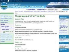
These Maps are for the Birds
Young scholars identify and study New York State Breeding Bird Atlas maps to learn where different bird species nest and how their distributions have changed over time. They also identify how maps serve as representations of a...
Syracuse University
Erie Canal
While canals are not the way to travel today, in the first half of the nineteenth century, they were sometimes the best way to move goods and people. Scholars examine primary sources, including maps and pictures, to investigate the role...
Curated OER
States Research Project
Eighth graders create an in-depth research report on a state. They conduct Internet research, write a comparison essay about New York State and their assigned state, create a 3-dimensional map, and develop a Powerpoint presentation.
Curated OER
The Gold Rush
Students identify the routes involved in the Gold Rush on a map. In this map skills lesson, students use a United States map to locate the routes used to travel to California during the Gold Rush. Students demonstrate how to use the map...
Curated OER
Using Social Studies in Five Shared Reading Lessons: Geography
After several short 15-minute mini-lessons, your learners will gain an understanding of the characteristics of a non-fiction text. Using the book Map It by Elspeth Leacock, your class will become acquainted with non-fiction terms...


