Curated OER
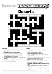
Deserts Crossword
In this geography crossword puzzle, students answer twenty-one questions about deserts. Among the topics are plants, animals, and terrain.
Curated OER
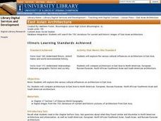
East Asian Architecture
Seventh graders compare architecture in East Asia to North American, European, Russian/Eurasian, North African/Southwest Asian and South American architecture. They search the internet for current and historic images of East Asian...
Curated OER
Southeast Asian Architecture
Seventh graders search online for current and historic images of Southeast Asian architecture. They compare architecture in Southeast Asia to North American, European, Russian/Eurasian, North African/Southwest Asian and South American...
Curated OER
Identifying Continents and Oceans
Students locate and identify the four major oceans and the seven continents on a world map. They use an unlabeled world map and compass rose to describe relative locations of the continents and oceans.
Curated OER
Land of the Rising Sun
Students survey aspects of traditional and modern Japanese customs and beliefs in the seven lessons of this unit. Both the culture and the geography of the country are studied in this unit.
Curated OER
Deserts Puzzle
In this geography worksheet, students complete a crossword puzzle referring all to deserts. They identify the various types of desert land and what plants and animals can survive in these lands. Also, students identify the people who...
Curated OER
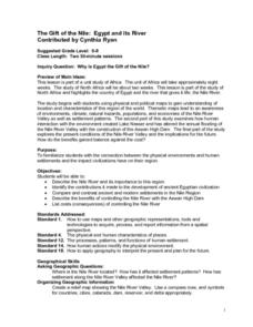
The Gift of the Nile: Egypt and its River
Students begin with a piece of a puzzle that shows an artifact from ancient Egypt. They find others who have pieces that go with their puzzle piece. Students work in these groups to construct a relief map of the Nile River Valley.
Curated OER
Maps that Teach
Students study maps to locate the states and capital on the US map. Students locate continents, major world physical features and historical monuments. Students locate the provinces and territories of Canada.
Pulitzer Center
Revolution in Tunisia
How much do your pupils really know about the revolution in Tunisia? In order to inform your class and spark discussion, first create a country profile, comparing and contrasting Tunisia with the United States. Learners then analyze the...
Curated OER
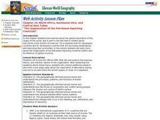
The Organization of the Petroleum Exporting Countries
Pupils investigate the global importance of the African and Asian countries that export petroleum. They access the OPEC website and research this organization. They answer questions and write an essay about alternative energy sources.
Curated OER
Veni, Vidi, Vici
Students participate in a Roman festival to complete a unit on Roman Civilization. In this Roman Civilization lesson plan, students learn about Cleopatra, Julius Caesar, the Mediterranean Region, and more. Students share what they...
VIF Learning Center
Languages as Reflection of Cultures and Civilizations: French Speaking Countries
Expand your class's vision of the French-speaking world by conducting this research project. Pupils focus on building 21st-century skills while they look up information about a French country and put together presentations.
Curated OER
Who Dropped What into the Melting Pot?
Students show the movement of people to the United States from other countries on maps. They study the geographic cultural roots of foods that contribute to the melting pot of food in America. They research where an ingredient comes from...
Curated OER
Peace in Palestine?
Seventh graders imagine themselves to be one of the characters listed in the simulation handout imbedded in this plan. In character, and working in groups, 7th graders simulate a conversation that would be held around the table, in each...
Curated OER
Dead Sea Investigation: Middle East and African Connections
Learners demonstrate comprehension of the physical characteristics of the Dead Sea region and its connection to the Red Sea and the African Great Rift Valley. They are given students the opportunity to understand the role of plate...
Curated OER
Globe Game
Learners are arranged into groups and are given a map or globe. Students select a location on the map. Learners as yes and no questions to guess the specific place that was chosen.
Curated OER
Population Density
Students examine world population density and population distribution. They create pie charts showing population distribution and analyze population patterns in the United States and major regions of the world. They identify...
Curated OER
Create a World
Students combine imaginative powers with known map-making techniques to create a whole new world.
Curated OER
World Hunger - A Cultural Crisis
Students explore the problem of world hunger and starvation. After a class discussion, students use a map to identify specific areas where populations are starving. In groups, students research reasons for the lack of food. They prepare...
Curated OER
European Exploration, Trade and Colonization
Students complete many activities including mapping, reading books, and Internet research to learn about European exploration. In this European lesson plan, students study geographical mapping, trade, and colonization.
Curated OER
We've got the whole world in our hands
Students explore spatial sense in regards to maps about the globe. In this maps lesson plan, students label oceans, locate the continents and poles, follow directions, and explain the symbols on a map.
Curated OER
Yo-ho, Yo-ho a Viking's Life for Me
Students complete a unit of lessons on the Vikings. They analyze maps, read and discuss myths, summarize the main ideas from resource materials, watch videos, sing a song, draw a picture to illustrate Norse mythology, and define key...
Curated OER
Drake’s West Indian Voyage 1588-1589
Students examine the exploration routes of Sir Francis Drake. In this American exploration lesson, students investigate primary sources to trace the routes and contact with the natives that Sir Francis Drake experienced on his voyages in...
Curated OER
Pangaea Puzzle Pieces
Learners i examine 10 pieces of evidence for the Pangaea theory and use them to reconstruct the super continent. They determine that land masses on Earth are slowly changing shape as a result of moving for millions of years.


