Curated OER
The Colonization of Liberia
Students analyze how slavery shaped social and economic life in the South. They study methods of passive and active resistance to slavery, and the similarities and differences between African-American and white abolitionists.
Curated OER
Passport to Stories Around the World
Students read stories from various cultures and create a passport indicating the completion and comprehension of the story. The template for the passport is included. The instructional activity can be used for a broad range of ages...
Curated OER
The Roman Empire
Fourth graders identify the reasons behind the fall of the Roman Empire and describe the changes that occurred after the fall of the Roman Empire.
Curated OER
How to Celebrate the 800th Anniversary of the Mogol Empire
Students research information on the Mongolian Empire from various readings and online videos of primary sources and create a poster for oral presentation. Students connect history with the current day, while incorporating geographical,...
Curated OER
Rome Comes to Third Grade
Students explore the world of Ancient Rome in this thirteen lessons unit. the rise and fall of the Roman Empire is probed. The ideals that inspired the people's sense of purpose are developed in these lessons.
Curated OER
Getting to Know My World
Students participate in hands-on activities using maps and globes to identify geographical features. Students use map legends to identify direction. Students locate oceans, continents, countries, states and cities. Handouts and...
Curated OER
This Land is Your Land
Students consider the concept of borders and their development by looking at maps and documents. They create a presentation highlighting a current border dispute and propose solutions.
Curated OER
Animals in Myths and Real Life
Students research the role of lions, elephants, and bears in ancient Roman life and mythology. They develop a strong understanding of the role animals played in important ancient Roman historical events and myths.
Curated OER
Mapping Population Changes In The United States
Students create a choropleth map to illustrate the population growth rate of the United States. They explore how to construct a choropleth map, and discuss the impact of population changes for the future.
Curated OER
Marcus's Big City Adventure
Fourth graders review their knowledge of nutrition and the 5 food groups. Then they read a story which involves food from Ethiopia, India, and Mexico. They examine these foods and their nutrients, considering the health value of each.
Curated OER
The Roman Empire-Map Activity
In this Roman Empire worksheet, students complete a map activity in which they label and color civilizations, countries and physical features as instructed. There are no maps included.
Curated OER
Regions of South America
Students explore facts about South America in the four lessons of this unit. Booklets are created from the materials produced as the class delves into the topic.
Curated OER
Landforms All Around
Students create a "Landform Dictionary". They develop an overlay map and participate in hands-on activities to identify the key characteristics of landforms. They discuss the plant and animal life of these areas. Handouts for the lessons...
Curated OER
Old World and New World - Why Contact Took So Long
Students use a globe to determine why contact between the old world and the new world took a long time. In this map skills lesson, students analyze routes between regions to determine why it took so long for the old world and the new...
Curated OER
Australian Travel Adventure
Seventh graders are introduced to the states and territories within Australia. Using the internet, they bookmark sites and take notes on what they want to share with their classmates. They also complete a map study on the country to...
Curated OER
Trekking to Timbuktu
Students view a television show to provide a context for conducting research into the location and culture of Timbuktu. The students complete a report on the subject in the form of a research paper.
PBS
Pbs News Hour Extra: Lesson Plan: Middle East and North Africa Geography
Enhance student geography knowledge of the Middle East and North Africa with this two or three day lesson plan.
Georgia Department of Education
Ga Virtual Learning: World Geography: North Africa/southwest Asia
Comprehensive learning module on the geography of North Africa and Southwest Asia. Multi-media resources and assessment.
Other
Harper College: North Africa/ Sw Asia Map Tutorial
Quiz yourself on the physical geography of Southwest Asia and North Africa by using this tutorial to Check your knowledge of landforms, bodies of water, and rivers in this area of the world.
Lizard Point Quizzes
Lizard Point: Northern Africa: Countries Quiz
Try this interactive geography quiz which tests your knowledge about the countries in Northern Africa.
Choices Program, Brown University
Choices: Teaching With the News: Protests, Revolutions, and Democratic Change
Third in a series of lessons on North Africa and the Middle East in which students survey the current political situation, consider the role of the international community and identify the political geography of the region. Multi-media...
Louisiana Department of Education
Louisiana Doe: Louisiana Believes: World Geography: Oil in the Middle East and Africa
Students develop and express claims through discussion and writing which examine the importance of oil and water to the success and survival of the Middle East and North Africa.
Ducksters
Ducksters: Geography for Kids: Libya
Learn about Libya's history and geography on this site.
Nations Online Project
Nations Online: Morocco
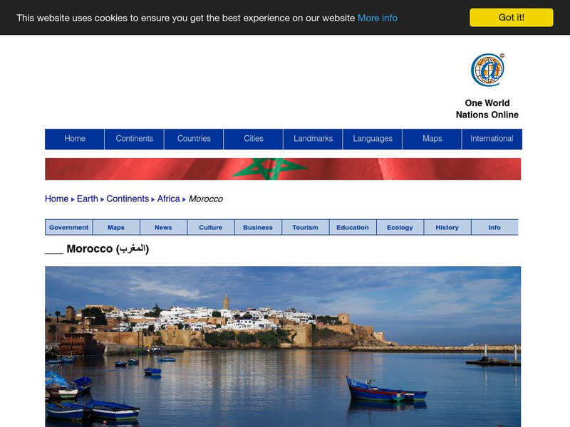
Great reference source that takes you on a virtual trip to the North African nation of Morocco. Background overview is given on its art, culture, people, environment, geography, history, economy, and government. There are numerous links...


