Curated OER
African Safari
Seventh graders examine different countries in Africa to research. They choose one to concentrate their research on using the five themes of geography. They design a multimedia presentation that will make up the African safari.
Curated OER
Wild Habitats
Learners research and Illustrate the natural habitats of giraffes and other animals imported into ancient Rome. They draw a map of Europe, North Africa, and West Asia and draw the animals that come from each region in their proper places.
Curated OER
Animal Invasion
Students research and illustrate the natural habitats and evolution of giraffes and other animals imported into ancient Rome. They draw a map of Europe, North Africa, and West Asia and draw the animals from each region in their proper...
Curated OER
Exploring an Atlas
Young scholars explore global geography by participating in an atlas activity. In this countries of the world lesson, students collaborate in small groups and analyze an atlas while researching continents, countries and demographics....
Curated OER
The Geography of the United States
Full of bright maps and interesting information, this presentation details U.S. Geography. Slides include basic facts about size, regions, topography, and demographics, as well as fascinating trivia about the United States, including...
Penguin Books
A Teacher's Guide to the Signet Classic Edition of William Shakespeare's Antony and Cleopatra
Was Antony "transformed/Into a strumpet's fool," as Philo declares? (I, i) Was Cleopatra "green in judgment"? (I,5) A guide to Antony and Cleopatra, Shakespeare's tragedy, provides instructors with a framework for teaching the play about...
Curated OER
Africans in Mexico
Students read case studies to examine the role of Africans in Mexico. Using maps, they research the areas that are discussed in the text and map out movement maps of Africans to and from Africa. They research the history of the Mexico...
Curated OER
Old World and New World - Why Contact Took So Long
Learners use a globe to determine why contact between the old world and the new world took a long time. In this map skills lesson, students analyze routes between regions to determine why it took so long for the old world and the new...
Curated OER
Global Lesson: Social Studies On-Line Global Lesson: Social Studies On-Line Continents
In this geography PowerPoint a simple world map on which each continent is represented by a solid green landform is the background for each of the nine slides. The continent names appear in a list on the first slide, followed by one...
Curated OER
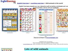
Wild Animals in the World
In this wild animals instructional activity, students answer multiple choice map questions, choose the correct animal names for the pictures, and more. Students complete 4 activities.
Curated OER
World Map and Globe - Lesson 15 (K-3)
Students discover mountain ranges and their locations in the world. In this physical map instructional activity, students locate and identify major mountain ranges of the world on a large physical map.
Curated OER
Getting to Know My World
Students participate in hands-on activities using maps and globes to identify geographical features. Students use map legends to identify direction. Students locate oceans, continents, countries, states and cities. Handouts and...
Curated OER
Continents
Students investigate World Geography by researching the different continents. In this Asian Geography lesson, students discuss the continent of Pangaea and color a worksheet of the continents. Students locate China on the map worksheet...
Curated OER
The Brief American Pageant: American in World War II
From the home front to the middle of Europe, America's presence in World War II was forever transitioning with the strain of war. The variety of maps and charts offered in this presentation helps to contextualize the 1940's. The amount...
Curated OER
Maps that Teach
Students study maps to locate the states and capital on the US map. Students locate continents, major world physical features and historical monuments. Students locate the provinces and territories of Canada.
Curated OER
Globe Game
Young scholars are arranged into groups and are given a map or globe. Students select a location on the map. Young scholars as yes and no questions to guess the specific place that was chosen.
Curated OER
Garb and Grub Across the Globe
First graders discuss what part of the world their ancestors came from. They locate the locations on a map and discuss the differences and similarities of each continent and their people. They become familiar with the traditional...
Curated OER
World Hunger - A Cultural Crisis
Young scholars explore the problem of world hunger and starvation. After a class discussion, students use a map to identify specific areas where populations are starving. In groups, young scholars research reasons for the lack of food....
Curated OER
European Explorers of North and South America
Sixth graders explore the connection between the geography of America and the migration of the Native Americans to the American continents to the future conquering of the continents by the Europeans. They discuss the causes and effects...
Curated OER
The Seven Continents Scavenger Hunt
Who doesn't enjoy an engaging scavenger hunt? Here, scholars listen to, and discuss, the informative text, Where is my Continent? by Robin Nelson. They then explore the seven continents and four major oceans using Google Earth.
Curated OER
ASWAN HIGH DAM
Students use modeling compound, Lego blocks, water, paper and tape to construct and label the Aswan High Dam.
Curated OER
Yo-ho, Yo-ho a Viking's Life for Me
Students complete a unit of lessons on the Vikings. They analyze maps, read and discuss myths, summarize the main ideas from resource materials, watch videos, sing a song, draw a picture to illustrate Norse mythology, and define key...
Curated OER
New Food Saves Lives, Could End Hunger
Students locate the country of Niger, then read a news article about a new type of food that is being used to fight childhood hunger in Africa. In this current events lesson plan, the teacher introduces the article with map and...
Curated OER
Dissolution of the Ottoman Empire
In this Ottoman Empire learning exercise, students read a 3-page selection and examine maps pertaining to the topic and then respond to 7 short answer questions.


