Curated OER
Mali
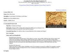
Seventh graders begin the lesson by reading primary sources about the country of Mali. Using maps drawn in the past, they discuss what they can gather about the country from the map and how it has changed over time. They use a graphic...
Curated OER
Who Dropped What into the Melting Pot?
Students show the movement of people to the United States from other countries on maps. They study the geographic cultural roots of foods that contribute to the melting pot of food in America. They research where an ingredient comes from...
Curated OER
Dead Sea Investigation: Middle East and African Connections
Students demonstrate comprehension of the physical characteristics of the Dead Sea region and its connection to the Red Sea and the African Great Rift Valley. They are given students the opportunity to understand the role of plate...
Curated OER
The Phoenicians and the Beginnings of the Alphabet
Students research the history of the alphabet and the Phoenician people. In this alphabet history lesson, students view images of Phoenician ships and discuss their trading abilities. Students view various locations on a map and visit...
Curated OER
What the Empire Lost: The Ottoman Empire
In this Ottoman Empire worksheet, students read a 1-page selection about the decline of the empire, examine the provided map on the topic, and then respond to 5 short answer questions about the information presented.
Curated OER
European Explorers
Students research one of seventeen explorers before filling in a worksheet. Next, they write a song verse using the information and sing it to the tune of "Row, Row, Row Your Boat." On the next day, they play a game of "Who Am I?" using...
Curated OER
Identifying Continents and Oceans
Learners locate and identify the four major oceans and the seven continents on a world map. They use an unlabeled world map and compass rose to describe relative locations of the continents and oceans.
Curated OER
History/Geography
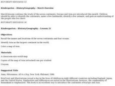
Students review North America, Africa, Europe and Asia. They identify Australia as the smallest continent. They identify Australia as an island continent nicknamed "the land down under." They color a map of Australia.
Curated OER
Where in the World? Oceans & Continents
In this geography worksheet, students answer 6 questions using a coded map as a reference, then students identify labeled geographic features.
Curated OER
The Science of Weather: Hurricanes
Students use this USA today activity to learn about hurricane season. In this hurricane lesson, students study the map of the earth and hurricane science. Students complete discuss questions. Students draw a map of the United States and...
Curated OER
Mesoamerica
Students demonstrate knowledge of early Middle American civilizations. They study Mesoamerican i religions, governments, and achievements. They identify geographies of North and South America.
Curated OER
Travel to Mesoamerica
Students research books, watch movies, and look on the internet to find information on ancient America, Mexico, and Central America. In this Mesoamerica lesson plan, students participate in a social studies unit on North America of the...
Curated OER
Introduction to the World Globe
Students examine a globe and the world map to see what constitutes the differences. In this world map introductory lesson, students discuss what they see when they view the globe. Students then, look at a world map and compare the...
Curated OER
U.S. Archaeological Sites: Geography Practice
In this archaeological sites worksheet, students read about sites in the Unites States and use a map to complete a set of 7 short answer questions.
Curated OER
Region Reality
Eighth graders compare and contrast world regions and explore the theme of world regions. In this world geography instructional activity, 8th graders name regions in the U.S. and mark them on a map. Students discuss the cultural and...
Curated OER
Jamestown Journey Part 1
Fourth graders work to solve one of the major problems facing the Jamestown settlers, the best location to settle upon arrival in Jamestown. Students discuss and review the past European and American events that lead to the...
Curated OER
Sports Franchises: The Demographic Dimension
Students examine how U.S. population patterns have changed over time. Using the growth of major league baseball to illustrate these patterns, students create maps, examine regional migration patterns, and make predictions for the future.
Bismarck Public Schools
Chapter 9 Review WKST
Here is a traditional multiple-choice, true/false, and fill-in-the-blank assessment on the presidency of James Monroe in the United States. It was designed to supplement a particular textbook chapter, but could be used to assess learning...
Curated OER
Life and Times, Developing a Chronology
Students review the career and life of Ernie Pyle as an example of a biography in context. They consider how a chronology maps out the events in the life of an individual in the context of other events that were occurring at the same time.
Curated OER
African Masks (Pre-Visit)
Second graders observe and describe several masks from different parts of Africa housed in the Smithsonian Institute (National Museum of African Art) Washington, D.C. They use the internet to view the Smithsonian's virtual exhibits.
Curated OER
Landforms All Around
Students create a "Landform Dictionary". They develop an overlay map and participate in hands-on activities to identify the key characteristics of landforms. They discuss the plant and animal life of these areas. Handouts for the lessons...
Curated OER
Australian Travel Adventure
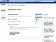
Seventh graders are introduced to the states and territories within Australia. Using the internet, they bookmark sites and take notes on what they want to share with their classmates. They also complete a map study on the country to...
Owl Teacher
Teach Ancient Rome!
Teaching the class about Ancient Rome can be fun for you and for them! Check out this incredible resource that has everything you need to bring ancient Roman civilization back to life. Begin by scrolling to the bottom of the page and...
Curated OER
World War II - The Allied Response
Your class will benefit from this excellent presentation on World War II, and the Allied Response to Hitler's threat. The PowerPoint is packed with important information about battles, key figures in the war, and has an excellent...


