Curated OER
Tension Over Slavery
Eighth graders research the events that lead to the US Civil War. They use the Jigsaw technique to report the findings of their research.
Curated OER
Korean War
Students identify and interpret general information about the Korean War, including important dates, terms, events, and participants. They also identify what the Cairo Declaration was and what military forces, political forces, and...
Curated OER
An American Legacy-Lewis and Clark’s Corps of Discovery Study
Fifth graders travel with the Corps of Discovery. In this ancient civilizations lesson, 5th graders research print and Internet sources about the Lewis and Clark expedition. Students prepare PowerPoint presentations to share their...
Curated OER
Deerfield Matures: Deerfield's Changing Economy
Eleventh graders explain that Deerfield became prosperous because of the river trade and improved agricultural practices. They examine how transportation and communication were improved.
Curated OER
Columbus' Perception of the New World
students investigate readings relating to the voyage of Columbus in 1492 and to make historical connections based on those readings. They form pairs to share insights and answer specific questions, and share information in a final class...
Curated OER
Plate Tectonic - Volcanoes Post Lab
Second graders discover volcanoes that occur around the world. They identifying volcano parts.
Curated OER
Colonies and Revolution: Comparing US and Mexican History
Students examine the emergence of the United States and Mexico as independent nations. They compare the colonial history of the two countries and discover the emergence of social classes.
Curated OER
Exploring National Marine Sanctuaries
Students conduct Internet research of the living organisms in national marine sanctuaries, and the resources protected in the sanctuaries. Students gather information about each of the sanctuaries and make an oral presentation and poster...
Curated OER
What Do We Know About Africa?
First graders explore Africa, its geography and climate. After completing a KWL chart, 1st graders locate Africa on a globe and discuss how its location on the earth affects its climate. Using the Internet and a given fact sheet,...
Curated OER
Lesson Plan on Migration
Fourth graders diagram written and oral directions of a Native American, European Viking, Right Whale or Humpback Whale migration route, the student diagram all directions only in the sequence given, with arrows indicating direction of...
Curated OER
Search for the Humpback Whale
Students work in teams to research and explore whale adaptations, behavior, migration, habitat, communication, and interactions with humans and present their findings.
Curated OER
Militia of the American Revolutionary War
Young scholars explore the role of the colonial militia n the American Revolutionary War. Using traditional and internet resources, students, complete a research worksheet designed to provide information about the militia. Worksheet is...
Curated OER
Geography Overview
Second graders look at the United States often over the next few months. Help them to see how the United States has changed as territories have become states. They may be surprised to know the areas of our country that were territories...
Curated OER
Geography of Early China
Students research and identify the primary geographic features of China. They investigate which features isolated China, and identify the significance of the Hwang River to Early Chinese civilizations. Finally, they research the Silk...
The Newberry Library
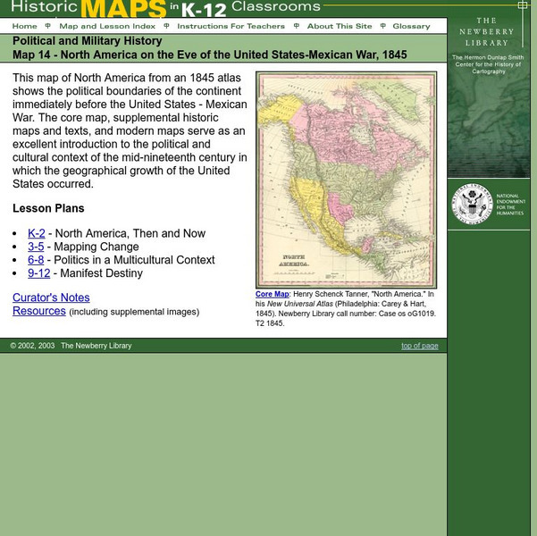
Newberry: Political and Military History: Map 14: u.s. Mexican War, 1845
Lessons for students in K-12 depicting North America prior to the United States and Mexico War, 1845. Students explore the mid-century political and cultural context in which the U.S. experienced growth and expansion.
PBS
Pbs Learning Media: North American Rivers and Their Widths
Rivers are essential to any society. They provide fresh water, recreation, and transportation. Students will analyze the distribution and relationship among North American rivers using this map from NASA. Background information and...
Science Education Resource Center at Carleton College
Serc: Mapping the Glaciers
In this activity, students will use Minnesota Geological Survey 3-D maps of the upper Midwest to trace the outlines of where they believe glaciers may have affected North America. They will identify landforms that resulted from glacial...
PBS
Pbs Learning Media: Taming the Mississippi
At 2,300 miles long, the Mississippi River is the second longest river in North America. People have tried to control the flow of the river to prevent floods and keep it flowing towards port cities. This can lead to loss of land in the...
Huntington Library
Huntington Library: Triangular Trade
In this lesson, 5th graders learn about the many societal structures that developed in colonial days, including the conditions for self-government in America, the free-market economy, and the slavery system. Background information for...
Other popular searches
- Map of North America
- North America Map Outline
- North America Map Reading
- North America Map Features
- North America Map 1750
- Ecosystems North America Map
- Physical Map North America
- North America Map Worksheets
- North America Map Outline%2
- Maps North America Migration
- North America Map Outline\%2
- Map Colonial North America


