Curated OER
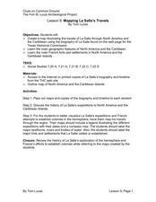
Mapping La Salle's Travels
Students use the internet to create a map showing the path of La Salle through North America and the Caribbean. They identify the main geographic features of the two areas and the main French forts. They also complete a timeline.
Curated OER
Settling Nroth America: Improvisation and Playwriting
Students map the classroom by marking the movement of the first Americans' migration from Alaska down into North America. To improve their skills in map-reading and sense of direction, students identify physical features of the map and...
Curated OER
Tracing Our Own Family Pilgrimages
Students observe a world map and are introduced to vocabulary like: cities, continents, rivers, lakes, and oceans. They discuss the names of the cities they live in and locate them on the map; then using a colored pushpin indicate: the...
Curated OER
European Explorers of North and South America
Sixth graders explore the connection between the geography of America and the migration of the Native Americans to the American continents to the future conquering of the continents by the Europeans. They discuss the causes and effects...
Curated OER
Geography Words
This learning exercise uses maps of South America and Canada to combine basic geography vocabulary and using prepositions. Students use the maps to answer questions about the locations of various countries on the two maps. This would be...
Curated OER
The Gold Rush
Young scholars identify the routes involved in the Gold Rush on a map. In this map skills instructional activity, students use a United States map to locate the routes used to travel to California during the Gold Rush. Young scholars...
Curated OER
Mars Geologic Mapping
Students identify and interpret photographic details of a Martian surface image, design, and create a simple features map. They identify and interpret the geologic history of a part of Mars' surface and then, analyze and discuss the...
Curated OER
The United States in 1790
In this geography skills worksheet, students study the provided map of the United States in 1790 and then complete the provided quiz over the 17 states and territories.
Curated OER
We've got the whole world in our hands
Students explore spatial sense in regards to maps about the globe. In this maps lesson plan, students label oceans, locate the continents and poles, follow directions, and explain the symbols on a map.
Curated OER
An Age of Exploration
Students investigate U.S. history by examining North American timelines. In this American exploration instructional activity, students research the events that led to Columbus finding America and participate in a jeopardy game regarding...
Curated OER
European Exploration, Trade and Colonization
Students complete many activities including mapping, reading books, and Internet research to learn about European exploration. In this European lesson plan, students study geographical mapping, trade, and colonization.
Curated OER
The Monarch Butterfly Watch
Learners explore monarch migration through the Journey North web site. In this butterfly instructional activity, students use the internet to identify a butterfly's migration pattern. Learners write in electronic journals.
Curated OER
Mapping the West
Students determine how Americans' perception of the geographical features of the West changed following the Lewis and Clark expedition. They analyze historical maps of the West.
AGSSS
World Regions
Help your learners to visualize where historical events have taken place around the globe with a map that details the major regions of the seven continents.
Core Knowledge Foundation
Volume 1 - A History of the United States: Precolonial to the 1800s
Volume One of the 299-page Core Knowledge History of the United States covers events from the Precolonial Period to the 1800s.
Curated OER
The Bear Facts
Students explore various kinds of bears and gather information about them. In this research and habitats instructional activity, students chart their bear information on large posters with illustrations of their bears. Students map the...
California Academy of Science
Kinesthetic Astronomy: Earth's Rotation
After completing the activity, "Kinesthetic Astronomy: The Meaning of a Year," zoom in on Earth's rotation using the same simulation setup and this outline. Each class member dons a map of the Western Hemisphere and plays the part of...
Curated OER
The American Revolution: 1775 - 1783
Track the ins and outs and wartime strategies used by both the British and the Americans during the Revolutionary War. Multiple comparisons are made between both factions, maps, statistical data, images, and light text is used throughout...
Curated OER
European Explorers
Students research one of seventeen explorers before filling in a worksheet. Next, they write a song verse using the information and sing it to the tune of "Row, Row, Row Your Boat." On the next day, they play a game of "Who Am I?" using...
Curated OER
Canada: Our Neighbor and Friend
Students investigate the geography and culture of Canada by practicing the French language. For this world geography lesson, students create a continent map of North America while analyzing the unique geography of Canada. Students...
Curated OER
South American Lakes, Rivers, and Seas Map Quiz
In this online interactive geography quiz activity, students respond to 25 identification questions regarding South American lakes, rivers, bays, and seas.
Curated OER
Absolute Location
Fifth graders examine the geographic concept of absolute location. Using a variety of resources, they create a life-size classroom grid and locate the coordinates of a point, identify latitude and longitude of different locations, and...
Curated OER
Exploring an Atlas
Students explore global geography by participating in an atlas activity. In this countries of the world lesson plan, students collaborate in small groups and analyze an atlas while researching continents, countries and demographics....
US Citizenship and Immigration Services
Thanksgiving 1—Pilgrims and American Indians
The Pilgrims first arrived in America in order to gain religious freedom. Here is a instructional activity that takes the class on this journey with the Pilgrims, stopping to look at how they got here, who they met when they arrived, and...
Other popular searches
- Map of North America
- North America Map Outline
- North America Map Reading
- North America Map Features
- North America Map 1750
- Ecosystems North America Map
- Physical Map North America
- North America Map Worksheets
- North America Map Outline%2
- Maps North America Migration
- North America Map Outline\%2
- Map Colonial North America


