Curated OER
BIGGER AND BIGGER: (We Live in a family, a neighborhood, a city, and the United States)
Students discover that they are part of bigger and bigger groups. They begin with families and work up to belonging to North America as they initiate a study of the whole country.
Curated OER
What They Left Behind: Early Multi-National Influences in the United States
Students examine how the European voyages of discovery influence American culture even today. They map eighteenth century Europe's impact on the United States.
Curated OER
What They Left Behind: Early Multi-National Influences in the United States
Learners research the impact of European voyages of discovery and colonial influence on different aspects of American culture. They access a number of online sources and reference maps to trace the influences of England, France, Holland,...
Curated OER
Mapmakers' Perspective
Students examine several maps and consider mapmakers' perspective in early depictions of North America.They determine how the spherical shape of the earth makes any north-south and east-west orientation a matter of perspective. For...
Curated OER
History/Geography
Students review North America, Africa, Europe and Asia. They identify Australia as the smallest continent. They identify Australia as an island continent nicknamed "the land down under." They color a map of Australia.
Curated OER
Native Americans
First graders explore the lifestyles of several North American tribes. They investigate about the homes, food, transportation, and daily living habits of each tribe. Pupils use a map to locate several Native American tribes in North...
Curated OER
Uncharted Territory
Students examine what were preconceived perceptions of the areas Lewis and Clark explored. They compare and contrast past and modern maps of North America. They accurately place route and site information on the map.
Curated OER
Cave Men to Cave Painting
Students explore the Ice Age. In this geology and social studies lesson, students read the book Eyewitness Books Early Humans and create a KWL chart about the Ice Age. Students locate Asia and North America on the World Map and...
Curated OER
European Exploration
Sixth graders analyze key European explorers and focus on where and why they explored. They research who sponsored the explorers as well as the accomplishments of the explorers. They discuss the lasting effects of the expeditions in...
It's About Time
Present-Day Climate in Your Community
So what exactly is climate? This first installment of a six-part series introduces the concept of climate using real-world data tables and topographic maps. The timely lesson includes a comprehensive overview of climate, as well as...
Curated OER
Peter The Butterfly
Pupils complete an interdisciplinary unit chronicling the life cycle and movement patterns of the butterfly. Through language arts, mathematics, and science activities, students identify various types of butterflies and document the...
Polk County Public Schools
The French and Indian War
Sharpen those pencils and get to writing with a series of document-based questions about the French and Indian War. High schoolers focus on maps, letters, and other primary documents from the 18th century before answering writing prompts...
National Wildlife Federation
Massive Migrations
Turn your students into flocks of migratory birds for this fun activity on animal migration. Prior to the activity, the teacher creates four different migration routes in the classroom or any available open space, labeling nesting...
Core Knowledge Foundation
Columbus Sailed the Ocean Blue
Young adventurers embark on a journey, setting sail along the blue ocean with Christopher Columbus. Teachers will find that this unit makes their lesson planning smooth sailing!
Curated OER
What Kind of Santa Claus You Are.
Students use a photograph analysis sheet to analyze primary sources (photographs) of the Great Depression in small groups. They then write a poem about kids in the Depression Era that reflects their comprehension of the period and its...
Curated OER
Wild Animals in the World
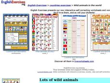
In this wild animals worksheet, students answer multiple choice map questions, choose the correct animal names for the pictures, and more. Students complete 4 activities.
Curated OER
World Map and Globe - Lesson 15 (K-3)
Students discover mountain ranges and their locations in the world. In this physical map lesson, students locate and identify major mountain ranges of the world on a large physical map.
Curated OER
Getting to Know My World
Students participate in hands-on activities using maps and globes to identify geographical features. Students use map legends to identify direction. Students locate oceans, continents, countries, states and cities. Handouts and...
Curated OER
Continents
Students investigate World Geography by researching the different continents. In this Asian Geography lesson, students discuss the continent of Pangaea and color a worksheet of the continents. Students locate China on the map worksheet...
Curated OER
Community and Colonization
Eighth graders explore the nature of the European colonization in the Americas. They compare how it relates to the inception of their community. Students identify the major players in America's colonization and explore the motivations...
Curated OER
It Bears Repeating!!!
Students research bears and their characteristics with a specific study on North American bears and polar bears. In this bear study lesson plan, students read books about polar bears and wild bears. Students complete activities to...
Curated OER
Old World and New World - Why Contact Took So Long
Students use a globe to determine why contact between the old world and the new world took a long time. In this map skills activity, students analyze routes between regions to determine why it took so long for the old world and the new...
Curated OER
Water and Land 207
Students examine maps of different projections, mathematically calculate distortions, and note the advantages and disadvantages of each map. They study the different maps and transfer the map to graph paper.
Curated OER
Global Lesson: Social Studies On-Line Global Lesson: Social Studies On-Line Continents
In this geography PowerPoint a simple world map on which each continent is represented by a solid green landform is the background for each of the nine slides. The continent names appear in a list on the first slide, followed by one...
Other popular searches
- Map of North America
- North America Map Outline
- North America Map Reading
- North America Map Features
- North America Map 1750
- Ecosystems North America Map
- Physical Map North America
- North America Map Worksheets
- North America Map Outline%2
- Maps North America Migration
- North America Map Outline\%2
- Map Colonial North America


