Richmond Community Schools
Map Skills
Young geographers will need to use a variety of map skills to complete the tasks required on this worksheet. Examples of activities include using references to label a map of Mexico, identify Canadian territories and European...
K12 Reader
Conflict Over North American Lands
Readers are introduced to some of the conflicts that arose over land and resources in the Americas in a two-part cross-curricular comprehension worksheet that asks kids to study the article and then to use information provided to...
University of Florida
Sailing to St. Augustine
Using a Florida map from 1597, young explorers consider the physical characteristics they would need in a site for a new colony and the resources they would need to survive. After selecting a site, class members research to discover the...
Institute for Geophysics
Understanding Maps of Earth
Here is your go-to student resource on primary geography concepts, including facts about the surface of the earth and its hemispheres, latitude and longitude, globes, types of maps, and identifying continents and oceans.
Curated OER
The North and South Magnetic Poles
In this north and south magnetic poles worksheet, students read about the presence of auroras over the earth's magnetic poles as opposed to the geographic poles. Students use 2 photographs taken by the IMAGE FUV and the Polar instruments...
Curated OER
Topographic Maps Worksheet
In this geography skills learning exercise, students respond to 37 multi-part questions that require them to read and interpret topographic maps.
Curated OER
Breaking News English: Iraq
In this Iraq worksheet, students read the article, answer true and false questions, complete synonym matching, complete phrase matching, complete a gap fill, answer short answer questions, answer discussion questions, write, and more...
Curated OER
Contour Map Worksheet #3
Earth scientists answer five multiple choice questions about the topographical map atop the worksheet. Use this as a quick assessment of understanding after having taught how to read contour lines and topographic maps.
Core Knowledge Foundation
Columbus Sailed the Ocean Blue
Young adventurers embark on a journey, setting sail along the blue ocean with Christopher Columbus. Teachers will find that this unit makes their lesson planning smooth sailing!
Curated OER
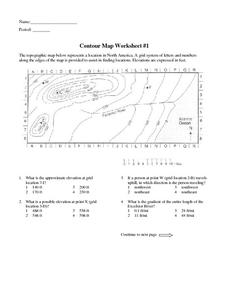
Contour Map Worksheet #1
Being able to read a topographic map is a standard in middle school earth science units and imperative for outdoor enthusiasts. As you introduce learners to this skill, you can assign this as an assessment or reinforcement. Pupils view a...
Curated OER
Continents and Oceans
In this geography worksheet, students read a paragraph and learn about the seven continents and five oceans of the world. Students study a map of the world and answer 12 short answer questions. This is an online interactive worksheet.
Tech Know Teaching
5th Grade Constructed Response Question
New to constructed response question worksheets? Here's a model that demonstrates how to construct questions that require readers to interpret graphics found in informational text.
Curated OER
Globe Lesson 5 - Latitude - Grade 6+
For this latitude worksheet, students read a 3-paragraph review of latitude and respond to 12 short answer questions.
K12 Reader
The Louisiana Purchase
Readers are asked to identify the main idea and two supporting ideas in a brief passage about the Louisiana Purchase.
Curated OER
Utah: State History
In this Utah state history worksheet, learners read two and a half pages of information about Utah and complete 10 true and false questions.
Curated OER
Invasive Mussels
In this ecology worksheet, students study a fact sheet on invasive mussels. They answer 8 short answer questions about it after reading the provided information.
Curated OER
Describing A Place - Part I The British Isles
In this describing place instructional activity, students label the cardinal and ordinal directions on a compass rose using the drop-down menus. They complete a matching activity by matching an item from column C with one in A and B....
Curated OER
The Arctic Ocean
In this Arctic Ocean worksheet, learners read a 2 page passage, then complete 10 true/false questions. Answers are included on page 4. A reference web site is given for additional activities.
Curated OER
Geographic Terms Glossary
In this geography instructional activity, students learn 60 common geographic terms. Students read the words that are arranged in alphabetical order along with the meanings. There are no questions to answer; this is a glossary.
Curated OER
The Great American Desert
In this American deserts worksheet, students study the images and read the passages to learn about the 6 divisions in the American landscape: the Eastern lowlands, the Flood Plain, the Great Plains, the Rocky Mountains, and the Pacific...
Curated OER
U.S. Archaeological Sites: Geography Practice
In this archaeological sites instructional activity, students read about sites in the Unites States and use a map to complete a set of 7 short answer questions.
Curated OER
Worksheet 7: Prepositions of Place
In this vocabulary skills worksheet, students read 8 sentences and fill in the blanks in each of the sentences with the appropriate prepositions listed as possible answers.
Curated OER
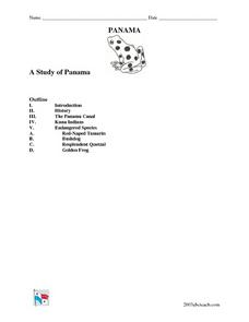
A Study of Panama
In this worksheet on Panama, students read an introduction about Panama, then read about its history, The Panama Canal, the Kuna Indians and the Endangered Species of Panama. After each selection, students answer a set of related questions.
Curated OER
Studying Seafloor Spreading on Land
In this seafloor spreading worksheet, students review the processes taking place along the mid-ocean ridges. This worksheet has 3 short answer questions.


